Category:Meir, Staffordshire
suburb of Stoke-on-Trent, Staffordshire, United Kingdom  | |||||
| Upload media | |||||
| Instance of | |||||
|---|---|---|---|---|---|
| Location | City of Stoke-on-Trent, Staffordshire, West Midlands, England | ||||
 | |||||
Media in category "Meir, Staffordshire"
The following 65 files are in this category, out of 65 total.
-

-

-
 A50 - domed footbridge off Box Lane - geograph.org.uk - 2342465.jpg 640 × 480; 63 KB
-
-
 A50 - footbridge at Grangewood Road - geograph.org.uk - 2342422.jpg 640 × 480; 68 KB
-
 A50 - footbridge off Recreation Road - geograph.org.uk - 2342471.jpg 640 × 480; 68 KB
-
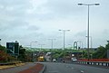
 A50 - Normacot junction - geograph.org.uk - 2342475.jpg 640 × 480; 62 KB
-
 A50 approaching Meir Tunnel - geograph.org.uk - 2342434.jpg 640 × 480; 65 KB
-
 A50 at Meir - geograph.org.uk - 2342410.jpg 640 × 480; 61 KB
-
 A50 descending toward Normacot - geograph.org.uk - 2342458.jpg 640 × 480; 63 KB
-
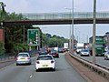
 A50 eastbound at Meir - geograph.org.uk - 3593051.jpg 640 × 481; 49 KB
-
 A50 eastbound near Meir - geograph.org.uk - 3593050.jpg 640 × 480; 38 KB
-
 A50 Meir tunnel - east portal - geograph.org.uk - 3268012.jpg 2,600 × 3,900; 1.64 MB
-
 A50 passing under footbridge - geograph.org.uk - 3413474.jpg 640 × 418; 40 KB
-
 A50, Entrance to the Meir Tunnel - geograph.org.uk - 4241646.jpg 640 × 480; 247 KB
-
 Bottle Kiln Sculpture - geograph.org.uk - 727727.jpg 640 × 480; 95 KB
-
 Bottle Kiln Sculpture - geograph.org.uk - 727731.jpg 640 × 480; 42 KB
-
 Broadway Methodist Church - geograph.org.uk - 5378477.jpg 1,600 × 1,200; 487 KB
-
 By the roundabout in Meir - geograph.org.uk - 5376355.jpg 1,600 × 1,200; 653 KB
-
 Cooperative Funeralcare - Meir - geograph.org.uk - 3943211.jpg 4,251 × 2,472; 4.76 MB
-
 Entrance to A50 Meir Tunnel under A520 - geograph.org.uk - 3592795.jpg 1,024 × 757; 83 KB
-
 FlyUnder - geograph.org.uk - 33950.jpg 640 × 480; 58 KB
-
 Footbridge over A50 - geograph.org.uk - 2920550.jpg 3,629 × 2,391; 2.87 MB
-
 Footbridge over A50 near Normacot - geograph.org.uk - 3592816.jpg 1,024 × 689; 78 KB
-
 Footbridge over A50 west of Meir Tunnel - geograph.org.uk - 3592802.jpg 1,024 × 621; 75 KB
-
 Footbridge over the A50 - geograph.org.uk - 3413470.jpg 800 × 509; 71 KB
-
 Footbridge over the A50 at Meir - geograph.org.uk - 5377556.jpg 1,600 × 1,200; 545 KB
-
 Footbridge over the A50, Meir - geograph.org.uk - 3413478.jpg 1,024 × 669; 91 KB
-
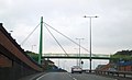
 Footbridge with cupolas over A50 - geograph.org.uk - 3592812.jpg 1,024 × 651; 85 KB
-
 Green Footbridge over Uttoxeter Road - geograph.org.uk - 4241693.jpg 640 × 480; 245 KB
-
-
 Holy Trinity Church, Meir - geograph.org.uk - 5377527.jpg 1,600 × 1,200; 746 KB
-
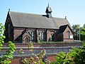
 Holy Trinity, Meir - geograph.org.uk - 534239.jpg 640 × 480; 67 KB
-
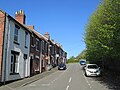
 Houses on Sandon Road, Meir - geograph.org.uk - 3943204.jpg 3,365 × 2,169; 3.37 MB
-
 King's Arms pub and Weston Road - geograph.org.uk - 3268001.jpg 3,900 × 2,600; 1.65 MB
-

-
 Meir Island - geograph.org.uk - 5918332.jpg 800 × 594; 88 KB
-
 Meir Park, Tesco - geograph.org.uk - 4520522.jpg 3,264 × 2,448; 1.9 MB
-
 Meir Park, Tesco car park - geograph.org.uk - 4520519.jpg 3,264 × 2,448; 1.98 MB
-
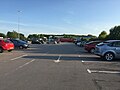 Meir Park, Tesco car park - geograph.org.uk - 4520520.jpg 3,264 × 2,448; 2.39 MB
-
 Meir Primary Care Centre - geograph.org.uk - 5378498.jpg 1,600 × 1,200; 545 KB
-
 Meir roundabout 1.jpg 1,600 × 1,200; 577 KB
-
 Meir roundabout 2.jpg 1,600 × 1,200; 528 KB
-
 Meir Tunnel (under construction) - geograph.org.uk - 3262879.jpg 2,088 × 1,475; 1.76 MB
-
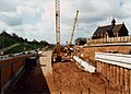 Meir tunnel West Portal (under construction) - geograph.org.uk - 3262900.jpg 2,089 × 1,492; 1.47 MB
-
 Meir Tunnel, Stoke-on-Trent - geograph.org.uk - 4241655.jpg 640 × 480; 181 KB
-
 Meir View - geograph.org.uk - 5376376.jpg 1,600 × 1,200; 625 KB
-
 New A50 Normacot (under construction) - geograph.org.uk - 3262916.jpg 2,086 × 1,486; 2.03 MB
-
 Original site of Alexandra CP School - geograph.org.uk - 3262969.jpg 2,096 × 1,500; 1.64 MB
-
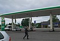 Petrol Station in Meir - geograph.org.uk - 2001905.jpg 640 × 435; 53 KB
-
 Red Footbridge over Uttoxeter Road - geograph.org.uk - 4241690.jpg 640 × 480; 245 KB
-

-
 Roof of Meir Tunnel (under construction) - geograph.org.uk - 3262889.jpg 2,092 × 1,499; 1.56 MB
-
 Royal Mail Building Normacot - geograph.org.uk - 2920626.jpg 3,985 × 1,663; 2.07 MB
-

-
 StevenWhyteMeirTunnel.jpg 812 × 378; 52 KB
-
 The A50 at Meir - geograph.org.uk - 5377509.jpg 1,600 × 1,200; 540 KB
-
 The Bottle Kiln Sculpture - geograph.org.uk - 2920554.jpg 2,823 × 2,039; 2.59 MB
-
 The Bottle Kiln sculpture by the A50 - geograph.org.uk - 3592788.jpg 1,024 × 687; 74 KB
-
-
 Uttoxeter Road at Meir - geograph.org.uk - 4241602.jpg 640 × 480; 261 KB
-
 Uttoxeter Road, Meir, Stoke-on-Trent - geograph.org.uk - 4241687.jpg 640 × 480; 233 KB
-
 West end of Meir tunnel A50 (during construction) - geograph.org.uk - 3263008.jpg 2,094 × 1,500; 1.39 MB
-
 Westbound A50 access slip road, Meir Park - geograph.org.uk - 3670623.jpg 1,024 × 768; 101 KB
-


_-_geograph.org.uk_-_3263019.jpg)


_-_geograph.org.uk_-_3262879.jpg)
_-_geograph.org.uk_-_3262900.jpg)


_-_geograph.org.uk_-_3262916.jpg)


_-_geograph.org.uk_-_3262889.jpg)


_-_geograph.org.uk_-_3263008.jpg)

