Category:Middleton, Warwickshire
village and civil parish in Warwickshire, UK  Church Lane. | |||||
| Upload media | |||||
| Instance of | |||||
|---|---|---|---|---|---|
| Location | North Warwickshire, Warwickshire, West Midlands, England | ||||
| Population |
| ||||
| Area |
| ||||
 | |||||
English: Middleton is a small village in the North Warwickshire district of the county of Warwickshire, England.
Subcategories
This category has the following 3 subcategories, out of 3 total.
Media in category "Middleton, Warwickshire"
The following 142 files are in this category, out of 142 total.
-
 'Going against the grain' - geograph.org.uk - 1122514.jpg 640 × 480; 61 KB
-

-

-

-
 A4091 at the turning for Middleton - geograph.org.uk - 2725090.jpg 640 × 480; 76 KB
-
 A4091 crossed by power lines - geograph.org.uk - 2725065.jpg 640 × 480; 63 KB
-
 A4091 north of Middleton Park - geograph.org.uk - 2725097.jpg 640 × 480; 78 KB
-
 A446 near Allen End - geograph.org.uk - 2416884.jpg 1,280 × 959; 663 KB
-
 About to join the A4091 - geograph.org.uk - 2725074.jpg 640 × 480; 90 KB
-
 Across to New Park Wood - geograph.org.uk - 4780167.jpg 1,536 × 2,560; 924 KB
-
 Archer's Haulage - geograph.org.uk - 2416876.jpg 1,280 × 959; 776 KB
-
 Ash End House Children's Farm - geograph.org.uk - 6370935.jpg 5,766 × 3,843; 3.91 MB
-
 Ash End House Children's Farm - geograph.org.uk - 6370968.jpg 5,766 × 3,843; 4.03 MB
-
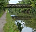
 Birmingham ^ Fazeley Canal - geograph.org.uk - 3672540.jpg 2,000 × 1,500; 675 KB
-

-

-
 Birmingham ^ Fazeley Canal, Gravel Pit Bridge - geograph.org.uk - 3672582.jpg 2,000 × 1,500; 622 KB
-

-
 Bluebell Woodland - geograph.org.uk - 4934960.jpg 640 × 426; 125 KB
-
 Bodymoor Heath Lane meets the A4091 - geograph.org.uk - 2832098.jpg 640 × 428; 71 KB
-
-

-
 Bridge across Langley Brook - geograph.org.uk - 4842560.jpg 800 × 514; 199 KB
-
 Bus Shelter, Middleton - geograph.org.uk - 1094519.jpg 640 × 480; 218 KB
-
 Car boot site has moved sign near The Belfry - geograph.org.uk - 3671840.jpg 1,024 × 768; 106 KB
-
 Church Lane (1) - geograph.org.uk - 2345923.jpg 3,072 × 2,048; 3.04 MB
-
 Church Lane, Middleton - geograph.org.uk - 2416905.jpg 1,280 × 935; 510 KB
-
 Church Lane, Middleton - geograph.org.uk - 2417014.jpg 1,280 × 959; 964 KB
-
 Church Lane, Middleton - geograph.org.uk - 2417026.jpg 1,280 × 959; 833 KB
-
 Churchyard wall, Middleton - geograph.org.uk - 2417029.jpg 1,280 × 959; 895 KB
-
-

-
 Countryside stiles - geograph.org.uk - 2808243.jpg 2,736 × 3,648; 3.2 MB
-
 Cows grazing at Lower Farm - geograph.org.uk - 5049397.jpg 640 × 427; 100 KB
-
 Cross fields to M6 Toll, near Wishaw - geograph.org.uk - 2164092.jpg 3,648 × 2,048; 2.13 MB
-
 Crowberry Lane ford - geograph.org.uk - 2417033.jpg 1,280 × 959; 906 KB
-

-
 Door in the Wall - geograph.org.uk - 2808232.jpg 2,736 × 3,648; 4.74 MB
-
 Dual carriageway begins - geograph.org.uk - 2725087.jpg 640 × 480; 93 KB
-
 Farmland near Shirrall Hall - geograph.org.uk - 415105.jpg 640 × 480; 63 KB
-
 Field by the A4091 - geograph.org.uk - 6709583.jpg 6,000 × 4,000; 4.3 MB
-
 Field footpath to Wood Farm - geograph.org.uk - 2808267.jpg 3,648 × 2,736; 3.52 MB
-
 Fields near The Belfry - geograph.org.uk - 6710632.jpg 6,000 × 4,000; 5.34 MB
-

-
 Flush Bracket Bench Mark S8598 - geograph.org.uk - 2416916.jpg 640 × 480; 177 KB
-
 Footbridge across stream - geograph.org.uk - 2808271.jpg 3,648 × 2,736; 3.95 MB
-
 Footpath junctions - geograph.org.uk - 2808313.jpg 3,648 × 2,736; 4.29 MB
-
 Footpath to New Park Wood - geograph.org.uk - 2808254.jpg 3,648 × 2,736; 3.92 MB
-
 Footpath to Wood Farm - geograph.org.uk - 2808249.jpg 2,736 × 3,648; 3.69 MB
-

-

-
-

-
 Green at the Belfry golf resort, Wishaw - geograph.org.uk - 4676546.jpg 800 × 613; 187 KB
-

-

-
 Green Man Pub, Middleton - geograph.org.uk - 244760.jpg 640 × 478; 53 KB
-
 Harvested field by the A4091 - geograph.org.uk - 6711396.jpg 6,000 × 4,000; 7.51 MB
-
 Holly Lane Bridge, M6 (Toll) - geograph.org.uk - 2661653.jpg 640 × 430; 53 KB
-
 Holly Lane crosses the M6 Toll - geograph.org.uk - 3195447.jpg 4,608 × 2,423; 2.08 MB
-
 Hoverfly on sow thistle - geograph.org.uk - 3672557.jpg 1,050 × 1,050; 989 KB
-
-

-
 Langley Cottages, Middleton - geograph.org.uk - 2417024.jpg 1,280 × 959; 607 KB
-
 Langley Mill MF radio station - geograph.org.uk - 2416838.jpg 1,280 × 959; 458 KB
-
 Large layby on A4091 - geograph.org.uk - 3671854.jpg 1,024 × 768; 130 KB
-
 Lay-by on A4091 - geograph.org.uk - 3671847.jpg 1,024 × 768; 125 KB
-
 Lay-by on the A4091 - geograph.org.uk - 6709574.jpg 6,000 × 4,000; 4.3 MB
-
 Lay-by on the A4091 with Mobile Cafe - geograph.org.uk - 2833799.jpg 640 × 428; 80 KB
-

-

-
 M6 (Toll), Junction T3 - geograph.org.uk - 2661602.jpg 640 × 472; 48 KB
-
 M6 Toll - geograph.org.uk - 2416851.jpg 1,280 × 951; 445 KB
-
 M6 Toll after junction T3 - geograph.org.uk - 2826237.jpg 640 × 481; 36 KB
-
 M6 Toll at junction T3 - geograph.org.uk - 2826230.jpg 640 × 481; 31 KB
-
 M6 Toll J3 and surrounding farmland - geograph.org.uk - 1863081.jpg 1,168 × 656; 129 KB
-
 M6 Toll Road, Grove End - geograph.org.uk - 3673013.jpg 640 × 480; 267 KB
-
 M6 Toll Road, Holly Lane Bridge - geograph.org.uk - 3673057.jpg 640 × 427; 219 KB
-
 M6 Toll Road, Southbound - geograph.org.uk - 3673020.jpg 640 × 480; 262 KB
-
 M6 Toll slip road to A38 - geograph.org.uk - 2413012.jpg 640 × 480; 56 KB
-
 M6Toll - geograph.org.uk - 2326384.jpg 640 × 439; 66 KB
-
 Middleton First School - geograph.org.uk - 2416976.jpg 1,280 × 959; 662 KB
-
 Middleton Ford - geograph.org.uk - 3238628.jpg 3,872 × 2,592; 2.5 MB
-
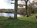
 Middleton Lakes RSPB reserve - geograph 4842548.jpg 800 × 561; 161 KB
-
 Middleton Lakes RSPB reserve - geograph.org.uk - 4842558.jpg 800 × 591; 144 KB
-

-
 Middleton Post Office postbox ref B78 70 - geograph.org.uk - 2417021.jpg 959 × 1,280; 1.09 MB
-

-
 Middleton village pump - geograph.org.uk - 2416967.jpg 1,280 × 959; 1,012 KB
-
 Middleton Village Recreation Room - geograph.org.uk - 1094513.jpg 640 × 404; 247 KB
-
 Middleton village shop - geograph.org.uk - 2416898.jpg 1,280 × 959; 472 KB
-
 Moxhull Wood Cottage - geograph.org.uk - 2416871.jpg 1,280 × 959; 608 KB
-
 Narrowboat moored by Fishers Mill Bridge - geograph.org.uk - 5049354.jpg 640 × 427; 103 KB
-

-
 National Paintballing Centre, Bassetts Pole - geograph.org.uk - 2803319.jpg 3,648 × 2,736; 3.12 MB
-
 New Park Wood - junction of footpaths - geograph.org.uk - 2808294.jpg 3,648 × 2,048; 4.14 MB
-
 Newland Nurseries Garden Centre - geograph.org.uk - 531743.jpg 640 × 413; 58 KB
-
 Newlands Garden Centre - geograph.org.uk - 285972.jpg 640 × 480; 105 KB
-

-
 Original Old Water Pump - geograph.org.uk - 2345941.jpg 2,048 × 3,072; 2.62 MB
-
 Paddock at Ash End House Children's Farm - geograph.org.uk - 6370957.jpg 5,766 × 3,843; 3.58 MB
-

-
 Right of way, Middleton Wood Farm - geograph.org.uk - 2803324.jpg 3,648 × 2,736; 3.92 MB
-
 Ringers' fines - geograph.org.uk - 2416955.jpg 959 × 1,280; 541 KB
-
 Road Junction to Hunts Green - geograph.org.uk - 2832039.jpg 640 × 428; 82 KB
-
 Rood screen grotesques - geograph.org.uk - 2416949.jpg 1,280 × 932; 615 KB
-
 Seed head of common sow thistle - geograph.org.uk - 3678005.jpg 1,500 × 1,500; 705 KB
-
 Sharpening marks - geograph.org.uk - 2416933.jpg 1,280 × 959; 951 KB
-
 Small Pond - geograph.org.uk - 2808304.jpg 3,648 × 2,736; 3.43 MB
-
 Stables in Middleton - geograph.org.uk - 244786.jpg 640 × 478; 102 KB
-
 Start of public footpath - geograph.org.uk - 2280383.jpg 3,264 × 2,448; 1.45 MB
-
 Start of public footpath - geograph.org.uk - 2280401.jpg 3,264 × 2,448; 1.77 MB
-
 Stoke End Farm on Middleton Lane - geograph.org.uk - 2833952.jpg 640 × 428; 72 KB
-

-
-
 The Green Man - geograph.org.uk - 2417012.jpg 944 × 1,280; 344 KB
-
 Tollbooth on the M6 Toll - geograph.org.uk - 2416859.jpg 1,280 × 959; 659 KB
-
 Towpath access by Fishers Mill Bridge - geograph.org.uk - 5182595.jpg 1,280 × 851; 517 KB
-
 Track at Ash End House Children's Farm - geograph.org.uk - 6370952.jpg 6,000 × 4,000; 4.45 MB
-

-
 Traffic congestion on London Road - geograph.org.uk - 5717679.jpg 6,000 × 4,000; 4.9 MB
-
 Traffic queue on London Road - geograph.org.uk - 5717673.jpg 6,000 × 4,000; 4.18 MB
-

-
 Transmitters by the M6 (Toll) - geograph.org.uk - 2661641.jpg 640 × 430; 53 KB
-
 Tree and plant display, outside St John the Baptist, Church - geograph.org.uk - 2339241.jpg 2,048 × 3,072; 3.27 MB
-
 View of Middleton - geograph.org.uk - 2808282.jpg 3,648 × 2,736; 2.45 MB
-
 Village Bench - geograph.org.uk - 2339214.jpg 3,072 × 2,048; 2.11 MB
-
 Village Pump, Church Lane, Middleton - geograph.org.uk - 1053721.jpg 640 × 480; 121 KB
-
 Village Shop, Church Lane, Middleton - geograph.org.uk - 1053725.jpg 640 × 480; 67 KB
-
 Withy Hill Road Bridge, M6 (Toll) - geograph.org.uk - 2661619.jpg 640 × 430; 44 KB
-
 Ash End House Children's Farm - geograph.org.uk - 244756.jpg 640 × 478; 127 KB
-
 Cricket Nets, Coppice Lane - geograph.org.uk - 285966.jpg 640 × 480; 106 KB
-
 Cross Green Farm - geograph.org.uk - 244752.jpg 640 × 478; 82 KB
-
 Farmland near Shirrall Farm - geograph.org.uk - 285977.jpg 640 × 422; 65 KB
-
 Fine horns - geograph.org.uk - 285971.jpg 640 × 407; 67 KB
-
 Hunts Green Turn - geograph.org.uk - 270900.jpg 640 × 512; 76 KB
-
 Middleton Equestrian Centre - geograph.org.uk - 244798.jpg 640 × 478; 118 KB
-
 Pool at Shirrall Hall Farm - geograph.org.uk - 285976.jpg 640 × 480; 115 KB
-
 Shirrall Hall Farm - geograph.org.uk - 285975.jpg 640 × 483; 78 KB
-
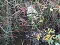 Stream and Berries - geograph.org.uk - 285978.jpg 640 × 480; 144 KB
-
 Trickley Coppice from Coppice Lane - geograph.org.uk - 285968.jpg 640 × 480; 122 KB
-
 View to Trickley Coppice - geograph.org.uk - 285970.jpg 640 × 480; 98 KB


_-_geograph.org.uk_-_2345923.jpg)


_-_geograph.org.uk_-_2661653.jpg)


,_Junction_T3_-_geograph.org.uk_-_2661602.jpg)


_-_geograph.org.uk_-_2661619.jpg)


_-_geograph.org.uk_-_2661641.jpg)