Category:Munsley
village and civil parish in Herefordshire, England  | |||||
| Upload media | |||||
| Instance of | |||||
|---|---|---|---|---|---|
| Location | Herefordshire, West Midlands, England | ||||
 | |||||

Subcategories
This category has the following 3 subcategories, out of 3 total.
Media in category "Munsley"
The following 119 files are in this category, out of 119 total.
-

-
-
 Ancient yew, Munsley - geograph.org.uk - 1803776.jpg 3,051 × 2,431; 4.27 MB
-
 Apple orchard - geograph.org.uk - 6047312.jpg 1,024 × 683; 315 KB
-
 Apple orchard near Ashperton - geograph.org.uk - 4308191.jpg 800 × 451; 204 KB
-
 Barn at Munsley Court - geograph.org.uk - 4639358.jpg 4,000 × 3,000; 4.1 MB
-
 Barn at Nupend Farm - geograph.org.uk - 4639357.jpg 4,000 × 3,000; 2.57 MB
-

-
 Bridge over old canal, near Moorend Farm - geograph.org.uk - 2964016.jpg 2,256 × 1,496; 918 KB
-
 Buildings at Jug's Green - geograph.org.uk - 895243.jpg 640 × 385; 65 KB
-
 Bus shelter and telephone box, Waller's Green - geograph.org.uk - 4453100.jpg 1,199 × 1,600; 334 KB
-
 Chapel interior, Swinmore Common - geograph.org.uk - 1169283.jpg 640 × 384; 237 KB
-
 Country lane near Marley Hall - geograph.org.uk - 948551.jpg 640 × 480; 114 KB
-
 Country road at Munsley Green - geograph.org.uk - 5265635.jpg 800 × 600; 203 KB
-
 Country road through Munsley - geograph.org.uk - 6046745.jpg 1,024 × 768; 282 KB
-
 Countryside near Callow Hill Farm - geograph.org.uk - 1217508.jpg 640 × 424; 64 KB
-
 Cows in summer pasture - geograph.org.uk - 895217.jpg 640 × 480; 128 KB
-
 Disused Hereford and Gloucester Canal - geograph.org.uk - 5276691.jpg 1,024 × 768; 341 KB
-
 Disused Hereford and Gloucester Canal - geograph.org.uk - 5276699.jpg 1,024 × 768; 361 KB
-
 Double primula - geograph.org.uk - 5690627.jpg 1,598 × 1,600; 1.43 MB
-
 Entrance to Callow Hill Farm - geograph.org.uk - 1217505.jpg 640 × 424; 85 KB
-
 Falcon Lane sign - geograph.org.uk - 3181161.jpg 1,199 × 1,200; 707 KB
-
 Farm building - geograph.org.uk - 6041696.jpg 1,024 × 768; 350 KB
-
 Farm road to The Nelmes - geograph.org.uk - 5356650.jpg 1,024 × 768; 202 KB
-
 Farmland near The Nelmes - geograph.org.uk - 5265632.jpg 800 × 600; 162 KB
-
 Farmland near The Nelmes - geograph.org.uk - 5356639.jpg 1,024 × 576; 163 KB
-
 Field beside the entrance to The Nelmes - geograph.org.uk - 5265631.jpg 1,024 × 768; 308 KB
-
 Field edge with trig point - geograph.org.uk - 3279103.jpg 1,500 × 1,125; 2.09 MB
-
 Font in Munsley church - geograph.org.uk - 5276812.jpg 768 × 1,024; 152 KB
-
 Footpath from Haywood Lane - geograph.org.uk - 4308192.jpg 800 × 451; 209 KB
-
 Former Hereford ^ Gloucester Canal by Moorend Farm - geograph.org.uk - 4639364.jpg 4,000 × 3,000; 5.37 MB
-
 Gloucester and Hereford Canal, 1 - geograph.org.uk - 4308184.jpg 800 × 451; 194 KB
-
 Gloucester and Hereford Canal, 2 - geograph.org.uk - 4308186.jpg 800 × 451; 197 KB
-
 Gravestone in Munsley church - geograph.org.uk - 5276801.jpg 450 × 800; 77 KB
-
 Gravestone in Munsley church - geograph.org.uk - 5276806.jpg 576 × 1,024; 139 KB
-
 Green lane at Munsley - geograph.org.uk - 6046759.jpg 1,024 × 768; 333 KB
-
 Hansnett Wood From The Footpath Stile - geograph.org.uk - 1349667.jpg 480 × 640; 254 KB
-
 Haywood Lane - geograph.org.uk - 4308193.jpg 800 × 451; 193 KB
-
 Haywood Lane canal bridge - geograph.org.uk - 4308183.jpg 800 × 451; 186 KB
-
 Headland right of way - geograph.org.uk - 6047297.jpg 1,024 × 768; 337 KB
-
 Headland right of way - geograph.org.uk - 6047301.jpg 1,024 × 768; 309 KB
-
 Heywood Lane - geograph.org.uk - 4639379.jpg 5,184 × 3,456; 7.56 MB
-
 Heywood Lane - geograph.org.uk - 6040734.jpg 1,024 × 768; 292 KB
-
 Heywood Lane heading for Ashperton - geograph.org.uk - 3106653.jpg 4,000 × 3,000; 3.42 MB
-
 Hop field by Heywood lane - geograph.org.uk - 4639339.jpg 4,962 × 3,308; 6.93 MB
-
 Lane near Upleadon Farm - geograph.org.uk - 948809.jpg 480 × 640; 96 KB
-
 Lane past Munsley Court - geograph.org.uk - 3611886.jpg 640 × 427; 97 KB
-
 Little Verzons farm shop - geograph.org.uk - 568517.jpg 640 × 480; 70 KB
-
 Lower Court, Munsley - geograph.org.uk - 5240879.jpg 3,248 × 2,160; 1.87 MB
-
 Lower Court, Munsley - geograph.org.uk - 6046756.jpg 1,024 × 768; 277 KB
-
 Maize Stubble - geograph.org.uk - 1169311.jpg 640 × 414; 251 KB
-
 Marley Hall's fields - geograph.org.uk - 948552.jpg 640 × 480; 73 KB
-
 Moorend Farm - geograph.org.uk - 3106667.jpg 4,000 × 3,000; 3.49 MB
-
 Moorend Farm - geograph.org.uk - 4639361.jpg 4,000 × 3,000; 4.13 MB
-
 Moorend Farm - geograph.org.uk - 6047295.jpg 1,024 × 683; 241 KB
-
 Moorend Farmhouse and farm - geograph.org.uk - 3106672.jpg 4,000 × 3,000; 3.42 MB
-
 Munsley Acre - geograph.org.uk - 792130.jpg 640 × 480; 115 KB
-
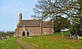
 Munsley church - geograph.org.uk - 5266638.jpg 1,024 × 768; 196 KB
-
 Munsley church - geograph.org.uk - 5266639.jpg 600 × 800; 117 KB
-
 Munsley church - geograph.org.uk - 6046755.jpg 1,024 × 768; 311 KB
-
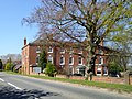
 Munsley Court - geograph.org.uk - 570057.jpg 640 × 427; 264 KB
-
 Munsley Court - geograph.org.uk - 948568.jpg 640 × 480; 78 KB
-
 Munsley Court fields - geograph.org.uk - 948588.jpg 640 × 480; 82 KB
-
 Munsley Court post box - geograph.org.uk - 948586.jpg 480 × 640; 148 KB
-
 Munsley Court windpump - geograph.org.uk - 948581.jpg 640 × 480; 72 KB
-
 Munsley Lane by The Nelmes - geograph.org.uk - 4248193.jpg 800 × 451; 268 KB
-
 Names on Munsley war memorial - geograph.org.uk - 5276789.jpg 768 × 1,024; 172 KB
-
 Orchard alongside the railway - geograph.org.uk - 4245423.jpg 800 × 451; 192 KB
-
 Orchard near Marley Hall - geograph.org.uk - 948554.jpg 640 × 480; 114 KB
-
 Orchard near Swinmore Farm - geograph.org.uk - 1169291.jpg 640 × 427; 290 KB
-
 Orchard, near The Verzons - geograph.org.uk - 2555810.jpg 2,256 × 1,496; 905 KB
-
 Orchards near Munsley - geograph.org.uk - 4245425.jpg 800 × 451; 288 KB
-
 Orchards west of Jug's Green - geograph.org.uk - 895234.jpg 640 × 351; 72 KB
-
 Overgrown disused canal - geograph.org.uk - 2964026.jpg 1,496 × 2,256; 867 KB
-
 Plaques above chapel doorway - geograph.org.uk - 1168558.jpg 640 × 400; 281 KB
-

-

-
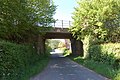 Railway bridge at Munsley - geograph.org.uk - 2963958.jpg 2,256 × 1,496; 918 KB
-
 Railway line towards Ledbury - geograph.org.uk - 2963259.jpg 2,256 × 1,496; 952 KB
-
 Right of way and green lane - geograph.org.uk - 6046758.jpg 1,024 × 768; 291 KB
-
 Road to Munsley church - geograph.org.uk - 6046740.jpg 1,024 × 768; 311 KB
-
 Road to Munsley church - geograph.org.uk - 6046753.jpg 1,024 × 768; 291 KB
-

-
 Spring is arriving - geograph.org.uk - 5356577.jpg 768 × 1,024; 343 KB
-
 St Bartholomew, Munsley - geograph.org.uk - 5240268.jpg 3,267 × 2,171; 1.62 MB
-
 St Bartholomew, Munsley - geograph.org.uk - 5240334.jpg 3,264 × 2,170; 1.22 MB
-
 St Bartholomew, Munsley - geograph.org.uk - 5240545.jpg 2,392 × 3,282; 1.88 MB
-
 St Bartholomew, Munsley - geograph.org.uk - 5240550.jpg 3,248 × 2,160; 1.75 MB
-
 St Bartholomew, Munsley - geograph.org.uk - 5240556.jpg 3,248 × 2,160; 1.79 MB
-
 St Bartholomew, Munsley - geograph.org.uk - 5240921.jpg 3,305 × 2,197; 1.54 MB
-
 St Bartholomew, Munsley - geograph.org.uk - 5240942.jpg 3,294 × 1,966; 2.08 MB
-
 Stained glass window, Munsley church - geograph.org.uk - 5276744.jpg 576 × 1,024; 124 KB
-
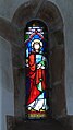 Stained glass window, Munsley church - geograph.org.uk - 5276748.jpg 576 × 1,024; 132 KB
-
 Stubble near Paunceford Court - geograph.org.uk - 948556.jpg 640 × 480; 94 KB
-
 Stubble near The Nelmes - geograph.org.uk - 948558.jpg 640 × 480; 67 KB
-
 Swinmore Common - geograph.org.uk - 1168454.jpg 640 × 427; 242 KB
-
 Swinmore Lane - geograph.org.uk - 4248192.jpg 800 × 451; 181 KB
-
 The Castle - geograph.org.uk - 4040911.jpg 800 × 531; 119 KB
-
 The Croft - geograph.org.uk - 1169307.jpg 640 × 429; 287 KB
-
 The Malvern Hills - geograph.org.uk - 5265634.jpg 800 × 600; 74 KB
-

-
 The Verzon hotel and restaurant - geograph.org.uk - 4453106.jpg 1,600 × 1,201; 1.65 MB
-
 The village hall - geograph.org.uk - 6293253.jpg 640 × 480; 102 KB
-
 Track and bridleway to Quatsford - geograph.org.uk - 895223.jpg 640 × 480; 91 KB
-
 Track to Paunceford Hop Kilns - geograph.org.uk - 4639392.jpg 5,004 × 3,336; 6.98 MB
-
 Tree in a field - geograph.org.uk - 5356654.jpg 1,024 × 768; 194 KB
-
 Trees in farmland - geograph.org.uk - 5356640.jpg 1,024 × 576; 193 KB
-
 Trig point near A438 at Trumpet - geograph.org.uk - 2741101.jpg 1,024 × 662; 180 KB
-
 Tunnel House - geograph.org.uk - 6040725.jpg 1,024 × 768; 212 KB
-

-
 Verzon House Hotel - geograph.org.uk - 2555806.jpg 2,256 × 1,496; 894 KB
-
 Victorian letterbox - geograph.org.uk - 5265637.jpg 450 × 800; 117 KB
-
 War memorial in Munsley church - geograph.org.uk - 5276788.jpg 768 × 1,024; 140 KB
-
 Wheat field, Munsley Green - geograph.org.uk - 895230.jpg 640 × 480; 102 KB
-
 White House Farm - geograph.org.uk - 6047309.jpg 1,024 × 683; 225 KB
-
 Windpump at Munsley Court - geograph.org.uk - 6046736.jpg 768 × 1,024; 262 KB
-
 Winter pansies 'Beaconsfield' - geograph.org.uk - 3181167.jpg 1,200 × 676; 545 KB
-
 Lower Court, Munsley - geograph.org.uk - 70705.jpg 640 × 426; 136 KB
-
 The Malvern Hills from the Verzons - geograph.org.uk - 55156.jpg 640 × 426; 131 KB


