Category:Myddle
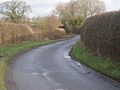
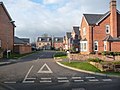
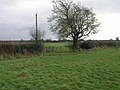
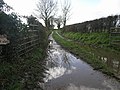
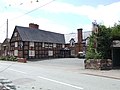
English: Myddle', also known as Mydle, Middle, ', M'dle, Meadley and Medle is a small village in Shropshire, England about 10 miles north of Shrewsbury, the county town of Shropshire. Myddle lies in the parish of Myddle with Broughton-le-Strange. The 2001 census recorded a population of 1,142 in the village.
village in Shropshire, United Kingdom  | |||||
| Upload media | |||||
| Instance of |
| ||||
|---|---|---|---|---|---|
| Location | Myddle, Broughton and Harmer Hill, Shropshire, West Midlands, England | ||||
 | |||||
Media in category "Myddle"
The following 54 files are in this category, out of 54 total.
-
 A Break in the Clouds - geograph.org.uk - 346667.jpg 640 × 480; 88 KB
-
 Burltonlane Farm - geograph.org.uk - 567041.jpg 640 × 423; 90 KB
-
 Converted timber-framed barns - geograph.org.uk - 46396.jpg 640 × 480; 115 KB
-
 Corner crack at Harmer hill quarry - geograph.org.uk - 689193.jpg 316 × 640; 91 KB
-
 Derelict stile on a Right of Way - geograph.org.uk - 658764.jpg 640 × 480; 103 KB
-
 Edge of Myddle - geograph.org.uk - 4354359.jpg 800 × 533; 198 KB
-
 Farm Buildings, Myddle - geograph.org.uk - 345041.jpg 640 × 433; 113 KB
-
 Farmtrack at Grumpy - geograph.org.uk - 658706.jpg 640 × 480; 93 KB
-
 Farmyard of Church Farm, Myddle - geograph.org.uk - 46393.jpg 640 × 480; 147 KB
-

-
 Fenemere View Farm - geograph.org.uk - 567048.jpg 640 × 480; 110 KB
-
 Field edge footpath approaching Myddle - geograph.org.uk - 2788532.jpg 640 × 480; 103 KB
-
 Field In North Shropshire - geograph.org.uk - 919833.jpg 640 × 480; 65 KB
-
 Footbridge on the footpath - geograph.org.uk - 1956676.jpg 1,280 × 960; 585 KB
-
 Former house, Myddle.jpg 640 × 480; 126 KB
-
 Green Field and Trees - geograph.org.uk - 346691.jpg 640 × 480; 94 KB
-
 Harmer Hill Wood - geograph.org.uk - 1956394.jpg 960 × 1,280; 579 KB
-
 Harmer Hill woods - geograph.org.uk - 2151973.jpg 1,600 × 1,200; 981 KB
-
 Houses on the hill - geograph.org.uk - 1956683.jpg 1,280 × 960; 572 KB
-
 Imaginative use of bricks - geograph.org.uk - 1956659.jpg 1,188 × 891; 415 KB
-
 Interesting chimney on the Red Lion - geograph.org.uk - 1956657.jpg 909 × 1,234; 427 KB
-
 Lane near Fenemere Manor - geograph.org.uk - 658747.jpg 640 × 480; 77 KB
-
 Lower Fenemere Farm - geograph.org.uk - 658736.jpg 640 × 480; 83 KB
-
 Lunch Time - geograph.org.uk - 346686.jpg 640 × 480; 82 KB
-
 Merrington Lane Pump - geograph.org.uk - 351780.jpg 640 × 480; 104 KB
-
 Myddle - geograph.org.uk - 1956417.jpg 1,280 × 960; 503 KB
-
 Myddle Hill - geograph.org.uk - 567733.jpg 480 × 640; 81 KB
-
 Myddlecastle.jpg 768 × 960; 439 KB
-
 Overgrown footpath - geograph.org.uk - 567412.jpg 480 × 640; 179 KB
-
 Part of the main road through Myddle - geograph.org.uk - 2788540.jpg 640 × 480; 87 KB
-
 Part of Wellcroft, Myddle - geograph.org.uk - 2788562.jpg 640 × 480; 79 KB
-

-
 Path to Newton - geograph.org.uk - 351769.jpg 640 × 480; 175 KB
-
 Path to the Airfield - geograph.org.uk - 346680.jpg 640 × 480; 105 KB
-
 Pony in Myddle village, Shropshire - geograph.org.uk - 2788635.jpg 640 × 480; 88 KB
-
 Puddle Track - geograph.org.uk - 346695.jpg 640 × 480; 112 KB
-
 Red Lion Inn, Myddle - geograph.org.uk - 1846090.jpg 640 × 480; 78 KB
-
 Red Lion, Myddle - geograph.org.uk - 1956654.jpg 1,280 × 960; 510 KB
-
 Right of Way obstructed - geograph.org.uk - 658763.jpg 640 × 480; 94 KB
-
 Stile near Fenemere Manor - geograph.org.uk - 658745.jpg 640 × 480; 93 KB
-
 Stile near Houlston - geograph.org.uk - 658712.jpg 640 × 480; 73 KB
-
 The Gough Walk, leading into Harmer Hill Wood - geograph.org.uk - 1956388.jpg 1,280 × 960; 596 KB
-
 The Red Lion, Myddle - geograph.org.uk - 200188.jpg 640 × 480; 73 KB
-
 The Village Hall, Myddle - geograph.org.uk - 1822955.jpg 640 × 449; 66 KB
-
 This hamlet is actually called Grumpy - geograph.org.uk - 658704.jpg 640 × 480; 84 KB
-
 Trackway through Castle Farm, Myddle - geograph.org.uk - 2788606.jpg 640 × 480; 105 KB
-
 Unoccupied house in Myddle village - geograph.org.uk - 2788545.jpg 640 × 480; 101 KB
-
 Unoccupied property in Myddle village - geograph.org.uk - 2788552.jpg 640 × 480; 106 KB
-
 Village Hall, Myddle - geograph.org.uk - 345045.jpg 640 × 433; 107 KB
-
 Village Pump, Myddle - geograph.org.uk - 594726.jpg 640 × 480; 135 KB
-
 Walking in gold - geograph.org.uk - 1955189.jpg 1,280 × 960; 533 KB
-
 Walking the dog^ - geograph.org.uk - 1956405.jpg 1,280 × 960; 605 KB
-
 Welcome to Myddle - geograph.org.uk - 1956653.jpg 1,280 × 960; 504 KB
-
 White house beside a field - geograph.org.uk - 1219609.jpg 600 × 405; 355 KB


