Category:Namibia photographs taken on 2017-04-20
| ← | 20 April 2017 | → | ||
| ← | April 2017 | → | ||

Namibia photographs taken on 20 April 2017.
Image files should be categorized here automatically using {{taken on}} template. Direct categorisation is also possible, if automatic is impossible.
Media in category "Namibia photographs taken on 2017-04-20"
The following 24 files are in this category, out of 24 total.
-
 Airport Keetmanshoop, Namibia (2017).jpg 4,578 × 2,918; 6.66 MB
-
 Brukkaros Mountain, Namibia (2017).jpg 4,928 × 3,264; 7.73 MB
-
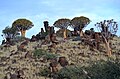
 Doleritfelsen und Köcherbäume.jpg 4,928 × 3,264; 5.78 MB
-
 Farm Langverwacht, Namibia (2017).jpg 4,928 × 3,264; 5.75 MB
-
 Farm within Kalahari Desert, Namibia.jpg 4,928 × 3,264; 5.75 MB
-
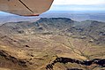
 Gochas bird eye view.jpg 4,928 × 3,264; 5.03 MB
-
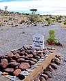 Grab eines Deutschen Schutztrupplers in Namibia (2017).jpg 2,498 × 3,077; 3.18 MB
-
 Graslandschaft in Namibia (2017).jpg 4,928 × 3,264; 5.38 MB
-
 Keetmanshoop Airport (2017).jpg 4,928 × 3,264; 4.65 MB
-
 Keetmanshoop Banner.jpg 4,926 × 705; 1.19 MB
-
 Krater des Brukkaros, Namibia (2017).jpg 4,928 × 3,264; 5.35 MB
-
 Kreuzung der Hauptstraßen C18 und C15 bei Gochas, Namibia (2017) mit Strassenbezeichnung.jpg 4,928 × 3,264; 6.94 MB
-
 Kreuzung der Hauptstraßen C18 und C15 bei Gochas, Namibia (2017).jpg 4,928 × 3,264; 7.05 MB
-
 Köcherbäume bei Keetmanshoop.jpg 4,928 × 3,264; 5.57 MB
-
 Köcherbäume und Doleritfelsen.jpg 4,755 × 3,132; 5.25 MB
-
 Mesosaurus Fossil Camp (2017).jpg 4,928 × 3,264; 5.58 MB
-
 Nossob und Nebenstraße M39, Namibia (2017).jpg 4,928 × 3,264; 5.46 MB
-
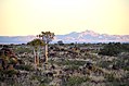
 Quiver trees near Keetmanshoop.jpg 4,928 × 3,264; 5.29 MB
-
 Quiver trees near Mesosaurus Fossil Camp.jpg 4,928 × 3,264; 5.01 MB
-
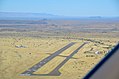 Runway Keetmanshoop.jpg 4,928 × 3,264; 4.01 MB
-
 Sand dune in the Kalahari Desert (Namibia).jpg 4,435 × 3,023; 5.85 MB
-
 Spitzkoppe near Keetmanshoop, Namibia (2017).jpg 4,313 × 2,786; 4.79 MB
-
 Windmotor bei Keetmanshoop (2017).jpg 4,928 × 3,264; 5.14 MB
-
 Witrand plateau, Namibia (2017).jpg 3,769 × 2,479; 3.02 MB
.jpg)
.jpg)

.jpg)


.jpg)
.jpg)
.jpg)
.jpg)
_mit_Strassenbezeichnung.jpg)
.jpg)


.jpg)
.jpg)


.jpg)
.jpg)
.jpg)
.jpg)