Category:Nebraska Highway 59
 | number: | (fifty-nine) |
|---|---|---|
| State highways in Nebraska: | 39 · 41 · 43 · 44 · 47 · 50 · 51 · 56 · 57 · 59 · 61 · 62 · 65 · 66 · 68 · 69 · 70 · 71 · 74 · 79 |
state highway in Knox and Ceder counties in Nebraska, United States  | |||||
| Upload media | |||||
| Instance of | |||||
|---|---|---|---|---|---|
| Location |
| ||||
| Transport network | |||||
| Connects with |
| ||||
| Owned by | |||||
| Maintained by | |||||
| Inception |
| ||||
| Length |
| ||||
| Terminus |
| ||||
| |||||
English: Media related to Nebraska Highway 59, a 37.49-mile (60.33 km) state highway in Knox and Ceder counties in Nebraska, United States, that has two unconnected segments. The western segment connects Nebraska Highway 14 (west of Creighton) with U.S. Route 81 (east–northeast of Magnet) and the eastern segment connects Nebraska Highway 57 (south of Coleridge) with U.S. Route 20 (north of Laurel).
Media in category "Nebraska Highway 59"
The following 7 files are in this category, out of 7 total.
-
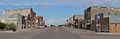
 Creighton, Nebraska Main Street 1.JPG 2,560 × 1,143; 1.12 MB
-
 Creighton, Nebraska Main Street 2.JPG 2,560 × 840; 730 KB
-
 Creighton, Nebraska Main Street 3.JPG 2,560 × 1,024; 926 KB
-
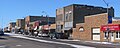 Creighton, Nebraska N side Main St W from Chase Av.JPG 2,462 × 986; 815 KB
-
 N-59.svg 600 × 600; 126 KB
-
 Nebraska Highway 59 map.png 3,425 × 2,031; 472 KB
-
 Nebraska State Spur 259.svg 501 × 401; 14 KB

