Category:U.S. Route 20 in Nebraska

_map.svg)

English: Media related to U.S. Route 20 in Nebraska (US 20), a 431.60-mile (694.59 km) section of U.S. Numbered Highway in Nebraska, United States, that connects US 20 in Wyoming with Interstate 129/US 20/U.S. Route 75 in Nebraska.
Subcategories
This category has only the following subcategory.
Media in category "U.S. Route 20 in Nebraska"
The following 14 files are in this category, out of 14 total.
-
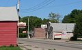
 Clinton, Nebraska from SW 1.JPG 2,369 × 719; 594 KB
-
 Dawes County.pdf 1,275 × 1,650; 9.34 MB
-
 Detailed map of Chadron, Nebraska.png 575 × 425; 16 KB
-
 EnteringNebraska.jpg 2,592 × 1,944; 2.04 MB
-
 Harrison, Nebraska US20 from W.JPG 2,454 × 1,042; 805 KB
-
 Jackson, Nebraska downtown 1.JPG 2,460 × 1,488; 1.29 MB
-
 Jackson, Nebraska downtown 2.JPG 2,439 × 1,085; 1.18 MB
-
 Pierce County NEBRASKA.png 3,000 × 3,407; 167 KB
-
 Rushville, Nebraska 2nd Street 1.jpg 2,425 × 967; 698 KB
-
 Rushville, Nebraska 2nd Street 2.jpg 2,296 × 1,103; 769 KB
-
 Rushville, Nebraska 2nd Street 3.jpg 2,416 × 916; 600 KB
-
 US 20 (NE) map.svg 1,180 × 688; 278 KB
-
 US 20 Nebraska 1926.svg 1,485 × 1,440; 31 KB
-
 US 20 Nebraska 1963.svg 600 × 600; 17 KB


