Category:Nether Whitacre
village in Warwickshire, England, UK  | |||||
| Upload media | |||||
| Instance of | |||||
|---|---|---|---|---|---|
| Location | North Warwickshire, Warwickshire, West Midlands, England | ||||
| Population |
| ||||
| Area |
| ||||
 | |||||
English: Nether Whitacre is a small village in the North Warwickshire district of the county of Warwickshire in England.
Subcategories
This category has the following 6 subcategories, out of 6 total.
B
- Botts Green (6 F)
G
H
- Hogrills End (4 F)
N
- Nether Whitacre War Memorial (1 F)
P
- Pubs in Nether Whitacre (9 F)
W
Media in category "Nether Whitacre"
The following 69 files are in this category, out of 69 total.
-
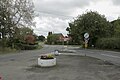
 A Country Road Junction - geograph.org.uk - 2890740.jpg 640 × 425; 87 KB
-

-
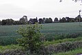
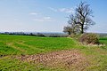 A Field of Corn and Hedgerows - geograph.org.uk - 2890697.jpg 640 × 425; 79 KB
-
 A large field - geograph.org.uk - 5570779.jpg 1,600 × 900; 375 KB
-

-
 Bakehouse and Oak Cottages at Nether Whitacre - geograph.org.uk - 5669542.jpg 2,448 × 1,836; 1.79 MB
-
 Betteridge Farm, Nether Whitacre - geograph.org.uk - 5669526.jpg 2,448 × 1,836; 1.95 MB
-
 Bodymoor Green Farm - geograph.org.uk - 6171750.jpg 6,000 × 4,000; 4.2 MB
-
 Church End farmhouse and barn Nether Whitacre.JPG 4,000 × 3,000; 3.19 MB
-
 Church House Nether Whitacre.JPG 4,000 × 3,000; 3.32 MB
-
 Confluence on the River Tame - geograph.org.uk - 6170264.jpg 6,000 × 4,000; 4.6 MB
-

-
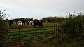 Cows in a field - geograph.org.uk - 5570751.jpg 1,600 × 900; 326 KB
-
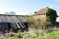 Derelict Farm Buildings - geograph.org.uk - 2892046.jpg 640 × 425; 101 KB
-
 Emerging crop near Halloughton Grange - geograph.org.uk - 6171766.jpg 6,000 × 4,000; 4.81 MB
-
 Field and sky - geograph.org.uk - 5570773.jpg 1,600 × 900; 430 KB
-
 Field entrance - geograph.org.uk - 3168470.jpg 640 × 480; 98 KB
-
 Five Bar Gate and Trees off Middle Lane - geograph.org.uk - 2892065.jpg 640 × 425; 108 KB
-
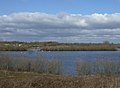 Flooded gravel pit near Lea Marston - geograph.org.uk - 3407422.jpg 640 × 469; 46 KB
-
 Growing wheat near Halloughton Grange - geograph.org.uk - 6171782.jpg 6,000 × 4,000; 5.39 MB
-

-
 Halloughton Grange , The Gate - geograph.org.uk - 857490.jpg 640 × 570; 212 KB
-
 Halloughton Grange - A Ghost Story - geograph.org.uk - 856175.jpg 640 × 480; 204 KB
-
 Halloughton Grange - geograph.org.uk - 6171773.jpg 1,600 × 1,067; 401 KB
-
-
 Halloughton Grange Panorama - geograph.org.uk - 857463.jpg 640 × 219; 169 KB
-
 Junction of Bakehouse Lane with Dingle Lane - geograph.org.uk - 5669533.jpg 1,469 × 1,102; 813 KB
-
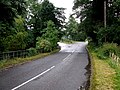
 Lane heading east towards the B4116 - geograph.org.uk - 3168473.jpg 640 × 480; 117 KB
-

-
 Minor road - geograph.org.uk - 5570745.jpg 1,600 × 900; 498 KB
-
 Minor road and high hedges - geograph.org.uk - 5570741.jpg 900 × 1,600; 419 KB
-
 Narrow Lane near Nether Whitacre - geograph.org.uk - 2892024.jpg 640 × 425; 72 KB
-
 Nether Whitacre Church Hall - geograph.org.uk - 5669560.jpg 1,632 × 1,224; 836 KB
-
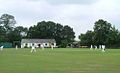
 Nether Whitacre Cricket Club - geograph.org.uk - 6171804.jpg 1,600 × 1,067; 436 KB
-
 Nether Whitacre Cricket Club - geograph.org.uk - 6171810.jpg 1,600 × 1,067; 520 KB
-
 Nether Whitacre SPO B46 - 16639504940.jpg 3,648 × 5,472; 6.94 MB
-
 Nether Whitacre SPO B46.jpg 3,648 × 5,472; 6.68 MB
-
 NetherWhitacreCC14082004.jpg 500 × 304; 16 KB
-
 OS benchmark - Hoggrill's End, The Malthouse - geograph.org.uk - 5669379.jpg 857 × 1,142; 501 KB
-
-

-
 Pear Tree Cottage on Bakehouse Lane - geograph.org.uk - 5669536.jpg 2,448 × 1,836; 1.56 MB
-
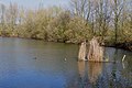
 Pond and woodland south of Kingsbury - geograph.org.uk - 3407420.jpg 640 × 640; 113 KB
-
 Private Drive to Whitehouse Farm - geograph.org.uk - 2890751.jpg 640 × 425; 113 KB
-
 Railway line towards Tamworth - geograph.org.uk - 5668432.jpg 1,306 × 979; 564 KB
-
 Railway to Tamworth - geograph.org.uk - 6171788.jpg 1,600 × 1,067; 549 KB
-

-
 Roadside buildings at Croxall Farm - geograph.org.uk - 5668436.jpg 1,469 × 1,102; 653 KB
-

-
 The Cottage, Nether Whitacre - geograph.org.uk - 5669376.jpg 2,448 × 1,836; 1.46 MB
-
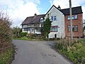
 The Driveway to Whitacre Hall - geograph.org.uk - 2890718.jpg 640 × 425; 105 KB
-
 The Gate - geograph.org.uk - 5497996.jpg 4,608 × 2,592; 2.9 MB
-
 The house at Hoggrill's End - geograph.org.uk - 5570648.jpg 1,600 × 900; 299 KB
-
 The Malt House, Nether Whitacre - geograph.org.uk - 5669386.jpg 2,156 × 1,638; 1.34 MB
-
 The Mound Cottage at Nether Whitacre - geograph.org.uk - 5669515.jpg 2,448 × 1,836; 1.65 MB
-
 The Old House, Nether Whitacre - geograph.org.uk - 5668441.jpg 2,448 × 1,836; 2.02 MB
-
 The River Bourne near Hoggrill's End - geograph.org.uk - 5668429.jpg 1,469 × 1,102; 957 KB
-
 The River Tame near Marston - geograph.org.uk - 6169665.jpg 6,000 × 4,000; 5.53 MB
-
 The road near Hill Farm - geograph.org.uk - 5570646.jpg 1,600 × 900; 422 KB
-
 The view from The Gate public house - geograph.org.uk - 5909028.jpg 2,000 × 1,333; 2.1 MB
-
 Whitacre Garden Centre - geograph.org.uk - 33599.jpg 640 × 480; 114 KB
-
 Yet more fields - geograph.org.uk - 6206085.jpg 2,000 × 1,330; 1.03 MB
-
 Aftermath of a fire, Nether Whitacre - geograph.org.uk - 211552.jpg 640 × 480; 64 KB
-
 Farm at Nether Whitacre - geograph.org.uk - 210845.jpg 640 × 480; 50 KB
-
 Halloughton Grange - geograph.org.uk - 49128.jpg 640 × 480; 181 KB
-
 Harvesting in progress - geograph.org.uk - 211607.jpg 640 × 480; 68 KB
-
 Ivy girt tree, Whitacre Fields - geograph.org.uk - 111162.jpg 480 × 640; 97 KB
-

-
 View towards Whitacre Hall - geograph.org.uk - 210843.jpg 640 × 480; 66 KB


