Category:Netherlands photographs taken on 2011-05-21
Countries of Europe: Austria · Belarus · Belgium · Croatia · Cyprus‡ · Czech Republic · Denmark · Estonia · Finland · France‡ · Georgia‡ · Germany · Greece · Hungary · Italy · Kazakhstan‡ · Latvia · Lithuania · Malta · Moldova · Netherlands‡ · Norway · Poland · Portugal‡ · Romania · Russia‡ · Serbia · Slovakia · Spain‡ · Sweden · Switzerland · Turkey‡ · Ukraine · United Kingdom
‡: partly located in Europe
‡: partly located in Europe
| ← | 21 May 2011 | → | ||
| ← | May 2011 | → | ||

Netherlands photographs taken on 21 May 2011.
Image files should be categorized here automatically using {{taken on}} template. Direct categorisation is also possible, if automatic is impossible.
Media in category "Netherlands photographs taken on 2011-05-21"
The following 73 files are in this category, out of 73 total.
-
 20110521 Oosterhaven 1-12 Groningen NL.jpg 4,200 × 2,400; 3.06 MB
-
 20110521 Oosterhaven 2 Groningen NL.jpg 2,200 × 4,000; 3.09 MB
-
 20110521 Oosterhaven 7-12 Groningen NL (2).jpg 5,600 × 3,500; 6.79 MB
-
 20110521 Oosterhaven 7-12 Groningen NL.jpg 3,300 × 3,000; 3.32 MB
-
 20110521 Tasmantoren Groningen NL (2).jpg 2,500 × 2,500; 2.22 MB
-
 20110521 Tasmantoren Groningen NL.jpg 4,500 × 3,000; 3.99 MB
-
 A splitted ear rabbit with his friend at Hoge Erf Schaarsbergen - panoramio.jpg 2,189 × 2,189; 971 KB
-
 Airzena Boeing 737-300 Verkuringen.jpg 1,026 × 681; 258 KB
-
 Amersfoort Railway Workshop 201104.jpg 2,736 × 3,648; 1.65 MB
-
 C 1000 - panoramio.jpg 4,000 × 3,000; 4.31 MB
-
 City Centre, 8011 Zwolle, Netherlands - panoramio (3).jpg 1,600 × 899; 258 KB
-
 Diezerstraat 1-7, Zwolle.jpg 1,600 × 899; 283 KB
-
 Ede-Wageningen station PROTOS.jpg 4,000 × 2,248; 2.2 MB
-
 Eindhoven the smartest (5919419254).jpg 1,024 × 770; 206 KB
-
 Gelderlandplein, Eindhoven 2011-05-25.jpg 1,920 × 1,080; 732 KB
-
 Grachtengordel-West, Amsterdam, Netherlands - panoramio (1).jpg 1,000 × 750; 209 KB
-
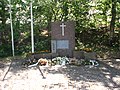 Grebbelinie Asschatterkade Monument.JPG 4,320 × 3,240; 2.67 MB
-
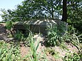
 Grebbelinie Asschatterkade Voorwerk.JPG 4,320 × 3,240; 2.8 MB
-
 Grebbelinie Asschatterkade.JPG 4,320 × 3,240; 2.84 MB
-
 Grebbelinie GL040 Asschatterkade.JPG 4,320 × 3,240; 3.13 MB
-
 Grebbelinie GL041 Asschatterkade.JPG 4,320 × 3,240; 3.43 MB
-
 Grebbelinie GL042 Asschatterkade.JPG 4,320 × 3,240; 3.18 MB
-
 Grebbelinie GL043 Asschatterkade.JPG 4,320 × 3,240; 2.74 MB
-
 Grebbelinie GL044 Asschatterkade.JPG 4,320 × 3,240; 3.24 MB
-
 Grebbelinie GL045 Asschatterkade.JPG 4,320 × 3,240; 3.28 MB
-
 Grebbelinie GL047 Asschatterkade.JPG 4,320 × 3,240; 2.53 MB
-
 Grebbelinie GL048 Asschatterkade.JPG 4,320 × 3,240; 2.46 MB
-
 Grebbelinie Leusden Damsluis.JPG 4,320 × 3,240; 2.38 MB
-
 Grebbelinie Tankversperring Asschatterkade.JPG 4,320 × 3,240; 3.3 MB
-
 Hasselt, geboortehuis van Kiliaen van Rensselaer foto3 2011-05-22 09.27.jpg 3,312 × 4,416; 7.15 MB
-
 Hasselt, monumentaal pand2 foto2 2011-05-21 09.19.jpg 4,416 × 3,312; 6.76 MB
-
 Hattem, Netherlands - panoramio (1).jpg 1,600 × 899; 382 KB
-
 Hattem, Netherlands - panoramio (2).jpg 899 × 1,600; 249 KB
-
 Hattem, Netherlands - panoramio (3).jpg 1,600 × 899; 242 KB
-
 Hattem, Netherlands - panoramio.jpg 899 × 1,600; 242 KB
-
 Heerenveen, kerk in straatzicht foto1 2011-05-21 18.18.JPG 4,416 × 3,312; 10.86 MB
-
 Heerenveen, stadhuis Crackstate foto8 2011-05-21 18.09.JPG 4,416 × 3,312; 8.84 MB
-
 In Rotterdam (5918858299).jpg 1,024 × 770; 370 KB
-
 In Rotterdam (5918858549).jpg 1,024 × 770; 353 KB
-
 LX-ZCV (21522579592).jpg 1,000 × 667; 412 KB
-
 Maas in Rotterdam (5918858089).jpg 1,024 × 770; 272 KB
-
 Melkmarkt 41-53, Zwolle.jpg 1,600 × 899; 318 KB
-
 Meppel, de Meppeler toren in straatzicht foto1 2011-05-21 11.58.JPG 4,416 × 3,312; 10.96 MB
-
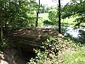
 Meppel, twee ophaalbruggen foto1 2011-05-21 11.36.JPG 4,416 × 3,312; 11.25 MB
-
 Meppel, watertoren foto7 2011-05-21 12.27.JPG 3,284 × 4,379; 9.98 MB
-
 Nieuwe Markt 12-16, Zwolle - BB.jpg 1,600 × 899; 289 KB
-
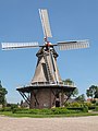 Nijeveen, korenmolen de Sterrenburg foto8 2011-05-21 13.01.JPG 3,247 × 4,329; 9.44 MB
-
 Nijeveen, Nederlands Hervormde kerk foto6 2011-05-21 13.17.JPG 4,416 × 3,312; 13.52 MB
-
 NS Plan V te Ede-Wageningen.jpg 4,000 × 2,248; 2.25 MB
-
 Oude treinsporen - panoramio.jpg 4,000 × 3,000; 4.36 MB
-
 Oudeschoot, kapel foto1 2011-05-21 17.01.JPG 4,416 × 3,312; 8.7 MB
-
 Pelserbrugje, Zwolle, Netherlands - panoramio (1).jpg 1,600 × 899; 259 KB
-
 Pink flowers (5773125234).jpg 3,032 × 2,024; 4.06 MB
-
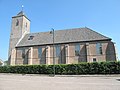 Rouveen, kerk foto4 2011-05-21 10.33.jpg 4,416 × 3,312; 7.76 MB
-
 Sassenpoort - BB - 4.jpg 899 × 1,600; 257 KB
-

-
 Social sofa Zoetermeer Van Galenstraat (2).jpg 1,460 × 1,095; 364 KB
-

-
 Standbeeld Rembrand van Rijn - panoramio.jpg 3,000 × 4,000; 1.3 MB
-
 Steenwijkerwold, kerk protestantse gemeente foto11 2011-05-21 14.59.jpg 4,416 × 3,312; 6.19 MB
-
 Terras op Plein.jpg 4,000 × 2,248; 1.77 MB
-
 Texel - De Hors - View NNW towards Den Hoorn - On the right Military Base Joost Dourlein.jpg 5,921 × 3,947; 21.61 MB
-
 Texel - Den Hoorn - Mokweg - View ENE on water level regulation.jpg 5,969 × 3,978; 22.15 MB
-
 Texel - Nature Reserve De Hors - View North towards De Mok & Den Hoorn III.jpg 5,906 × 3,937; 19.98 MB
-
 Texel - Nature Reserve De Hors - View North towards Hoornder Kerkje.jpg 3,945 × 5,918; 23.05 MB
-
 Texel - Nature Reserve De Mok - View NNE over Mokbaai towards Den Hoorn.jpg 5,969 × 3,978; 19.75 MB
-
 Thorbeckegracht, Zwolle - BB- 2.jpg 1,600 × 899; 283 KB
-
 Tussen Wolvega en De Blesse, de Linde foto2 2011-05-21 15.43.JPG 4,416 × 3,312; 7.7 MB
-
 Voetgangersbrug, Vondelpark 2011.jpg 3,264 × 2,448; 3.81 MB
-
 VW politie Kennemerland, pic1.JPG 3,648 × 2,736; 4.03 MB
-
 VW politie Kennemerland, pic2.JPG 3,243 × 2,432; 3.3 MB
-
 Wolvega, molen foto1 2011-05-21 16.19.JPG 3,312 × 4,416; 8.75 MB
-
 Zwolle, Netherlands - panoramio.jpg 1,600 × 899; 353 KB


.jpg)

.jpg)


.jpg)


.jpg)

.jpg)


.jpg)
.jpg)
.jpg)


.jpg)
.jpg)
.jpg)
.jpg)


.jpg)
.jpg)


.jpg)


