Category:No Man's Heath, Warwickshire
English: No Man's Heath is an area six miles north-east of Tamworth, Staffordshire. Its name indicates that it is on high heathland near the borders of four English counties: Derbyshire, Leicestershire, Warwickshire, and Staffordshire. The place is probably a highpoint on an ancient road, either Roman or Mercian. Nearby in the late 1800s were Netherseal Colliery and Netherseal Hall.
village in Warwickshire, United Kingdom  | |||||
| Upload media | |||||
| Instance of |
| ||||
|---|---|---|---|---|---|
| Location | Newton Regis, North Warwickshire, Warwickshire, West Midlands, England | ||||
 | |||||
Media in category "No Man's Heath, Warwickshire"
The following 32 files are in this category, out of 32 total.
-
 Arable land south of No Man's Heath - geograph.org.uk - 1780721.jpg 640 × 480; 126 KB
-
 B5493 towards No Man's Heath - geograph.org.uk - 5045522.jpg 640 × 480; 73 KB
-
 B5493, No Man's Heath - geograph.org.uk - 2366237.jpg 640 × 480; 96 KB
-
 Church Lane, No Man's Heath - geograph.org.uk - 5045542.jpg 640 × 480; 92 KB
-

-
 Clifton Road enters No Man's Heath - geograph.org.uk - 743471.jpg 640 × 415; 74 KB
-
 Clifton Road, No Man's Heath - geograph.org.uk - 2366225.jpg 640 × 480; 76 KB
-
 Close up, Elizabeth II postbox, No Man's Heath - geograph.org.uk - 5046879.jpg 1,220 × 2,442; 636 KB
-
 Crop field near No Man's Heath - geograph.org.uk - 5045521.jpg 640 × 480; 63 KB
-
 Crop field near No Man's Heath - geograph.org.uk - 5045530.jpg 640 × 480; 72 KB
-
 Elizabeth II postbox, No Man's Heath - geograph.org.uk - 5046876.jpg 640 × 480; 118 KB
-
 Entering No Man's Heath - geograph.org.uk - 5045533.jpg 640 × 480; 75 KB
-
 Farm track near No Man's Heath - geograph.org.uk - 1780712.jpg 640 × 480; 127 KB
-
 Four Counties Spice, No Man's Heath - geograph.org.uk - 5045543.jpg 640 × 431; 56 KB
-
 Grazing, No Man's Heath - geograph.org.uk - 5045536.jpg 640 × 480; 74 KB
-
 House in No Man's Heath - geograph.org.uk - 5045539.jpg 640 × 468; 65 KB
-

-
 Newton Field - geograph.org.uk - 743480.jpg 640 × 473; 60 KB
-
 No Man's Heath Village Hall - geograph.org.uk - 5045540.jpg 640 × 480; 69 KB
-
 No Man's Heath Village Hall - geograph.org.uk - 934741.jpg 640 × 410; 63 KB
-
 Polytunnels near Clifton Road - geograph.org.uk - 743558.jpg 640 × 433; 72 KB
-
 Pub car park at No Man's Heath - geograph.org.uk - 1778098.jpg 640 × 480; 74 KB
-
 Public Footpath near No Man's Heath - geograph.org.uk - 743383.jpg 640 × 611; 99 KB
-
 Salt Street at No Man's Heath - geograph.org.uk - 1778118.jpg 640 × 480; 94 KB
-
-

-
 St Mary the Virgin - geograph.org.uk - 934831.jpg 640 × 427; 69 KB
-
 The B5493 in No Man's Heath - geograph.org.uk - 743465.jpg 640 × 444; 61 KB
-
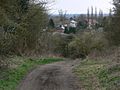
 The village of No Man's Heath - geograph.org.uk - 743401.jpg 640 × 416; 67 KB
-

-
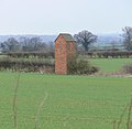 Unusual farm building - geograph.org.uk - 743474.jpg 640 × 624; 70 KB
-
 Waymark south of No Man's Heath - geograph.org.uk - 1780354.jpg 640 × 480; 106 KB


