Category:North and Middle Littleton
English: North and Middle Littleton is a civil parish in the Wychavon district of Worcestershire, England. The parish includes the villages of North Littleton and Middle Littleton and is near South Littleton.
civil parish in Worcestershire, England  | |||||
| Upload media | |||||
| Instance of | |||||
|---|---|---|---|---|---|
| Location | Wychavon, Worcestershire, West Midlands, England | ||||
| Population |
| ||||
| Area |
| ||||
 | |||||
Subcategories
This category has the following 2 subcategories, out of 2 total.
M
N
- North Littleton (4 F)
Media in category "North and Middle Littleton"
The following 108 files are in this category, out of 108 total.
-
 Access Track to Blenheim Woods - geograph.org.uk - 3213540.jpg 640 × 480; 48 KB
-
 B4510 at Cleeve Hill - geograph.org.uk - 5444285.jpg 640 × 481; 467 KB
-

-
 Beware of the dog - geograph.org.uk - 2761693.jpg 4,320 × 3,240; 5.01 MB
-
 Black shed under a cloudy sky - geograph.org.uk - 2465555.jpg 640 × 480; 70 KB
-
 Blake's Hill (1) - geograph.org.uk - 4139545.jpg 1,024 × 768; 122 KB
-
 Blake's Hill (2) - geograph.org.uk - 4139553.jpg 1,024 × 768; 137 KB
-
 Blake's Hill at the 39 metre spot height - geograph.org.uk - 4139516.jpg 1,024 × 768; 132 KB
-
 Blake's Hill, looking east - geograph.org.uk - 4139518.jpg 1,024 × 768; 138 KB
-
 Boats at the Fish and Anchor Locks on the River Avon - geograph.org.uk - 1923556.jpg 3,264 × 2,448; 1.91 MB
-
 Bridleway heading north to Hoden Farm - geograph.org.uk - 4139532.jpg 768 × 1,024; 550 KB
-
 Bridleway signpost, north side, Blake's Hill - geograph.org.uk - 4139529.jpg 1,024 × 768; 231 KB
-
 Bringing in the Sheaves, Offenham Park - geograph.org.uk - 2011949.jpg 3,264 × 2,448; 1.96 MB
-
 Bucklestreet Cottages - geograph.org.uk - 2761725.jpg 4,320 × 3,240; 4.9 MB
-
 Bucklestreet farmhouse - geograph.org.uk - 2761730.jpg 4,320 × 3,240; 4.71 MB
-
 Building Plot for Sale Hoarding - geograph.org.uk - 3213546.jpg 480 × 640; 65 KB
-
 Caravan site at the Fish and Anchor Inn - geograph.org.uk - 5912357.jpg 4,000 × 3,000; 2.27 MB
-
 Casual visitor to Offenham Park - geograph.org.uk - 1923521.jpg 3,264 × 2,448; 1.98 MB
-
 Church of St. Nicholas, Middle Littleton - geograph.org.uk - 6018434.jpg 1,024 × 768; 222 KB
-
 Churchyard and Barn - geograph.org.uk - 4123819.jpg 1,354 × 1,600; 376 KB
-
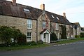
 Cottages at Middle Littleton - geograph.org.uk - 6018443.jpg 1,024 × 768; 169 KB
-
 Cottages, Middle Littleton - geograph.org.uk - 5806120.jpg 1,024 × 740; 121 KB
-
 Country crossroads - geograph.org.uk - 2761711.jpg 4,320 × 3,240; 4.73 MB
-
 Cross roads on Buckle St - geograph.org.uk - 2795599.jpg 640 × 480; 91 KB
-
 Crossroads at Ullington - geograph.org.uk - 1978504.jpg 480 × 640; 75 KB
-
 Crossroads on B4085 with B4510 - geograph.org.uk - 3546393.jpg 640 × 480; 60 KB
-
 Dean's Farm - geograph.org.uk - 2794121.jpg 640 × 457; 77 KB
-
 Drive to Ullington Hall Farm - geograph.org.uk - 2794552.jpg 640 × 480; 86 KB
-
 Entrance to Crossways - geograph.org.uk - 2766648.jpg 640 × 480; 95 KB
-
 Field of wheat, near Blake's Hill - geograph.org.uk - 1978475.jpg 640 × 480; 89 KB
-
 Fields and woodland - geograph.org.uk - 2760707.jpg 4,320 × 3,240; 4.95 MB
-
 Fields near North Littleton - geograph.org.uk - 2794113.jpg 640 × 480; 61 KB
-
 Floating Pontoon - geograph.org.uk - 2044053.jpg 3,264 × 2,448; 1.9 MB
-
 Footpath meets the road - geograph.org.uk - 2761689.jpg 4,320 × 3,240; 4.75 MB
-
 Footpath through the fields - geograph.org.uk - 2465567.jpg 640 × 480; 124 KB
-
 Footpath to School Lane - geograph.org.uk - 6018159.jpg 1,024 × 768; 357 KB
-
 Footpath, Cleeve Hill - geograph.org.uk - 5444289.jpg 640 × 481; 703 KB
-
 Ford at Harvington Lock - geograph.org.uk - 5912365.jpg 4,000 × 3,000; 2.92 MB
-

-
 Grass field, Middle Littleton - geograph.org.uk - 6018146.jpg 1,024 × 768; 141 KB
-
 Harvington 1997 - geograph.org.uk - 2881719.jpg 640 × 396; 70 KB
-
 Heron in the reeds, Offenham Park - geograph.org.uk - 1923531.jpg 3,264 × 2,448; 1.98 MB
-
 Hot Air Balloons over Offenham Park - geograph.org.uk - 1464656.jpg 640 × 480; 33 KB
-
 House by the churchyard, Middle Littleton - geograph.org.uk - 5806139.jpg 1,024 × 768; 222 KB
-
 Houses in North Littleton - geograph.org.uk - 1978434.jpg 640 × 480; 67 KB
-
 Lane junction at Middle Littleton - geograph.org.uk - 2465554.jpg 640 × 480; 118 KB
-
 Littleton Football Club Pitch - geograph.org.uk - 1978453.jpg 640 × 480; 67 KB
-
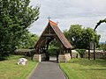 Lychgate, Middle Littleton - geograph.org.uk - 6018180.jpg 1,024 × 768; 232 KB
-
 Middle Littleton, Houses on Croft Road - geograph.org.uk - 5444535.jpg 640 × 481; 440 KB
-
 North Littleton Amery Lodge 1 GradeII.jpg 3,456 × 2,304; 3.53 MB
-
 North Littleton Amery Lodge 2 GradeII.jpg 3,456 × 2,304; 3.63 MB
-
 North Littleton Arden Cottage 1 GradeII.jpg 3,456 × 2,304; 3.28 MB
-
 North Littleton Arden Cottage 2 GradeII.jpg 3,456 × 2,304; 3.09 MB
-
 North Littleton Bake House GradeII.jpg 2,647 × 2,227; 1.7 MB
-
 North Littleton Barn to the rear of Old Farmhouse GradeII.jpg 3,456 × 2,304; 3.96 MB
-
 North Littleton Barn to the South of Old Farmhouse GradeII.jpg 3,456 × 2,304; 3.45 MB
-
 North Littleton Gable Cottage GradeII.jpg 2,463 × 2,299; 1.73 MB
-
 North Littleton Greystones Cottage GradeII.jpg 2,542 × 2,302; 1.99 MB
-
 North Littleton Hemborne GradeII.jpg 2,777 × 2,230; 1.46 MB
-
 North Littleton Lynton GradeII.jpg 3,456 × 2,304; 1.6 MB
-
 North Littleton Old Farmhouse GradeII.jpg 3,482 × 2,341; 2.33 MB
-
 North Littleton Old Post Office GradeII.jpg 2,545 × 2,285; 1.72 MB
-
 North Littleton post office.jpg 3,456 × 2,304; 2.47 MB
-
 North Littleton The Cottage GradeII.jpg 2,253 × 2,115; 1.43 MB
-
 North Littleton The Poplars 1 GradeII.jpg 3,456 × 2,304; 3.65 MB
-
 North Littleton The Poplars 2 GradeII.jpg 3,456 × 2,304; 2.91 MB
-
 North Littleton Tudor Cottage GradeII.jpg 3,456 × 2,304; 3.8 MB
-
 North Littleton Twyne Cottage GradeII.jpg 3,456 × 2,304; 3.41 MB
-
 North Littleton Walnut House GradeII.jpg 3,117 × 2,221; 2.15 MB
-
 North Littleton Walnut House2 GradeII.jpg 3,119 × 2,241; 2.29 MB
-
 North Littleton Weavers Cottage Etc.jpg 2,736 × 2,053; 1.6 MB
-
 North Littleton Weavers Cottage GradeII.jpg 1,814 × 2,234; 1.22 MB
-
 North side verge, Blake's Hill - geograph.org.uk - 4139538.jpg 1,024 × 768; 174 KB
-
 Once Hill Barn - geograph.org.uk - 2761679.jpg 4,320 × 3,240; 4.81 MB
-
 Paddocks at Middle Littleton - geograph.org.uk - 6018420.jpg 1,024 × 768; 164 KB
-
 Pond by the track - geograph.org.uk - 2760701.jpg 4,320 × 3,240; 4.71 MB
-
 Pure pretension - geograph.org.uk - 2761720.jpg 4,320 × 3,240; 4.69 MB
-
 River Avon at Harvington - geograph.org.uk - 3546401.jpg 640 × 480; 62 KB
-
 River Avon at Offenham - geograph.org.uk - 5444270.jpg 640 × 481; 362 KB
-
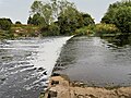 River Avon Ford and Weir at Offenham - geograph.org.uk - 5444272.jpg 640 × 481; 491 KB
-
 River Avon, Harvington Lock - geograph.org.uk - 2004670.jpg 3,008 × 2,000; 1.65 MB
-
 Road junction in North Littleton - geograph.org.uk - 1978431.jpg 640 × 480; 90 KB
-
 Roadside wildflowers, Littleton - geograph.org.uk - 1978461.jpg 640 × 480; 124 KB
-
 Same Floating Pontoon, Offenham Park - geograph.org.uk - 2044056.jpg 3,264 × 2,448; 1.95 MB
-
 School Lane, North Littleton - geograph.org.uk - 628416.jpg 640 × 480; 118 KB
-
 Sheep grazing at Middle Littleton - geograph.org.uk - 5806125.jpg 1,024 × 768; 165 KB
-
 Sheep in Field off School Lane - geograph.org.uk - 5444502.jpg 640 × 427; 389 KB
-
 Swan on the Avon near the Fish and Anchor Inn - geograph.org.uk - 5912360.jpg 4,000 × 3,000; 2.92 MB
-
 The Croft Barn - geograph.org.uk - 6018155.jpg 1,024 × 758; 126 KB
-
 The Croft Barn, North Littleton - geograph.org.uk - 5806130.jpg 1,024 × 768; 140 KB
-
 The Fish and Anchor at Offenham - geograph.org.uk - 5444277.jpg 640 × 481; 426 KB
-
 The Fish and Anchor Inn - geograph.org.uk - 5444268.jpg 640 × 481; 378 KB
-
 The Fish and Anchor Inn - geograph.org.uk - 5912368.jpg 4,000 × 3,000; 2.24 MB
-
 The Fish ^ Anchor - geograph.org.uk - 4937422.jpg 800 × 600; 98 KB
-
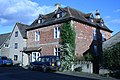
 The Ivy Inn - geograph.org.uk - 2794118.jpg 640 × 480; 109 KB
-
 The Ivy Inn, North Littleton - geograph.org.uk - 5444294.jpg 640 × 427; 369 KB
-
 The Pound, North Littleton - geograph.org.uk - 6018165.jpg 1,024 × 768; 231 KB
-
 Tithe Barn, Middle Littleton - geograph.org.uk - 6018121.jpg 1,024 × 768; 166 KB
-
 Tithe Barn, Middle Littleton - geograph.org.uk - 6018143.jpg 1,024 × 768; 151 KB
-
 Towards the road - geograph.org.uk - 2761683.jpg 4,320 × 3,240; 5 MB
-

-
 Track to Hill's Barn - geograph.org.uk - 5088598.jpg 2,000 × 1,333; 1.52 MB
-
 Ullington Mill - geograph.org.uk - 2794537.jpg 640 × 482; 81 KB
-
 View from Cleeve Hill - geograph.org.uk - 5444282.jpg 640 × 480; 535 KB
-
 West Side, North Littleton - geograph.org.uk - 5444295.jpg 640 × 481; 456 KB
-
 Wheat field near Ullington Mill - geograph.org.uk - 1978489.jpg 640 × 480; 108 KB
-
 Wooded track - geograph.org.uk - 2761675.jpg 4,320 × 3,240; 5.18 MB
-
 Worcestershire farmland - geograph.org.uk - 2760719.jpg 4,320 × 3,240; 4.47 MB


_-_geograph.org.uk_-_4139545.jpg)
_-_geograph.org.uk_-_4139553.jpg)


