Category:October 2009 in North Yorkshire
Deutsch: Bilder, die im Oktober 2009 in North Yorkshire aufgenommen worden sind. Bitte beachten Sie, dass dies weder das Datum des Uploads noch das Datum des Scannens eines Fotos ist.
English: Images/pictures taken in North Yorkshire during October 2009. Note this is not the date of the upload, nor the date a photo was scanned.
Español: Fotografías o imágenes tomadas en North Yorkshire durante octubre 2009. No es la fecha de subida ni escaneo, sino la fecha en que las fotografías o imágenes se crearon.
Esperanto: Bildoj faritaj en North Yorkshire en oktobro 2009. Tio ne estas la dato, kiam la bildoj estis alŝutitaj aŭ skanitaj.
Français : Photographies ou images prises en North Yorkshire durant octobre 2009. Ce n'est pas la date du téléchargement ou du scan.
Galego: Fotografías ou imaxes tomadas en North Yorkshire durante outubro 2009. Non é a data de subida nin escaneamento, senón a data na que se crearon as fotografías ou imaxes.
Italiano: Fotografie o immagini scattate a North Yorkshire nel ottobre 2009. Nota bene: la data non si riferisce né a quella di upload né a quella in cui la foto è stata digitalizzata.
Norsk bokmål: Bilder tatt i North Yorkshire i løpet av oktober 2009. Merk at dette ikke er datoen for opplasting, eller når et bilde har blitt skannet.
Norsk nynorsk: Bilete teke i North Yorkshire i løpet av oktober 2009. Merk at dette ikkje er datoen for opplasting, eller når eit bilete har vorte skanna.
Русский: Изображения, сделанные в North Yorkshire в течение октябрь 2009 (не дата загрузки изображения).
Українська: Зображення, зроблені в North Yorkshire протягом жовтень 2009. Зауважте, що це не дата завантаження чи дата сканування фотографії.
| October 2008 | ← | October 2009 | → | October 2010 | |||||||
| Jan | Feb | Mar | Apr | May | Jun | Jul | Aug | Sep | Oct | Nov | Dec |
| 102 | 131 | 133 | 160 | 279 | 263 | 181 | 133 | 126 | 110 | 109 | 159 |
|---|---|---|---|---|---|---|---|---|---|---|---|
Media in category "October 2009 in North Yorkshire"
The following 109 files are in this category, out of 109 total.
-
 'I am the power' (4002194411).jpg 2,048 × 1,362; 773 KB
-
 Culloden Tower - geograph.org.uk - 1525441.jpg 640 × 480; 92 KB
-
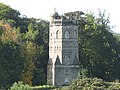
 Oliver Duckets Folly - geograph.org.uk - 1525632.jpg 640 × 470; 79 KB
-
 GR Postbox, Richmond - geograph.org.uk - 1535659.jpg 427 × 640; 111 KB
-
 Richmond Bridge - geograph.org.uk - 1536697.jpg 640 × 473; 98 KB
-
 Richmond Bridge - geograph.org.uk - 1536700.jpg 640 × 480; 110 KB
-
 Richmond Methodist Church - geograph.org.uk - 1540578.jpg 640 × 461; 69 KB
-
 Solar Eclipse, Richmond - geograph.org.uk - 1535671.jpg 640 × 601; 133 KB
-
 VR Postbox, Richmond - geograph.org.uk - 1536703.jpg 480 × 640; 107 KB
-
 West End Stores, Richmond - geograph.org.uk - 1535660.jpg 640 × 480; 73 KB
-
 St Botolphs church (geograph 4116614).jpg 2,796 × 2,084; 1.05 MB
-

-
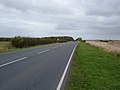 A166 towards Fridaythorpe - geograph.org.uk - 1541378.jpg 640 × 480; 48 KB
-
 Aislaby Postbox - geograph.org.uk - 1536675.jpg 480 × 640; 94 KB
-
 All Saints Church - geograph.org.uk - 1557274.jpg 640 × 425; 108 KB
-
 All Saints Church - geograph.org.uk - 1557291.jpg 640 × 425; 100 KB
-
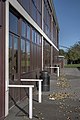
 Allertonshire School - geograph.org.uk - 1522630.jpg 640 × 427; 224 KB
-
 Allertonshire School - geograph.org.uk - 1522646.jpg 427 × 640; 220 KB
-
 Allertonshire.jpg 640 × 427; 251 KB
-
 Approaching Duck Street - geograph.org.uk - 1560300.jpg 640 × 480; 97 KB
-
 Approaching Far Side - geograph.org.uk - 1562882.jpg 640 × 480; 89 KB
-
 B6160 north of Barden Tower - geograph.org.uk - 1554691.jpg 480 × 640; 103 KB
-

-
 Brotton railway station (site), Yorkshire (geograph 3275430).jpg 1,024 × 768; 154 KB
-
 Brough Hall - geograph.org.uk - 1558683.jpg 640 × 585; 102 KB
-
 Castle Howard Station - geograph.org.uk - 1558390.jpg 567 × 381; 255 KB
-
 Castle Howard Station.jpg 567 × 378; 265 KB
-

-

-

-

-

-
 Costa Northallerton.JPG 1,050 × 1,496; 593 KB
-
 Costcutter in Ramshill Road, Scarborough - geograph.org.uk - 1527780.jpg 640 × 480; 128 KB
-
 Cottages in Wharfe - geograph.org.uk - 1525872.jpg 640 × 426; 368 KB
-
 Cover Bridge - geograph.org.uk - 1517353.jpg 640 × 480; 39 KB
-
 Fairburn and Railway - geograph.org.uk - 1524859.jpg 480 × 640; 84 KB
-
 Farmland near Gill's Farm - geograph.org.uk - 1541429.jpg 640 × 480; 105 KB
-
 Feizor, a quiet corner in Autumn - geograph.org.uk - 1542731.jpg 640 × 480; 107 KB
-
 Filey Station Footbridge and Platform - geograph.org.uk - 1546907.jpg 640 × 466; 153 KB
-
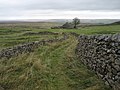
 Footpath to Potter Lane Farm - geograph.org.uk - 1523289.jpg 640 × 372; 53 KB
-
 Former Railway building - geograph.org.uk - 1530567.jpg 640 × 479; 111 KB
-
 Gate and private sign - geograph.org.uk - 1548481.jpg 640 × 480; 94 KB
-
 Gateway in Newtondale - geograph.org.uk - 1525232.jpg 640 × 480; 194 KB
-
 Grinkle railway station (site), Yorkshire (geograph 3276282).jpg 1,024 × 768; 220 KB
-
 Guisborough railway station (site), Yorkshire (geograph 4288105).jpg 1,600 × 1,200; 386 KB
-
-
 Harwood Dale Road - geograph.org.uk - 1547206.jpg 640 × 480; 69 KB
-
 Headless statue - geograph.org.uk - 1560616.jpg 480 × 640; 121 KB
-
 Hedgerow beside Pefham Lane - geograph.org.uk - 1541422.jpg 640 × 480; 104 KB
-
 Hinderwell railway station (site), Yorkshire (geograph 3276288).jpg 1,024 × 768; 174 KB
-

-

-
 Hutton Gate railway station (site), Yorkshire (geograph 4287307).jpg 1,600 × 1,200; 403 KB
-
 Inghey Bench Mark - geograph.org.uk - 1563408.jpg 640 × 480; 152 KB
-
 Inghey Boundary Stone - geograph.org.uk - 1563223.jpg 640 × 480; 149 KB
-
 Inghey Boundary Stone - geograph.org.uk - 1563226.jpg 640 × 480; 140 KB
-
 Inghey Bridge - geograph.org.uk - 1563219.jpg 640 × 480; 85 KB
-
 Inghey Bridge - geograph.org.uk - 1563437.jpg 640 × 370; 74 KB
-
 Inghey Bridge Flush Bracket - geograph.org.uk - 1563221.jpg 480 × 640; 136 KB
-
 Ingleby railway station (site) (geograph 3351550).jpg 1,024 × 768; 207 KB
-
 Jet Filling station - geograph.org.uk - 1530577.jpg 640 × 479; 92 KB
-

-
 Lippersley Pike - geograph.org.uk - 1539864.jpg 640 × 425; 90 KB
-
 Loftus railway station (site), Yorkshire (geograph 3275444).jpg 1,024 × 768; 240 KB
-
 Loftus railway station (site), Yorkshire (geograph 3275506).jpg 1,024 × 768; 203 KB
-
 Long Preston Railway Station - geograph.org.uk - 1540156.jpg 640 × 482; 119 KB
-

-
 Looking towards Harrogate station - geograph.org.uk - 1565202.jpg 640 × 480; 101 KB
-
 Low Road towards East Ayton - geograph.org.uk - 1547079.jpg 640 × 480; 71 KB
-
 Lund Farm, South West of Selby - geograph.org.uk - 1561568.jpg 640 × 480; 60 KB
-
 Lund Farm, South West of Selby - geograph.org.uk - 1561569.jpg 640 × 480; 55 KB
-

-

-
 Muston level-crossing, Filey - geograph.org.uk - 1544597.jpg 640 × 480; 53 KB
-
 North Skelton railway station (site), Yorkshire (geograph 3275427).jpg 1,024 × 768; 307 KB
-
 Northallerton Waterstones cropped.JPG 2,017 × 1,205; 900 KB
-
 Oak Tree Inn, Catterick - geograph.org.uk - 1563894.jpg 640 × 410; 62 KB
-
 Passing ships - geograph.org.uk - 1525740.jpg 640 × 480; 45 KB
-
 Path to Kettlewell Carr - geograph.org.uk - 1530728.jpg 640 × 480; 83 KB
-
 Pinchingthorpe 2nd railway station (site), Yorkshire (geograph 4287262).jpg 1,024 × 768; 363 KB
-
 Potto railway station (site) (geograph 3350566).jpg 1,024 × 768; 236 KB
-
 Reflections in the River Nidd - geograph.org.uk - 1524269.jpg 640 × 483; 102 KB
-
 Ridge lane abandoned tramway tunnel - geograph.org.uk - 1546965.jpg 640 × 427; 134 KB
-
 Ridge lane abandoned tramway tunnel - geograph.org.uk - 1546970.jpg 640 × 427; 121 KB
-
 Rievaulx Abbey - geograph.org.uk - 1556438.jpg 640 × 480; 66 KB
-
 Rievaulx Abbey - geograph.org.uk - 1559336.jpg 480 × 640; 75 KB
-
 S160 at Grosmont.jpg 1,024 × 685; 619 KB
-
 Saltburn railway station (site), Yorkshire (geograph 3275420).jpg 1,024 × 732; 142 KB
-
 Sandbank Hut - geograph.org.uk - 1525554.jpg 640 × 480; 145 KB
-
 Seat Overlooking North Beck - geograph.org.uk - 1522621.jpg 640 × 427; 290 KB
-
 Sexhow railway station (site) (geograph 3350575).jpg 1,024 × 768; 305 KB
-
 Skipton Little Theatre - geograph.org.uk - 1563661.jpg 632 × 640; 107 KB
-
 St John's Church, Cononley - geograph.org.uk - 1534058.jpg 640 × 480; 76 KB
-
 St John's Church, Cononley - geograph.org.uk - 1534068.jpg 640 × 480; 70 KB
-

-
 St John's Church, Cononley, Porch - geograph.org.uk - 1534065.jpg 480 × 640; 79 KB
-
 Staithes railway station (site), Yorkshire (geograph 3276286).jpg 1,024 × 768; 180 KB
-
 Stokesley railway station (site) (geograph 3351543).jpg 1,024 × 768; 179 KB
-
 The former bathing pool at South Bay - geograph.org.uk - 1532504.jpg 640 × 480; 97 KB
-
 The George Hotel, Easingwold - geograph.org.uk - 1556429.jpg 640 × 480; 80 KB
-

-
 The Railway, Skipton.jpg 640 × 436; 71 KB
-
 The road to Ramsgill - geograph.org.uk - 1523320.jpg 480 × 640; 55 KB
-
 Toll House, Skipton - geograph.org.uk - 1552375.jpg 640 × 480; 109 KB
-
 Track near Feizor - geograph.org.uk - 1542732.jpg 640 × 480; 76 KB
-
 View over Bolton Abbey, towards Skipton - geograph.org.uk - 1595372.jpg 640 × 480; 117 KB
-
 Whixley.jpg 6,839 × 1,845; 1.75 MB
-
 Yorkshire Coast College - geograph.org.uk - 1547069.jpg 640 × 480; 49 KB
.jpg)


.jpg)


,_Yorkshire_(geograph_3275430).jpg)


_-_geograph.org.uk_-_1547109.jpg)


,_Yorkshire_(geograph_3276282).jpg)
,_Yorkshire_(geograph_4288105).jpg)


,_Yorkshire_(geograph_3276288).jpg)


,_Yorkshire_(geograph_4287307).jpg)


_(geograph_3351550).jpg)


,_Yorkshire_(geograph_3275444).jpg)
,_Yorkshire_(geograph_3275506).jpg)


,_Yorkshire_(geograph_3275427).jpg)


,_Yorkshire_(geograph_4287262).jpg)
_(geograph_3350566).jpg)


,_Yorkshire_(geograph_3275420).jpg)


_(geograph_3350575).jpg)


,_Yorkshire_(geograph_3276286).jpg)
_(geograph_3351543).jpg)


