Category:Old county maps of Berwickshire
Traditional counties (shires) of Scotland: Aberdeenshire · Angus · Argyll ≈ Argyllshire · Ayrshire · Banffshire · Berwickshire · Buteshire · Caithness · Clackmannanshire · Cromartyshire · Dumbartonshire · Dumfriesshire · East Lothian · Fife · Inverness-shire · Kincardineshire · Kinross-shire · Kirkcudbrightshire · Lanarkshire · Midlothian · Moray · Nairnshire · the Orkney Islands ≈ Orkney Islands · Peeblesshire · Perthshire · Renfrewshire · Ross-shire · Roxburghshire · Selkirkshire · the Shetland Islands ≈ Shetland Islands · Stirlingshire · Sutherland · West Lothian · Wigtownshire
Media in category "Old county maps of Berwickshire"
The following 10 files are in this category, out of 10 total.
-
 "Mercia vulgo vicecomitatus Beruicensis - auct Timothei Pont" (22071509790).jpg 3,930 × 2,952; 2.14 MB
-

-

-

-
 Berwickshire (1794).png 2,000 × 1,554; 3.14 MB
-
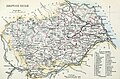 BERWICKSHIRE Civil Parish map.jpg 3,114 × 2,047; 1.8 MB
-
 Berwickshire map Lowe.jpg 646 × 508; 102 KB
-
 Blaeu - Atlas of Scotland 1654 - MERCIA - Berwickshire.jpg 6,217 × 4,667; 5.55 MB
-
 Imperial Gazetteer of Scotland - Berwickshire (1854).png 3,500 × 2,420; 11.4 MB
-
 Joan Blaeu - Merse - 1654 - Area 'Duns Grinnla Fogo'.png 945 × 859; 1.35 MB
.jpg)
.6.(7).jpg)

.png)


.png)

%27_(11291022104).jpg)