Category:Old maps of Arunachal Pradesh
States of India: Andhra Pradesh · Arunachal Pradesh · Assam · Bihar · Goa · Gujarat · Jharkhand · Karnataka · Kerala · Madhya Pradesh · Maharashtra · Manipur · Meghalaya · Odisha · Sikkim · Tamil Nadu · Telangana · Tripura · Uttar Pradesh · Uttarakhand · West Bengal
Union territories: Andaman and Nicobar Islands · Dadra and Nagar Haveli and Daman and Diu · Delhi · Jammu and Kashmir · Ladakh · Lakshadweep · Puducherry
Former states of India: Jammu and Kashmir ·
Former union territories: Daman and Diu ·
Union territories: Andaman and Nicobar Islands · Dadra and Nagar Haveli and Daman and Diu · Delhi · Jammu and Kashmir · Ladakh · Lakshadweep · Puducherry
Former states of India: Jammu and Kashmir ·
Former union territories: Daman and Diu ·
Media in category "Old maps of Arunachal Pradesh"
The following 66 files are in this category, out of 66 total.
-
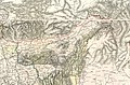 1888 Survey of India map of Assam and the Himalayan region.jpg 5,577 × 3,649; 8.87 MB
-
 BL Add.Or.3017, f. 6.png 1,024 × 788; 1.91 MB
-
 'Front of Tibet' Map Painted by Wu Run-De (1907).jpg 1,000 × 827; 299 KB
-
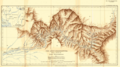 Lohit Brahmaputra 1909.png 2,949 × 1,648; 6.94 MB
-
 1913 map of Tsari and Subansiri by F. M. Bailey.jpg 1,191 × 743; 384 KB
-
 1913 North-Eastern Frontier and Tibet by Morshead and Bailey from RE Journal 1921.jpg 5,733 × 4,158; 3.12 MB
-
 1914 Northeastern Frontier and Tibet by Morshead and Bailey.jpg 5,592 × 4,182; 25.14 MB
-
 1936 Survey of India map of Highlands of Tibet and Surrounding Regions.jpg 16,605 × 11,925; 17.46 MB
-

-
 1945 McMahon Area--Map No 5 from Tibetan Precis.jpg 5,080 × 4,259; 1.21 MB
-
 1946 National Geogapic map of Bengal and Assam.jpg 1,553 × 1,693; 634 KB
-
 1946 National Geographic map of Northeast India.jpg 1,503 × 2,105; 681 KB
-
 1960 Northern Frontier of India by SOI.jpg 4,384 × 3,252; 1.02 MB
-
 Arunachal Pradesh border shown in a 1936 Survey of India map of Tibet.jpg 5,125 × 2,205; 5.13 MB
-
 Assam. 7-69. LOC gm70003328.jpg 3,187 × 4,175; 1.7 MB
-
 Assam. 7-69. LOC gm70003328.tif 3,187 × 4,175; 38.07 MB
-
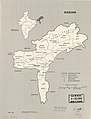
 AssamProvince1936 Map.png 2,000 × 2,060; 519 KB
-
-

-
 Li-ma NH47 13 2402912.jpg 8,862 × 6,742; 13.48 MB
-
 Map India and Pakistan 1-250,000 Tile NH 46-15 Kyimdong Dzong.jpg 5,000 × 3,800; 3.54 MB
-
 Map of Buroi fort.jpg 920 × 728; 127 KB
-
 McMahon Line on 1936 Survey of India map of Tibet.jpg 2,969 × 1,509; 2.12 MB
-
 Namcha Barwa NH46 12 2402906.jpg 8,862 × 6,742; 15 MB
-
 NH-46-11 Linchih Tibet.jpg 8,608 × 6,587; 11.38 MB
-
 NH-46-12 Pomi China; India.jpg 8,544 × 6,587; 11.19 MB
-
 NH-46-14 Lungtzutsung China.jpg 8,576 × 6,579; 6.79 MB
-
 NH-46-15 Chintung China.jpg 8,608 × 6,584; 9.14 MB
-
 NH-46-16 Nizamghat India.jpg 8,576 × 6,576; 8.42 MB
-
 NH-46-16 Nizamghat.jpg 5,228 × 3,936; 6.99 MB
-
 NH-47-13 Ch-A-Yu China 1966.jpg 11,634 × 8,834; 12.58 MB
-
 NH-47-9 Janwu China.jpg 8,576 × 6,582; 10.87 MB
-
 North-East Frontier in 1946 map of India by National Geographic.jpg 1,321 × 835; 250 KB
-
 Sheet-83-dibrugarh-1924.jpg 5,408 × 6,270; 3.34 MB
-
 Simla Convention - contending claims in Kham.jpg 1,725 × 1,397; 872 KB
-
 Simla Convention borders in Kham.jpg 2,877 × 2,061; 1.38 MB
-
 Simla Convention map by Hugh Richardson.jpg 6,136 × 4,674; 1.68 MB
-
 Su-tun NH47 9 2402914.jpg 8,872 × 6,774; 12.18 MB
-
 Tawang Monyul region from 1936 Survey of India map.jpg 1,293 × 1,045; 605 KB
-
 Txu-oclc-10552568-nh46-12.jpg 5,000 × 3,800; 4.96 MB
-
 Txu-oclc-10552568-nh46-14 (cropped).jpg 4,189 × 3,192; 3.5 MB
-
 Txu-oclc-10552568-nh46-14.jpg 5,000 × 3,795; 4.04 MB
-
 Txu-oclc-10552568-nh47-13.jpg 5,000 × 3,790; 4.28 MB
-
 Txu-oclc-10552568-nh47-9.jpg 5,000 × 3,794; 4.08 MB
-
 Txu-oclc-6654394-ng-46-6th-ed.jpg 5,000 × 4,752; 9.55 MB
-
 Txu-oclc-6654394-nh-46-2nd-ed.jpg 5,548 × 4,516; 6.29 MB
-
 Txu-oclc-6654394-nh-47-1st-ed.jpg 4,853 × 4,512; 5.92 MB
-
 Txu-pclmaps-oclc-181831961-72-j-kumla-river-1912.jpg 3,594 × 4,431; 2.28 MB
-
 Txu-pclmaps-oclc-181831961-78-m-towang-1920.jpg 3,691 × 4,893; 1.96 MB
-
 Txu-pclmaps-oclc-181831961-82-h-tsari-1940.jpg 3,623 × 4,889; 1.76 MB
-
 Txu-pclmaps-oclc-181831961-82-l-kombong-1917.jpg 3,569 × 4,983; 2.07 MB
-
 Txu-pclmaps-oclc-181831961-82-l-simong-1917.jpg 3,566 × 4,502; 1.86 MB
-
 Txu-pclmaps-oclc-181831961-82-o-mishmi-hills-1942.jpg 3,668 × 4,881; 1.99 MB
-
 Txu-pclmaps-oclc-181831961-82-o-namcha-barwa-1916.jpg 3,652 × 4,825; 2.54 MB
-
 Txu-pclmaps-oclc-181831961-82-p-nizamghat-1927.jpg 3,661 × 4,859; 2.57 MB
-
 Txu-pclmaps-oclc-181831961-83-m-sadiya-1919.jpg 3,612 × 4,733; 1.9 MB
-
 Txu-pclmaps-oclc-181831961-83-m-sadiya-1930.jpg 3,653 × 4,817; 2.43 MB
-
 Txu-pclmaps-oclc-181831961-83-m-sadiya-1942.jpg 3,620 × 4,998; 2.51 MB
-
 Txu-pclmaps-oclc-181831961-91-c-kangri-karpo-la-1917.jpg 3,602 × 4,779; 1.43 MB
-
 Txu-pclmaps-oclc-181831961-91-h-rima-1918.jpg 3,733 × 4,738; 1.68 MB
-
 Txu-pclmaps-oclc-181831961-91-h-rima-1925.jpg 3,916 × 4,830; 2.27 MB
-
 Txu-pclmaps-oclc-181831961-91-h-rima-1942.jpg 3,640 × 5,085; 1.91 MB
-
 Txu-pclmaps-oclc-181831961-91-l-atuntze-1923.jpg 3,646 × 4,868; 2.08 MB
-
 Txu-pclmaps-oclc-181831961-91-l-mekong-valley-p-1903.jpg 7,060 × 4,868; 2.62 MB
-
 Upper Subansiri area from 1936 Survey of India map of Tibet.jpg 1,094 × 712; 381 KB
-
 Xikang province in 1950 CIA map of Tibet.jpg 1,991 × 1,305; 733 KB


.jpg)


.jpg)


.jpg)


