Category:Old maps of Australia
Countries of Oceania: Australia · Fiji · Federated States of Micronesia · Kiribati · Marshall Islands · Nauru · New Zealand · Palau · Papua New Guinea · Samoa · Solomon Islands · Tonga · Tuvalu · Vanuatu
Other areas: Clipperton Island · Cook Islands · French Polynesia · Guam · Hawaii · New Caledonia · Niue · Northern Mariana Islands · Pitcairn Islands · Wallis and Futuna – Partly: British overseas territories · Indonesia · French Southern and Antarctic Lands
Other areas: Clipperton Island · Cook Islands · French Polynesia · Guam · Hawaii · New Caledonia · Niue · Northern Mariana Islands · Pitcairn Islands · Wallis and Futuna – Partly: British overseas territories · Indonesia · French Southern and Antarctic Lands
Use the appropriate category for maps showing all or a large part of Australia. See subcategories for smaller areas:
| If the map shows | Category to use |
|---|---|
| Australia on a recently created map | Category:Maps of Australia or its subcategories |
| Australia on a map created more than 70 years ago | Category:Old maps of Australia or its subcategories |
| the history of Australia on a recently created map | Category:Maps of the history of Australia or its subcategories |
| the history of Australia on a map created more than 70 years ago | Category:Old maps of the history of Australia or its subcategories |
Wikimedia category | |||||
| Upload media | |||||
| Instance of | |||||
|---|---|---|---|---|---|
| |||||
Subcategories
This category has the following 23 subcategories, out of 23 total.
Media in category "Old maps of Australia"
The following 197 files are in this category, out of 197 total.
-
'Mistress Branican' by Léon Benett 35.jpg 800 × 564; 140 KB
-
'The Children of Captain Grant' by Édouard Riou 117.jpg 847 × 525; 149 KB
-
115 australien-festland (1905).png 2,218 × 1,799; 2.49 MB
-
Map - Special Collections University of Amsterdam - OTM- HB-KZL 31-01-28.tif 7,888 × 6,447; 145.49 MB
-
1833 fremantle townsite plan.jpg 2,501 × 3,777; 578 KB
-
HODGSON(1846) EXPLORATION ROUTE FROM JIMBOUR TO NORTH WEST.jpg 2,237 × 2,703; 2.18 MB
-
1876 Stieler's Map of Southeastern Australia - Geographicus - AustraliaEast-s-76.jpg 3,389 × 4,000; 3.87 MB
-
HARVEN(1883) p026 CONTINENT AUSTRALIA.jpg 1,991 × 1,389; 1.46 MB
-
(1897) OZEANIA.jpg 3,097 × 2,425; 3.75 MB
-
(1897) AUSTRALIA.jpg 3,103 × 2,449; 4.07 MB
-
1911 Britannica - Map of Australia1.png 662 × 962; 1.5 MB
-
1911 Britannica - Map of Australia2.png 656 × 962; 1.67 MB
-
1938 Index to Admiralty charts of Australia nla.obj-574968257.jpg 11,143 × 8,263; 15.41 MB
-
22 of '(Travelling About over New and Old Ground, etc.)' (11161390436).jpg 1,792 × 1,225; 410 KB
-
22 of 'Travelling About over New and Old Ground, etc' (11097164386).jpg 1,792 × 1,290; 425 KB
-
26 of 'La Nouvelle Zélande. Histoire ... Avec cartes et planches' (11163746505).jpg 1,923 × 1,303; 657 KB
-
26 of 'Vol. 2. Fourth edition. (Supplement.)' (11201898906).jpg 3,072 × 3,437; 1.58 MB
-
272 of 'Reminiscences of Australia, with hints on the squatters' life' (11025198896).jpg 2,288 × 2,946; 942 KB
-
304 of 'Le Continent austral. Hypothèses et découvertes' (11302611806).jpg 1,207 × 918; 153 KB
-
31 of 'The Native Tribes of Central Australia. (With illustrations.)' (11253680454).jpg 1,397 × 2,275; 460 KB
-
387 of 'Le Continent austral. Hypothèses et découvertes' (11220439016).jpg 2,240 × 1,564; 485 KB
-
399 of 'The Black Police. A story of modern Australia, etc' (11210896746).jpg 2,000 × 1,317; 596 KB
-
411 of 'The Native Tribes of Central Australia. (With illustrations.)' (11254049154).jpg 4,820 × 4,935; 3.46 MB
-
89 of 'Enterprise in Tropical Australia. (With maps.)' (11025337215).jpg 2,942 × 2,223; 1.02 MB
-
A new Fleuron N042026-3.png 1,252 × 1,057; 63 KB
-
A short history of England and the British Empire (1915) (14580630770).jpg 3,056 × 1,920; 805 KB
-
A sketch of the natural history of Australia BHL43165813.jpg 2,240 × 1,476; 348 KB
-
ACT area Murray County 1886.jpg 1,200 × 1,200; 253 KB
-
Admiralty Chart No 1044 North Coast of Australia Sheet IV, Published 1825.jpg 11,599 × 7,884; 36.87 MB
-
Admiralty Chart No 1059 Chart of Terra Australis. Sheet I South coast, Published 1814.jpg 11,631 × 7,899; 40.02 MB
-
Admiralty Chart No 1061 Chart of Terra Australis. Sheet III South coast, Published 1814.jpg 11,613 × 7,897; 45.75 MB
-
Admiralty Chart No 1066 Chart of Terra Australis. sheet 1 East coast, Published 1814.jpg 5,842 × 7,878; 19.97 MB
-
Admiralty Chart No 1067 Chart of Terra Australis. Sheet II, East coast, Published 1814.jpg 5,758 × 7,842; 19.01 MB
-
Admiralty Chart No 1068 Chart of Terra Australis. Sheet III East coast, Published 1814.jpg 11,582 × 7,916; 40.15 MB
-
Admiralty Chart No 1075 Chart of part of the N.E. coast of Australia. Sheet 1, Published 1824.jpg 11,653 × 7,898; 23.33 MB
-
Admiralty Chart No 1088 Arafura Sea, Published 1837.jpg 15,285 × 8,644; 39.86 MB
-
Admiralty Chart No 2759b Australia southern portion, Published 1885.jpg 16,329 × 11,143; 70.69 MB
-
Admiralty Chart No 2763 Australia, Coral Sea and Great Barrier Reefs. Sheet 1, Published 1860.jpg 11,888 × 7,771; 47.94 MB
-
Admiralty Chart No 475 North West Coast of Australia, Published 1880.jpg 16,426 × 11,313; 45.54 MB
-
Admiralty Chart No 567 Australia, New South Wales, Jervis Bay, Published 1895.jpg 11,660 × 17,355; 75.52 MB
-
AMH-8089-KB Map of Australia.jpg 2,400 × 1,816; 693 KB
-
Archives des missions scientifiques et littéraires (1881) (19130814594).jpg 2,065 × 2,808; 1.17 MB
-
Archives des missions scientifiques et littéraires (1881) (19753400635).jpg 2,870 × 2,404; 1.54 MB
-
Arnold Guyot03.jpg 500 × 456; 59 KB
-
Australia 1860.jpg 1,544 × 2,064; 725 KB
-
Meyers b2 s0144a.jpg 2,048 × 1,694; 762 KB
-
Australia 1900.jpg 1,699 × 1,276; 301 KB
-
Australia in 1794 Samuel Dunn Map of the World in Hemispheres.JPG 990 × 624; 168 KB
-
Australia map 1863.jpg 457 × 364; 75 KB
-
Australia. LOC 00552796.jpg 3,393 × 4,396; 1.38 MB
-
Australia. LOC 00552796.tif 3,393 × 4,396; 42.67 MB
-
Australia. LOC 00552797.jpg 2,005 × 2,672; 920 KB
-
Australia. LOC 00552797.tif 2,005 × 2,672; 15.33 MB
-
Australia1848.jpg 5,589 × 4,512; 1.57 MB
-
Australie et Nouvelle Zélande - btv1b530089619.jpg 3,116 × 2,809; 1.07 MB
-
Australien 1905.png 1,800 × 1,508; 1.67 MB
-
Australien, karta, Nordisk familjebok Kap Leeuwin.jpg 1,156 × 988; 546 KB
-
Australien, karta, Nordisk familjebok.jpg 3,172 × 2,561; 4.22 MB
-
Brisbane Town 1840.jpg 788 × 596; 152 KB
-
Brockhaus and Efron Encyclopedic Dictionary b1 090-1.jpg 3,399 × 2,552; 3.82 MB
-
Caert van't Landt van d'Eendracht (detail showing Willems River).jpg 712 × 532; 254 KB
-
Caert van't Landt van d'Eendracht (NLA balanced).jpg 5,496 × 3,035; 2.51 MB
-
Carapook, county of Dundas - (located in state of Victoria). LOC 2008624021.jpg 7,428 × 10,362; 8.94 MB
-
Carapook, county of Dundas - (located in state of Victoria). LOC 2008624021.tif 7,428 × 10,362; 220.21 MB
-
Carte de l'Australie. LOC 00556401.jpg 6,288 × 4,680; 4.59 MB
-
Carte de l'Australie. LOC 00556401.tif 6,288 × 4,680; 84.19 MB
-
Carte de la Nouvelle Hollande et de quelques terres voisines (34423193701).jpg 1,200 × 1,261; 628 KB
-
Chart of the Malay Archipelago Dutch discoveries in Australia 1618.jpg 3,600 × 4,971; 3.75 MB
-
Charts Showing Humidity, also Wet and Dry Bulb Isotherms Fig 53-54.png 2,526 × 3,941; 327 KB
-
Desceliers 1550 map - Australia detail.jpg 2,711 × 2,589; 1.1 MB
-
Desceliers 1550 map - detail showing Arenes.jpg 450 × 450; 30 KB
-
Early voyages to Terra Australis - map facing p.37.jpeg 2,991 × 2,432; 308 KB
-
Festland von Australien und benachbarte Inseln.jpg 5,663 × 4,593; 6.78 MB
-
FMIB 36089 Distribution of Retropinna semoni.jpeg 687 × 787; 81 KB
-
FMIB 36616 Map of Port Stevens.jpeg 1,833 × 1,687; 486 KB
-
FMIB 36625 Map of Broken Bay, Including Pitt and Brisbane Waters.jpeg 1,678 × 1,647; 450 KB
-
Globe Coronelli Map of New Holland.jpg 2,816 × 2,112; 1.81 MB
-
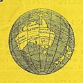
Globe terrestre de Jacques Vau de Claye (1583).gif 232 × 228; 47 KB
-
Gulf-of-Carpentaria-Australia-Otto-Petri-1859-Rotterdam.jpg 640 × 480; 125 KB
-
Henry de Freycinet and Australian Governor-General.jpg 500 × 334; 44 KB
-
Hessel Gerritsz - Malay Archipelago and Australia.jpg 2,858 × 4,232; 3.11 MB
-
Ilustración del Atlas Vallard.jpg 3,088 × 4,112; 9.12 MB
-
Itinéraire du Caitaine Cook.JPG 813 × 824; 162 KB
-
Java La Grande.jpg 800 × 645; 46 KB
-
Jeugdhal in Energiehal. Voorlichting politie, Bestanddeelnr 912-7450.jpg 2,563 × 2,600; 1.05 MB
-
Johannes Schöner, globe of 1533, southern hemisphere.jpg 1,000 × 972; 501 KB
-
King Island map 1887 nla.obj-232345405.jpg 3,022 × 5,110; 3.27 MB
-
LA2-NSRW-1-0177.jpg 3,713 × 2,781; 2.89 MB
-
Le Tour du monde-02-p187.jpg 1,266 × 850; 316 KB
-
Le Tour du monde-03-p091.jpg 1,251 × 864; 298 KB
-
Londe of Java.jpg 600 × 359; 87 KB
-
Ludwig Leichhardt6.jpeg 3,789 × 3,102; 1.41 MB
-
Map of Australia(GN00264).jpg 3,264 × 2,448; 1.07 MB
-
Map of Australia(GN00265).jpg 3,264 × 2,448; 940 KB
-
Map of Glenelg East 1936.JPG 3,136 × 4,603; 10.16 MB
-
Map of Western Australia - btv1b53060414s.jpg 7,518 × 10,622; 13.02 MB
-
Map-533.jpg 437 × 600; 52 KB
-
Maslens Inland Sea of Australia.jpg 658 × 534; 99 KB
-
Matthew Flinders - General chart of Terra Australis or Australia.jpg 4,716 × 3,320; 7.68 MB
-
New South Wales South East1952 subdivision map.jpg 17,313 × 13,453; 149.06 MB
-
Nineteen counties, Australia, 1832.jpg 1,200 × 1,200; 268 KB
-
Nla.obj-234332820.tif 9,104 × 6,814; 177.5 MB
-
NSRW Map of Australia.png 1,474 × 1,111; 960 KB
-
NW Australia 1885.jpg 1,263 × 1,396; 269 KB
-
Old Australia map in german.jpg 1,452 × 878; 591 KB
-
P033 - N° 527. D’Adélaïde à Sydney. - Liv4-Ch05.png 1,446 × 1,730; 330 KB
-
Parishes of Tullamarine and Maribyrnong 1892.jpg 973 × 730; 194 KB
-
PikiWiki Israel 15147 JNF box in Australia Park in Misgav.JPG 2,048 × 1,536; 682 KB
-
Pinkerton Map 1818 - Recolour v1.6.tif 5,317 × 3,973; 60.46 MB
-
Plan of Canberra, the Federal Capital of the Commonwealth of Australia LOC 2006629794.jpg 8,496 × 8,815; 10.22 MB
-
Plan of Canberra, the Federal Capital of the Commonwealth of Australia LOC 2006629794.tif 8,496 × 8,815; 214.27 MB
-
Preserving Archipelagus Orientalis.ogv 3 min 59 s, 1,280 × 720; 79.95 MB
-
Recherche Archipelago map 1792 nla.obj-230811677-1.jpg 5,000 × 3,485; 8.16 MB
-
RobertDixonGippsland.jpg 999 × 838; 127 KB
-
RobertDixonMoretonBay.jpg 747 × 1,000; 209 KB
-
Révai nagy lexikona; az ismeretek enciklopédiája (1911) (14597938099).jpg 1,912 × 3,034; 1,005 KB
-
Révai nagy lexikona; az ismeretek enciklopédiája (1911) (14761602916).jpg 1,894 × 3,252; 644 KB
-
Sketch of the proposed route from Sydney to Port Essington (14086132064).jpg 1,000 × 1,601; 1.03 MB
-
Somerset, Albany Island.jpg 825 × 679; 288 KB
-
State Library of New South Wales000.jpg 2,816 × 2,112; 3.35 MB
-
StateLibQld 2 107716 Coorparoo Heights Estate map, 1916.jpg 751 × 1,000; 167 KB
-
StateLibQld 2 119336 Map of the town of Mount Isa, 1935.jpg 1,000 × 949; 130 KB
-
StateLibQld 2 131715 Map of Cairns' wharves, 1876.jpg 763 × 1,000; 104 KB
-
StateLibQld 2 191855 Estate map for Pacific Ocean Estate, Southport, 1915.jpg 636 × 1,000; 137 KB
-
StateLibQld 2 200851 Estate map of the Vaughan Estate, Redcliffe, 1890-1900.jpg 793 × 1,000; 154 KB
-
StateLibQld 2 200987 Map of Woodford in the Parish of Durundur, 1904.jpg 1,000 × 886; 203 KB
-
Stielers Handatlas 1891 72.jpg 5,100 × 4,300; 6.11 MB
-
Stielers Handatlas 1891 73.jpg 4,300 × 5,150; 6.79 MB
-
Sturt and Hume and Hovell expeditions.jpg 800 × 519; 79 KB
-
Sydney Cove Port Jackson 1788 Fowkes.jpg 1,496 × 1,096; 1.68 MB
-
Süd-Östliches Australien.jpg 5,722 × 4,653; 7.5 MB
-
Südliche Oberflaeche der Erde.jpg 6,928 × 5,502; 9.33 MB
-
Tasmanmap1644.jpg 3,236 × 2,516; 2.83 MB
-
The Australian zoologist (1934) (20350220795).jpg 3,072 × 2,752; 1.01 MB
-
The Great Barrier Reef of Australia (Plate) (6898578584).jpg 1,398 × 2,009; 2.16 MB
-
The Overflow Parish 1880.png 464 × 692; 625 KB
-
U.S. Foreign Service posts, Bureau of East Asian and Pacific Affairs (EA). 12-71. LOC 75690926.jpg 15,412 × 11,154; 14.33 MB
-
Vallard Australia-1547d.jpg 3,604 × 2,504; 2.32 MB
-
Van Keulen-Nieuwe Pascaert van Oost Indien-1680-1735-2.png 4,769 × 4,162; 3.48 MB
-
Vintage Map of Australia 1817.jpg 6,006 × 5,046; 4.78 MB
-
Wallace Island Life p497.png 1,424 × 1,327; 59 KB
-
Yuzhakov Big Encyclopedia Map of Australia.jpg 4,620 × 3,828; 3.81 MB
-
Älteste Generalkarte Australiens von Freycinet 1811 verbessert.jpg 6,008 × 3,970; 5.4 MB
-
БСЭ1. Австралийская Федерация 2.jpg 1,484 × 920; 581 KB
-
Харківський морський музей 17.jpg 4,608 × 3,456; 5.24 MB


