Category:Old maps of Brecknockshire

Subcategories
This category has only the following subcategory.
Media in category "Old maps of Brecknockshire"
The following 6 files are in this category, out of 6 total.
-
 Ordnance Survey Drawings - Crickhowell (OSD 195).jpg 2,807 × 4,000; 4.25 MB
-
 Ordnance Survey Drawings - Builth (OSD 196).jpg 5,747 × 3,375; 5.09 MB
-
 Ordnance Survey Drawings - Llandovery, Carmarthenshire (Sir Gaerfyrddin) (OSD 190).jpg 5,827 × 3,287; 2.44 MB
-
 Ordnance Survey Drawings - Builth, Powys (OSD 310-2).jpg 4,000 × 3,887; 4.16 MB
-
 Ordnance Survey Drawings - Cardigan (OSD 310-1).jpg 5,745 × 3,388; 3.33 MB
-
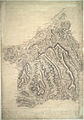
 PRYSE(1873) p01.625 - Brecknockshire.jpg 2,213 × 2,954; 1.29 MB
.jpg)
.jpg)
_(OSD_190).jpg)
.jpg)
.jpg)
_p01.625_-_Brecknockshire.jpg)