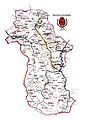
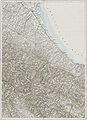
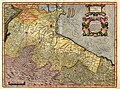
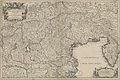
Category:Old maps of Emilia-Romagna
- Regions of Italy: Abruzzo · Aosta Valley · Apulia · Basilicata · Calabria · Campania · Emilia-Romagna · Friuli-Venezia Giulia · Lazio · Liguria · Lombardy · Marche · Molise · Piedmont · Sardinia · Sicily · Trentino-South Tyrol · Tuscany · Umbria · Veneto
Use the appropriate category for maps showing all or a large part of Emilia-Romagna. See subcategories for smaller areas:
| If the map shows | Category to use |
|---|---|
| Emilia-Romagna on a recently created map | Category:Maps of Emilia-Romagna or its subcategories |
| Emilia-Romagna on a map created more than 70 years ago | Category:Old maps of Emilia-Romagna or its subcategories |
| the history of Emilia-Romagna on a recently created map | Category:Maps of the history of Emilia-Romagna or its subcategories |
| the history of Emilia-Romagna on a map created more than 70 years ago | Category:Old maps of the history of Emilia-Romagna or its subcategories |
Subcategories
This category has the following 18 subcategories, out of 18 total.
A
- Atlante Vallardi - Emilia (6 F)
B
C
- Old maps of Cesena (8 F)
- Old maps of Comacchio (3 F)
F
I
M
P
- Old maps of Piacenza (5 F)
- Old maps of Pieve di Cento (1 F)
R
Media in category "Old maps of Emilia-Romagna"
The following 53 files are in this category, out of 53 total.
-

-
 Delta-Pô-1603.jpg 537 × 733; 114 KB
-

-
 Ducato di Ferrara (8342170795) (cropped).jpg 926 × 1,234; 1.47 MB
-
 Ducato di Ferrara (8342170795).jpg 6,684 × 5,571; 36.06 MB
-
 "Ducato di Modena regio et Carpi, col dominio della Carfagnana." (22066888058).jpg 3,678 × 3,168; 2.25 MB
-
 Map - Special Collections University of Amsterdam - OTM- HB-KZL 33.03.38.tiff 7,108 × 6,262; 127.35 MB
-

-
 1780 Bonne Map of Venice in Western Italy - Geographicus - Venice-bonne-1780.jpg 3,000 × 2,085; 1 MB
-
 Vallardi - Ferrara.jpg 6,188 × 4,168; 9.2 MB
-
 Italy- a handbook for travellers. First Part (Nothern Italy) (1893) (14781117122).jpg 2,624 × 1,688; 1.93 MB
-

-
 266 of 'L'Italia geografica illustrata, etc' (11208912514).jpg 3,318 × 2,192; 1.94 MB
-
-
 Atlas Van der Hagen-KW1049B12 065-DVCATO di PARMA et di PIACENZA.jpeg 5,500 × 4,308; 3.82 MB
-
 AustroPrussianWar SouthernBattlefield.png 1,508 × 1,131; 643 KB
-
 Centurisation.jpg 545 × 750; 114 KB
-
 Conca, città profondata 01.jpg 637 × 426; 97 KB
-
 Enemy defence overprint no. 6 - DPLA - 399f49db31a63e676d8960085fbc007b.jpg 6,166 × 8,999; 8.59 MB
-

-

-

-
-
 Italy - handbook for travellers (1880) (14595592618).jpg 1,336 × 1,404; 468 KB
-

-

-
 Legazione di Romagna.jpg 531 × 376; 124 KB
-
 Livorno - 28-44.jpg 3,618 × 4,990; 3.56 MB
-
 Mantua - 28-45.jpg 3,580 × 4,982; 3.88 MB
-
 Mappa Cervia antica.jpeg 1,244 × 960; 244 KB
-
 Mappa della Romagna nel 17esimo secolo.jpg 815 × 600; 214 KB
-
 Mappa Provincia di Bobbio.jpg 2,488 × 3,504; 3.22 MB
-
 Métaure Atlas Historique Schul-Atlas, 1905.JPG 1,137 × 913; 334 KB
-
 Palude1603.jpg 716 × 658; 141 KB
-
 Paludes1570.jpg 1,082 × 754; 184 KB
-

-

-

-
 Ravenna - 30-44.jpg 3,621 × 4,997; 3.58 MB
-
 Reilly 500.jpg 800 × 632; 114 KB
-
 Romagna olim Flaminia (8357189515).jpg 800 × 660; 138 KB
-
 Romagna olim Flaminia 1598-1620.jpg 2,704 × 2,012; 1.95 MB
-
 Romagna olim Flaminia.jpg 741 × 598; 182 KB
-
 Shepherd Map Regio Aemilia (1911).jpg 1,347 × 737; 427 KB
-
 StatoPallavicino.jpg 722 × 810; 250 KB
-
 Stielers Handatlas 1891 17.jpg 5,100 × 4,250; 7.39 MB
-
 Stielers Handatlas 1891 20.jpg 5,050 × 4,200; 7.28 MB
-
 Territorio di Bologna (8358253232).jpg 800 × 663; 165 KB
-
 Topografia e idrografia del Reno 1732.jpg 7,886 × 5,184; 1.93 MB
-
 Verona - 29-45.jpg 3,595 × 4,991; 3.86 MB
-
 View from Ferrara 47.JPG 2,880 × 2,160; 1,017 KB
-
 VIII - AEMILIA.svg 709 × 501; 712 KB
-
 États Italie Trente Brixen 1702.jpg 8,576 × 5,712; 27 MB


_(cropped).jpg)
.jpg)
.jpg)


_(1893)_(14781117122).jpg)
._De_l%27esprit_et_de_la_force_intellectuelle_et_morale_dans_l%27Ari%C3%A8ge_et_les_Pyr%C3%A9n%C3%A9es_Centrales_..._avec_eaux-fortes_de_Chauvet%27_(11277842465).jpg)
.jpg)
.jpg)


_(14595592618).jpg)

.jpg)


.jpg)


.jpg)


.jpg)


