Category:Old maps of Jamaica
Countries of North America: Antigua and Barbuda · The Bahamas · Barbados · Belize · Canada · Costa Rica · Cuba · Dominica · Dominican Republic · El Salvador · Grenada · Guatemala · Haiti · Honduras · Jamaica · Mexico · Nicaragua · Panama · Saint Kitts and Nevis · Saint Lucia · Saint Vincent and the Grenadines · Trinidad and Tobago‡ · United States of America‡
Other territories: Bermuda · Florida Keys · Greenland · Guadeloupe · Martinique · Montserrat · Puerto Rico · Saint Barthélemy · Saint-Martin · Saint Pierre and Miquelon
‡: partly located in North America
Other territories: Bermuda · Florida Keys · Greenland · Guadeloupe · Martinique · Montserrat · Puerto Rico · Saint Barthélemy · Saint-Martin · Saint Pierre and Miquelon
‡: partly located in North America
Subcategories
This category has the following 10 subcategories, out of 10 total.
- 17th-century maps of Jamaica (34 F)
*
K
- Old maps of Kingston Harbour (9 F)
P
- Old maps of Port Royal (27 F)
W
Media in category "Old maps of Jamaica"
The following 16 files are in this category, out of 16 total.
-
 A New Map of the Island of Jamaica from an Actual Survey (BM 1868,0822.5015).jpg 2,500 × 1,821; 837 KB
-
 Plans des isles, rades, et ports de plusieurs lieux de lAmérique (4579410398).jpg 8,568 × 6,104; 14.15 MB
-
 Admiralty Chart No 448 Great Pedro Bluff to South Negril Point, Published 1880, New Edition 1913.jpg 16,306 × 11,084; 19.84 MB
-
 Carnegie Institution of Washington publication (1902-) (20536080485).jpg 3,184 × 2,040; 844 KB
-
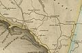 CumberlandValleyJamaica.jpg 834 × 540; 105 KB
-
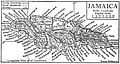 EB1911 Jamaica.jpg 518 × 278; 136 KB
-
 Item 53219.jpg 600 × 492; 57 KB
-

-

-

-

-
 Plano de la travesia desde Carta Xena a la Biuora Y., ysla de Jamayca. LOC 90683841.jpg 5,676 × 8,123; 4.09 MB
-
 Plano de la travesia desde Carta Xena a la Biuora Y., ysla de Jamayca. LOC 90683841.tif 5,676 × 8,123; 131.91 MB
-

-

-

.jpg)
.jpg)

_(20536080485).jpg)


,_RP-P-1896-A-19368-3094.jpg)


_(14595860758).jpg)