Category:Old maps of Southeast Asia
Subcategories
This category has the following 16 subcategories, out of 16 total.
B
- Old maps of Brunei (9 F)
I
J
M
- Old maps of the Malay Peninsula (12 F)
O
P
- Ptolemy's 11th Asian Map (41 F)
~
Media in category "Old maps of Southeast Asia"
The following 200 files are in this category, out of 246 total.
(previous page) (next page)-
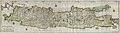
 Nova Archipelagi Orientalis Tabula Joan Blaeu 6663.png 979 × 756; 1.71 MB
-

-

-

-
 49 of 'Zigzag Journeys in the Antipodes ... Fully illustrated' (11199330115).jpg 1,752 × 1,317; 426 KB
-

-

-
 A list of the birds known to inhabit the Island of Celebes (20763667625).jpg 2,308 × 3,096; 1.3 MB
-

-

-
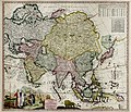
 AMH-7120-KB Map of Asia and Australia.jpg 2,400 × 2,092; 1.37 MB
-
 Asia and its islands.png 15,898 × 6,819; 158.56 MB
-
 Asia from the Geographisch Handtbuch (south east).jpg 800 × 600; 221 KB
-
 B26055911G - Wall map of Asia.jpg 6,638 × 5,406; 12.43 MB
-
 B26055912H - Nieuwe en zeer naaukeurige kaart van t eyland Java Major of Groot Java.jpg 11,442 × 3,136; 11.66 MB
-
 B26055913I -Insulae Iavae pars Occidentalis edente Hadriano Relando.jpg 8,871 × 4,045; 12.82 MB
-
 B26055914J - A detailed map of Asia and Southeast Asia.jpg 7,646 × 4,693; 10.27 MB
-
 B26055915K - Asia and its islands according to D'Anville.jpg 6,402 × 5,605; 13.59 MB
-
 B26055917B - Engraved wall map of Asia.jpg 6,585 × 5,449; 13.94 MB
-
 B26055921H - De landvoogdy van Amboina met de elf onderhoorige eylanden.jpg 8,360 × 3,407; 8.99 MB
-

-
 B26055926B - Carte de l'isle de Java avec les isles de Banca.jpg 7,172 × 5,004; 9.22 MB
-

-
 B26055929E - Carta prima generale dell'Asia.jpg 7,196 × 4,987; 8.35 MB
-

-

-
 B26055933K - India Orientalis nec non insularum adiacentium.jpg 6,518 × 5,505; 9.95 MB
-
 B26055936C - Asia in tabula geographica delineatio.jpg 6,321 × 5,415; 12.47 MB
-
 B26055937D - Exactissima Asia delineatio.jpg 6,131 × 5,392; 11.43 MB
-
 B26055938E - Exactissima Asia delineatio.jpg 6,399 × 5,608; 10.57 MB
-
 B26055939F - ccuratissima totius Asia.jpg 6,093 × 5,205; 10.79 MB
-
 B26055940I - India orientalis, cum adjacentibus insulis nova delineatione ob oculos polita.jpg 6,101 × 5,205; 12.11 MB
-

-
 B26055942K - Indie Orientali di qua e di la dal Gange col loro arcipelago.jpg 6,776 × 5,296; 9.7 MB
-

-

-
 B26055946D - Asia according to ye newest observations.jpg 7,051 × 5,089; 11.68 MB
-
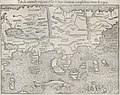
 B26055947E - Vndecima Asie Tabvla.jpg 7,055 × 5,086; 8.28 MB
-
 B26055948F - Indiae orientalis insvlarvmqve adiacientivm typvs.jpg 6,058 × 4,266; 7.41 MB
-
 B26055949G - Indiae orientalis insvlarvmqve adiacientivm typvs.jpg 6,438 × 4,521; 9.33 MB
-
 B26055950J - Tabvla XI Asiae.jpg 5,658 × 4,537; 5.72 MB
-
 B26055952A - Indiae orientalis insvlarvmqve adiacientivm typvs.jpg 5,961 × 4,166; 7.37 MB
-

-
 B26055954C - Paskaerte zynde t'Oosterdeel van Oost Indien.jpg 6,593 × 5,443; 8.48 MB
-
 B26055955D - Undecima Asiae Tabula.jpg 6,180 × 5,224; 8.01 MB
-
 B26055956E - Vndecima Asiae Tabvla.jpg 6,761 × 5,308; 9.82 MB
-
 B26055958G - Tabula geograph in qua Europae, Africae, Asiaeq.jpg 6,483 × 4,319; 6.94 MB
-
 B26055960K - India Orien Talis.jpg 5,986 × 4,627; 6.51 MB
-
 B26055962B - Vndecima Asiae Tabvla.jpg 6,963 × 5,153; 6.47 MB
-
 B26055963C - Nova tabula insularum Iavae, Sumatrae, Borneonis et aliarum Malaccam usque.jpg 6,103 × 5,334; 7.63 MB
-
 B26055965E - Carta particolare dell' Isole Celebes eÌ€ Gilioli parte Austrle.jpg 5,381 × 6,669; 6.79 MB
-
 B26055966F - Tabula Geographica Hydrophylacium Asiae Majoris exhibens.jpg 6,077 × 5,081; 7.08 MB
-
 B26055967G - Mar di India.jpg 6,321 × 5,078; 9.2 MB
-
 B26055969I - Tabula Indiae orientalis.jpg 6,021 × 4,928; 7.71 MB
-
 B26055972C - Indiae Orientalis nova descriptio.jpg 5,806 × 4,508; 8.21 MB
-
 B26055974E - Carta particolare del stretto di Sunda fra l'Isole di Sunda.jpg 4,973 × 6,314; 5.55 MB
-
 B26055975F - Mar di India.jpg 7,033 × 5,103; 7.84 MB
-
 B26055977H - India quae Orientalis dicitur, et insvlae adiacentes.jpg 5,856 × 4,586; 7.96 MB
-
 B26055978I - India quae Orientalis dicitur, et insvlae adiacentes.jpg 5,522 × 4,475; 7.31 MB
-
 B26055979J - India quae Orientalis dicitur, et insvlae adiacentes.jpg 5,757 × 4,723; 7.65 MB
-
 B26055980B - Isole dell'Indie divise in Filippine, Molucche e della Sonda.jpg 6,465 × 4,860; 8.54 MB
-

-
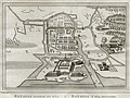
 B26055984F - Grundris der stadt und citadelle Batavia.jpg 4,278 × 7,514; 11.62 MB
-
 B26055986H - Indiae orientalis, nec non insularum adiacentium nova descriptio.jpg 6,145 × 5,065; 8.41 MB
-
 B26055987I - Insvlarvm Bandanensivm noviayima delineatio.jpg 5,363 × 4,566; 6.5 MB
-
-
 B26055989K - Le Indie Orientali e il loro arcipelago.jpg 5,733 × 4,620; 6.08 MB
-
 B26055991D - Kaart van het Eyland Bali.jpg 5,901 × 4,754; 6.15 MB
-
 B26055992E - Kaart der Zuyd-Wester Eylanden van Banda.jpg 6,351 × 4,638; 5.64 MB
-
 B26055993F - Batavia.jpg 6,881 × 3,723; 6.83 MB
-
 B26055995H - Carte hydro-geo-graphique des Indes orientales.jpg 7,013 × 5,117; 12.03 MB
-
 B26055998K - Sumatra ein grosse Insel.jpg 5,374 × 4,877; 6.52 MB
-
 B26055999A - Sumatra ein grosse Insel.jpg 5,730 × 5,049; 7.48 MB
-

-
 B26056001I - Insula Iava.jpg 5,666 × 4,663; 5.68 MB
-
 B26056002J - Svmatrae et insularum locorumque nonnullorum circumiacentium tabula noua.jpg 5,957 × 4,875; 6.66 MB
-
 B26056003K - A new plan of the Straits, situated to the east of Java Madura.jpg 4,049 × 5,880; 5.27 MB
-

-

-
 B26056007D - Insula Borneo et occidentalis pars Celebis cum adjacentibus insulis.jpg 6,666 × 5,384; 8.83 MB
-
 B26056008E - Nouvelle Carte de l'isle de Java.jpg 7,562 × 3,679; 5.7 MB
-
 B26056009F - Nouvelle Carte de l'isle de Java.jpg 7,247 × 3,675; 5.22 MB
-
 B26056010I - Molvccae insvlae celeberrimae.jpg 5,460 × 4,165; 7.08 MB
-
 B26056012K - Asia nova delineatio.jpg 5,983 × 4,831; 8.48 MB
-
 B26056014B - Asia noviter delieata.jpg 6,766 × 5,822; 10.35 MB
-
 B26056018F - Accuratissima totius Asia.jpg 6,590 × 5,445; 12.36 MB
-
 B26056020J - Asia recens summa cura delineata.jpg 5,509 × 4,219; 7.57 MB
-
 B26056021K - Map of Asia.jpg 6,145 × 4,849; 9.71 MB
-
 B26056022A - A new plaine and exact map of Asia.jpg 5,902 × 4,702; 11.25 MB
-
 B26056026E - A new mapp of Asia divided into kingdoms and provinces.jpg 6,790 × 5,822; 9.51 MB
-
-
 B26056028G - Asia nova descriptio.jpg 6,340 × 5,067; 9.43 MB
-
 B26056030K - Asie.jpg 7,017 × 4,894; 10.24 MB
-
 B26056031A - Ancient Asia according to its general divisions.jpg 6,308 × 4,709; 8.01 MB
-
 B26056033C - Tabula noua India orientalis meridionalis.jpg 6,296 × 4,513; 6.71 MB
-
 B26056034D - Isles de la Sonde.jpg 5,802 × 4,401; 4.89 MB
-
 B26056035E - Carte des Isles de Java, Sumatra Borneo.jpg 5,758 × 5,136; 5.93 MB
-
 B26056036F - Descripcion de las Indias del Poniente 14.jpg 6,091 × 4,552; 5.28 MB
-
 B26056037G - Nvoua carta delle Isole di Sunda, come Borneo, Sumatra e Iava Grande.jpg 6,831 × 5,253; 8.03 MB
-

-

-
 B26056040A - Terza Tavola (Southeast Asia).jpg 6,823 × 5,260; 8.7 MB
-
 B26056041B - Asia pars Avstralis insula.jpg 7,042 × 4,524; 7.65 MB
-
 B26056042C - Carte des Isles de Java, Sumatra, Borneo.jpg 5,520 × 4,832; 5.12 MB
-
 B26056043D - Tabvla Asiae XI.jpg 6,205 × 4,842; 7.23 MB
-
 B26056044E - Delineatio India orientalis.jpg 5,893 × 4,757; 6.61 MB
-
 B26056045F - India orientalis et insula.jpg 6,507 × 5,000; 7.54 MB
-
 B26056046G - Suite de l'ocean oriental.jpg 5,175 × 5,041; 5.34 MB
-
 B26056047H - Les Indes oriental et leur archipel.jpg 5,537 × 4,340; 4.84 MB
-
 B26056048I - Les Isles de la Sonde.jpg 4,578 × 4,040; 3.81 MB
-
 B26056053E - India Orientalis.png 6,244 × 4,363; 49.12 MB
-

-
 B26056055G - Carte des environs de Batavia.jpg 5,493 × 4,050; 4.61 MB
-

-
 B26056057I - A map of Batavia with all itts forts.jpg 6,156 × 5,009; 7.15 MB
-

-
 B26056059K - Les Isles Molvcqves; Celebes, Gilolo.jpg 5,400 × 4,191; 4.97 MB
-
 B26056060C - Les isles de la Sonde Moluques Philippines, Carolines, et Mariannes.jpg 4,732 × 4,398; 4.79 MB
-
 B26056061D - East India Is.jpg 5,176 × 4,584; 4.69 MB
-
 B26056062E - Les Indes orientales et leur archipel.jpg 6,512 × 4,330; 6.03 MB
-
 B26056063F - La Presqu'isle de l'Inde au dela du Gange, avec l'archipel des Indes.jpg 4,567 × 6,604; 6.28 MB
-
 B26056064G - Les Indes orientales et leur archipel.jpg 5,242 × 4,249; 5 MB
-
 B26056065H - Carte des isles de la Sonde et des isles Moluques.jpg 6,480 × 4,528; 6.25 MB
-
 B26056068K - Batavia.jpg 5,774 × 4,354; 6.18 MB
-
 B26056069A - A plan of the city and castle of Batavia.jpg 6,043 × 4,716; 7.54 MB
-
 B26056070D - Iles de Banda.jpg 4,251 × 3,999; 3.53 MB
-
 B26056071E - Isles de Banda.jpg 5,007 × 4,636; 5.36 MB
-
 B26056072F - Isle de Baly.jpg 4,659 × 4,244; 3.72 MB
-
 B26056073G - Carte particuliere de l'isle d'Amboine.jpg 6,229 × 4,656; 5.33 MB
-
 B26056074H - Asia secvnda pars terra in forma Pegasi.jpg 6,716 × 5,343; 9.89 MB
-
 B26056075I - Tabula orientalis regionis, Asia.jpg 6,317 × 4,980; 7.81 MB
-

-
 B26056077K - India extrema XIX nova Tabvla.jpg 6,182 × 5,007; 7.78 MB
-
 B26056078A - Svmatra.jpg 6,485 × 4,823; 8.41 MB
-
 B26056080E - Le Molucche.jpg 4,729 × 3,493; 3.77 MB
-
 B26056081F - Isles Moluques.jpg 5,849 × 4,391; 4.61 MB
-
 B26056082G - Carte des isles de la Sonde et des isles Moluques.jpg 6,515 × 4,625; 6.53 MB
-
 B26056083H - La ville de Materan, capitale du roiaume de meÌ‚me nom, avec ses environs.jpg 6,688 × 5,366; 9.62 MB
-
 B26056084I - Plan d'Amboine.jpg 5,839 × 4,705; 7.87 MB
-
 B26056085J - Karte von dem eylande Sumatra nach den tagebüchern der schiffer.jpg 5,415 × 4,725; 5.69 MB
-
 B26056087A - Carta dello stretto della Sonda, ed isole vicine.jpg 5,799 × 5,024; 5.79 MB
-
 B26056089C - Asia antiqua et nova.jpg 4,864 × 4,029; 5.67 MB
-
 B26056091G - Asia.jpg 5,805 × 4,600; 6.51 MB
-
 B26056093I - Skizzirte charte von der insel Celebes.jpg 4,147 × 6,532; 5.29 MB
-
-
 B26056095K - Asia.jpg 5,408 × 4,722; 5.6 MB
-
 B26056097B - Tabvla Asiae XI.jpg 5,865 × 4,283; 4.77 MB
-
 B26056098C - Tabvla Asiae XI.jpg 5,285 × 4,446; 5.31 MB
-
 B26056099D - Indiae orientalis insvlarvmqve adiacientivm t ilpvs.jpg 2,483 × 2,378; 1.6 MB
-
 B26056100I - India orientalis.jpg 4,102 × 3,200; 4.44 MB
-
 B26056101J - India orien.jpg 2,861 × 2,209; 1.57 MB
-
 B26056102K - India orient.jpg 2,838 × 2,192; 1.87 MB
-
 B26056103A - Isole Molvcche.jpg 3,288 × 2,508; 2.67 MB
-
 B26056105C - Indes orientalles ou du Gange.jpg 4,424 × 3,334; 4.66 MB
-
 B26056106D - Les isles des Indes orientalles.jpg 4,385 × 3,314; 4.57 MB
-
 B26056107E - India orientalis.jpg 2,537 × 1,542; 979 KB
-
 B26056108F - The isles of Sonda.jpg 3,193 × 2,496; 2.13 MB
-
 B26056109G - Inde.jpg 2,437 × 3,913; 2.32 MB
-
 B26056110J - Isles de la Sonde vers l'Occident.jpg 2,362 × 3,458; 2.22 MB
-
 B26056111K - Isles de la Sonde vers l'Orient.jpg 2,424 × 3,891; 2.73 MB
-

-
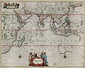
 B26056114C - The principal islands of the East-Indies.jpg 6,267 × 4,584; 6.1 MB
-

-
 B26056117F - East Indies.jpg 6,864 × 4,285; 7.68 MB
-
 B26056118G - Molucca insula.jpg 3,079 × 2,347; 2.67 MB
-
 B26056119H - Iava insvla.jpg 1,844 × 2,921; 1.53 MB
-
 B26056120K - Isole di Banda nelle Molucche.jpg 4,006 × 3,440; 3.11 MB
-
 B26056122B - Ins Macjan, Ins Bactjan.jpg 4,154 × 3,588; 3.69 MB
-
 B26056124D - Citadelle de Batavia.jpg 2,337 × 3,403; 2.91 MB
-
 B26056125E - Het Eiland Java.jpg 5,404 × 3,719; 4.73 MB
-
 B26056126F - Les Indes orientales pour la concorde de la geographie des diffeerents.jpg 4,739 × 3,525; 4.02 MB
-
 B26056128H - A mapp of the islands before Batavia.jpg 3,970 × 3,065; 3.04 MB
-
 B26056129I - Neu-Guinea und benachbarte Inseln.jpg 4,714 × 6,039; 5.58 MB
-
 B26056130A - East India Islands.jpg 3,539 × 2,245; 2.43 MB
-
 B26056132C - Le Indie.jpg 3,910 × 3,139; 3.25 MB
-
 B26056133D - Baly.jpg 2,908 × 2,030; 2.04 MB
-
 B26056134E - Das eyland Baly oder klein Java.jpg 5,095 × 3,930; 5.51 MB
-
 B26056135F - Borneo Insula.jpg 5,012 × 3,310; 3.99 MB
-
 B26056136G - Plan of the city of Batavia.jpg 4,037 × 3,706; 3.93 MB
-
 B26056137H - Ile de Baly ou petite Java.jpg 3,407 × 3,282; 2.61 MB
-
 B26056138I - Iles de Banda.jpg 3,347 × 3,153; 2.42 MB
-
 B26056139J - Batavia.jpg 2,941 × 4,023; 2.95 MB
-
 B26056142D - Insularum Moluccarum nova descriptio.jpg 4,653 × 3,812; 4.44 MB
-
 B26056143E - Asia.jpg 4,513 × 3,733; 5.27 MB
-
 B26056144F - Les IÌ‚les Moluques.jpg 3,732 × 6,247; 5.63 MB
-
 B26056146H - Isle Molvcoves.jpg 2,482 × 3,582; 3.07 MB
-
 B26056147I - Carte de l'isle Celebes ou Macassar.jpg 3,436 × 4,898; 3.66 MB
-
 B26056148J - Carte des isles Philippines Celebes et Moluques.jpg 3,612 × 5,341; 4.29 MB
-
 B26056149K - Carte particuliere des isles Moluques.jpg 3,920 × 5,667; 5.82 MB
-
 B26056150C - Town of Madura with four ships of Houtman's fleet.jpg 3,630 × 2,768; 3.29 MB
-
 B26056151D - De Moluccos en andere Speceri-Eilanden in d' Oost-Indien.jpg 5,456 × 3,884; 5.44 MB
-
 B26056153F - Svmatra cum circumiacentibus insulis.jpg 3,691 × 2,377; 2.68 MB
-
 B26056155H - Solar.jpg 4,271 × 3,539; 4 MB
-
 B26056156I - Molucca insula.jpg 2,919 × 2,438; 1.75 MB
-
 B26056157J - Laphao.jpg 1,830 × 3,313; 1.68 MB
-
 B26056158K - I. Timor.jpg 1,839 × 3,433; 1.73 MB
-
 B26056159A - Tabvla Asia VIII.jpg 5,698 × 4,370; 5.39 MB
-
 B26056160D - Hodiernæ Asia tabula.jpg 3,768 × 2,344; 1.98 MB
-
 B26056161E - Asiae nouita descr.jpg 2,585 × 1,951; 1.86 MB
-
 B26056162F 0001b - Iava minore and map of Necumera, Locaz, Patera, Botegon Mangama.jpg 3,573 × 2,264; 1.72 MB

.jpg)
%27_(11183114376).jpg)
._K_tisku_upravil_Prof._B._Bause._(Illustrated.)%27_(11248631484).jpg)
.jpg)


.jpg)


.jpg)


.jpg)


