Category:OpenStreetMap maps of Dermbach
Subcategories
This category has the following 8 subcategories, out of 8 total.
O
Media in category "OpenStreetMap maps of Dermbach"
The following 5 files are in this category, out of 5 total.
-
 Feldatal-Radweg Abschnitt Dermbach Nord.png 691 × 729; 462 KB
-
 Feldatal-Radweg Abschnitt Dermbach Süd.png 634 × 721; 459 KB
-
 Feldatal-Radweg Abschnitt Hartschwinden.png 690 × 729; 449 KB
-
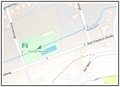 Lageplan Dermbach, Freibad.png 570 × 413; 108 KB
-
 Sportplatz Dermbach.png 681 × 481; 161 KB


