Category:OpenStreetMap maps of Unterbreizbach
Subcategories
This category has the following 2 subcategories, out of 2 total.
O
- OpenStreetMap maps of Räsa (1 F)
Media in category "OpenStreetMap maps of Unterbreizbach"
The following 12 files are in this category, out of 12 total.
-
 Karte zu Unterbreizbach - Alteberg.png 449 × 514; 124 KB
-
 Karte zu Unterbreizbach - Am Heeresberge.png 759 × 602; 235 KB
-
 Karte zu Unterbreizbach - Buchenberg.png 527 × 435; 136 KB
-
 Karte zu Unterbreizbach - Dietrichsberg.png 542 × 568; 171 KB
-
 Karte zu Unterbreizbach - Geiskopf.png 486 × 492; 121 KB
-
 Karte zu Unterbreizbach - Kornberg.png 765 × 608; 197 KB
-
 Karte zu Unterbreizbach - Langer Berg.png 502 × 411; 128 KB
-
 Karte zu Unterbreizbach - Sattelsberg.png 406 × 350; 116 KB
-
 Karte zu Unterbreizbach - Ulsterberg.png 653 × 572; 239 KB
-
 Karte zu Unterbreizbach - Öchsenberg.png 490 × 464; 241 KB
-
 Map of Unterbreizbach KundS Betriebsgelände.png 597 × 676; 350 KB
-
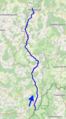 Ulster (rivière) OSM.png 282 × 508; 237 KB


_OSM.png)