Category:OpenStreetMap maps of Spain
Countries of Europe: Albania · Andorra · Armenia‡ · Austria · Azerbaijan‡ · Belarus · Belgium · Bosnia and Herzegovina · Bulgaria · Croatia · Cyprus‡ · Czech Republic · Denmark · Estonia · Finland · France‡ · Georgia‡ · Germany · Greece · Hungary · Iceland · Republic of Ireland · Italy · Kazakhstan‡ · Latvia · Liechtenstein · Lithuania · Luxembourg · Malta · Moldova · Montenegro · Netherlands‡ · North Macedonia · Norway · Poland · Portugal‡ · Romania · Russia‡ · San Marino · Serbia · Slovakia · Slovenia · Spain‡ · Sweden · Switzerland · Turkey‡ · Ukraine · United Kingdom · Vatican City
Specific status: Bailiwick of Guernsey · Isle of Man · Jersey – Limited recognition: Kosovo
‡: partly located in Europe
Specific status: Bailiwick of Guernsey · Isle of Man · Jersey – Limited recognition: Kosovo
‡: partly located in Europe
 Location |

Autonomous communities of Spain: Andalusia · Aragon ≈ Aragón · Asturias · the Balearic Islands ≈ Balearic Islands · the Basque Autonomous Community ≈ Basque Autonomous Community · the Canary Islands ≈ Canary Islands · Cantabria · Castile and León · Castile-La Mancha ≈ Castilla-La Mancha · Catalonia · Extremadura · Galicia (Spain) ≈ Galicia · the Community of Madrid ≈ Community of Madrid · the Region of Murcia ≈ Region of Murcia · Navarre · La Rioja (Spain) ≈ La Rioja, Spain · the Land of Valencia ≈ Land of Valencia ≈ the Valencian Community ≈ Valencian Community · Autonomous cities: Ceuta · Melilla
Subcategories
This category has the following 14 subcategories, out of 14 total.
A
- OpenStreetMap maps of Aragon (42 F)
- OpenStreetMap maps of Asturias (11 F)
B
C
- OpenStreetMap maps of Catalonia (17 F)
G
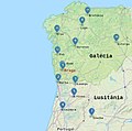
- OpenStreetMap maps of Galicia (28 F)
H
- OpenStreetMap maps of Huesca (2 F)
M
- OpenStreetMap maps of Murcia (5 F)
N
- OpenStreetMap maps of Navarre (10 F)
R
Media in category "OpenStreetMap maps of Spain"
The following 68 files are in this category, out of 68 total.
-
 Spain - OSM Mapnik.png 2,297 × 1,711; 3.01 MB
-
 Spain - OSM Mapnik.svg 478 × 360; 41.17 MB
-
 -ain amaiera euskal toponimian.jpg 712 × 503; 69 KB
-
 -uri amaiera euskal toponimian.jpg 700 × 528; 75 KB
-
 1992 Olympic Course area's (OpenStreetMap).png 433 × 278; 116 KB
-
 2017-08-17 Barcelona attacks fr.svg 760 × 1,074; 3.75 MB
-
 Accidente barajas 2008 localizacion German.png 498 × 714; 116 KB
-
 Accidente barajas 2008 localizacion-English.png 498 × 714; 112 KB
-
 Accidente barajas 2008 localizacion.png 498 × 714; 115 KB
-
 Adanero-antes.png 1,173 × 877; 101 KB
-
 Ampliaciones programadas del Metro de Granada.svg 512 × 477; 325 KB
-
 Ampliación centro metro de Granada (2022).svg 512 × 257; 528 KB
-
 Ampliación norte línea 1 metro de Granada (2021).svg 512 × 191; 182 KB
-
 Ampliación sur línea 1 metro de Granada (2021).svg 512 × 228; 307 KB
-
 Arlaban-Gasteiz-Alegria bideberdea mapa.png 813 × 755; 1,000 KB
-
 Atentados del 11 de marzo de 2004.jpg 971 × 544; 628 KB
-
 Autovía del Cantábrico A-8.png 5,273 × 743; 3.02 MB
-
 Calle Mayor, 25.JPG 989 × 549; 50 KB
-
 Ceuta2022OSM.png 6,000 × 2,820; 4.78 MB
-
 CircunvalaciónGranada-01.jpg 443 × 419; 183 KB
-
 Depth Gibraltar.jpg 1,278 × 958; 313 KB
-
 Empúries Map.png 2,000 × 3,000; 1.04 MB
-
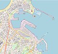 ESP — Port of A Coruña — OpenStreetMap 2023 — Mattes.jpg 3,728 × 3,484; 3.87 MB
-
 Gibraltarpedia map of interest.jpg 624 × 561; 270 KB
-
 GR-3 ROMÁNICO CATALÁN SUR.jpg 883 × 777; 227 KB
-
 Granada city map.png 527 × 707; 452 KB
-

-
 La Romana (Tous) con indicadores.png 790 × 583; 457 KB
-
 Linea2emtmalagaesquema.svg 1,443 × 858; 1.47 MB
-
 Localización discooteca Coolor.png 1,162 × 870; 553 KB
-
 Location map Malaga.png 752 × 597; 310 KB
-
 Location map Seville.png 1,039 × 797; 934 KB
-
 Location map Valladolid.png 1,449 × 1,479; 1.85 MB
-
 Maeztu-ZuñigaAcedo-Murieta bideberdea mapa.png 1,238 × 644; 1.43 MB
-
 Map of alhambra sp.svg 1,525 × 724; 1.99 MB
-
 Map of Malaga.png 1,124 × 794; 1.16 MB
-
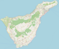 Map of Tenerife.png 2,194 × 1,819; 2.05 MB
-
 Mapa Almería.png 1,004 × 759; 348 KB
-
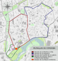 Mapa de las Murallas de Córdoba.png 1,708 × 1,785; 1.84 MB
-
 Mapa de OpenStreetMap de Alicante.PNG 891 × 531; 923 KB
-
 Mapa del Distrito Delicias.png 4,007 × 3,611; 9.35 MB
-
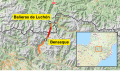 Mapa del tunel Benasque-Luchon.svg 512 × 300; 11.05 MB
-
 Mapa test ma 1.png 906 × 554; 252 KB
-
 MapaParquePinaresVenecia.jpg 1,527 × 840; 242 KB
-
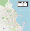 Melilla2022OSM.png 3,349 × 3,535; 5.85 MB
-
 Mundo watershed.jpg 1,204 × 833; 268 KB
-
 North Spain backgroundmap for FEVE an EuskoTren railnetworks.png 817 × 223; 117 KB
-
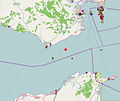 Openstreetmap map of GibraltarpediA related articles.jpg 801 × 675; 119 KB
-
 OpenStreetMap routing service.png 484 × 490; 93 KB
-
 Osm-intl,14,42.538243,1.296987,300x300.png 300 × 300; 7 KB
-
 Paroquial suevo.jpg 600 × 595; 199 KB
-
 Pedrena map.png 1,090 × 777; 602 KB
-
 Picassent-Alcàsser v3.png 761 × 541; 546 KB
-
 Plan der Straßenbahn Sevilla (Metro Centro).png 1,500 × 1,074; 470 KB
-
 PUIGMAL NURIA.jpg 1,116 × 1,037; 317 KB
-
 Rio Guadalhorce watershed.jpg 1,482 × 1,079; 362 KB
-
 Rio Ulla watershed.png 1,483 × 851; 1.68 MB
-
 RondaEsteGranada-01.jpg 443 × 419; 183 KB
-
 RondaNorteGranada-01.jpg 443 × 419; 181 KB
-
 SegundaCircunvalación-01.jpg 463 × 700; 262 KB
-
 SlangensteenMap.jpg 1,272 × 643; 162 KB
-
 Soraluze Eskoriatza bideberdea mapa.png 719 × 775; 1.12 MB
-
 Stolpersteine Mataro.png 1,162 × 803; 818 KB
-
 Tramvia de Sóller.svg 1,316 × 975; 436 KB
-
 Tranvía de Sóller.svg 1,316 × 975; 436 KB
-
 Uviéu (Spain) - OSM Mapnik.svg 1,448 × 1,095; 12.71 MB
-
 Via Nova2.jpg 1,172 × 570; 299 KB
-
 ViaXVII.jpg 1,133 × 506; 846 KB


.png)


.svg)
.svg)


.jpg)
_con_indicadores.png)


.png)


_-_OSM_Mapnik.svg)


.svg)