Category:OpenStreetMap maps of Italy
Countries of Europe: Albania · Andorra · Armenia‡ · Austria · Azerbaijan‡ · Belarus · Belgium · Bosnia and Herzegovina · Bulgaria · Croatia · Cyprus‡ · Czech Republic · Denmark · Estonia · Finland · France‡ · Georgia‡ · Germany · Greece · Hungary · Iceland · Republic of Ireland · Italy · Kazakhstan‡ · Latvia · Liechtenstein · Lithuania · Luxembourg · Malta · Moldova · Montenegro · Netherlands‡ · North Macedonia · Norway · Poland · Portugal‡ · Romania · Russia‡ · San Marino · Serbia · Slovakia · Slovenia · Spain‡ · Sweden · Switzerland · Turkey‡ · Ukraine · United Kingdom · Vatican City
Specific status: Bailiwick of Guernsey · Isle of Man · Jersey – Limited recognition: Kosovo
‡: partly located in Europe
Specific status: Bailiwick of Guernsey · Isle of Man · Jersey – Limited recognition: Kosovo
‡: partly located in Europe
Subcategories
This category has the following 20 subcategories, out of 20 total.
*
A
B
C
- OpenStreetMap maps of Calabria (30 F)
E
F
L
M
- OpenStreetMap maps of Marche (13 F)
P
S
T
U
- OpenStreetMap maps of Umbria (3 F)
V
Media in category "OpenStreetMap maps of Italy"
The following 121 files are in this category, out of 121 total.
-
 2009 IT Quake.png 821 × 605; 118 KB
-
 Abatemarco (OpenStreetMap).png 1,200 × 800; 156 KB
-
 Arena river drainage basin.png 588 × 653; 72 KB
-
 Armella location map.png 747 × 406; 238 KB
-
 Arno watershed.png 1,166 × 841; 1.32 MB
-
 Auronzo di Cadore Lago di Santa Caterina Ansiei River.png 1,325 × 661; 428 KB
-
 Aviosuperficie Pradelle Runways.svg 961 × 1,475; 1,019 KB
-
 Battaglia and Casaletto Spartano (OpenStreetMap).png 940 × 690; 176 KB
-
 Dolomiti Ampezzane Boite River Path.png 974 × 577; 434 KB
-
 Brevenna location map.png 1,035 × 545; 995 KB
-
 Calchere Valle di Vaiorzo mappa.png 977 × 702; 493 KB
-
 Calore Irpino.png 554 × 496; 419 KB
-
 Calore river map.png 1,479 × 1,381; 1.64 MB
-
 Camerota (municipal territory, OpenStreetMap).png 940 × 800; 280 KB
-
 CampioneDItalia2022OSM.png 4,184 × 3,933; 3.19 MB
-
 Canale Navarolo (OpenStreetMap).svg 4,965 × 1,250; 36.42 MB
-
 Cardile (OpenStreetMap).png 880 × 550; 63 KB
-
 Carta Rio San Marino .png 470 × 699; 164 KB
-
 Col d'Arpy map-fr.svg 2,343 × 2,302; 2.66 MB
-
 Col de Joux map-fr.svg 1,939 × 1,945; 1.86 MB
-
 Col de San Pellegrino OSM.png 1,260 × 542; 961 KB
-
 Corse osm.JPG 800 × 530; 52 KB
-
 Cucumella 2017.jpg 690 × 730; 62 KB
-
 Doire de Valgrisenche.png 344 × 425; 75 KB
-
 Dordolla Friuli Italy Openstreetmap 160129.jpg 437 × 523; 91 KB
-

-
 Emperor Louis II's charters.tif 922 × 1,176; 1.65 MB
-
 FABRIANO localizzazione.png 897 × 718; 769 KB
-
 Florenz - Karte.png 456 × 456; 118 KB
-
 Fluvione location map.png 961 × 450; 406 KB
-
 Fortino (Casaletto Spartano, OpenStreetMap).png 870 × 600; 77 KB
-
 Giara di Rezzo location map.png 800 × 419; 349 KB
-
 Giardino Botanico Alpino Viote - OpenStreetMap 20160526.png 1,202 × 709; 195 KB
-
 Giro del Trentino 2011.png 622 × 634; 763 KB
-
 Graveglia location map.png 1,328 × 533; 620 KB
-
 Greco di Bianco DOC.svg 699 × 541; 398 KB
-
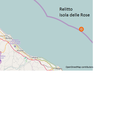
 Isola delle Rose.jpg 480 × 360; 32 KB
-
 La ferrovia decauville nella Foresta Umbra (superimposed onto OpenStreetMap).png 1,416 × 1,080; 577 KB
-

-
 Lac de Barbellino OSM.png 703 × 496; 504 KB
-
 Lac de Barcis OSM.png 646 × 510; 342 KB
-
 Lac de Barme location map.png 641 × 511; 151 KB
-
 Lac Miserin location map.png 745 × 700; 268 KB
-
 Lac Perrin location map.png 777 × 416; 113 KB
-
 Lago d'Avino map.png 1,025 × 499; 142 KB
-
 Landkarte Italien - Ustica.png 426 × 349; 93 KB
-
 Landkarte-Ustica.png 435 × 357; 34 KB
-
 Laura (Capaccio, OpenStreetMap).png 930 × 1,100; 238 KB
-
 Lavanestro mappa.png 1,322 × 545; 604 KB
-
 Lerrone mappa.png 1,235 × 573; 932 KB
-
 Li Galli - OpenStreetMap.png 733 × 625; 21 KB
-
 Location map Aosta.jpg 2,457 × 1,624; 801 KB
-
 Location map Cagliari.jpg 2,315 × 1,696; 787 KB
-
 Location map Campobasso.jpg 2,084 × 1,898; 540 KB
-
 Location map Trieste.jpg 1,883 × 1,730; 648 KB
-
 Macchia (Montecorvino Rovella, OpenStreetMap).png 941 × 638; 145 KB
-
 Mala Campo mappa.png 964 × 795; 152 KB
-
 Map Minervino di Lecce.png 987 × 732; 117 KB
-
 Map of Rome downtown.png 1,870 × 1,692; 4.68 MB
-
 Mappa archeologica di Interpromium (Tocco da Casauria).png 3,206 × 1,650; 4.02 MB
-
 Mappa delle cappelle mariane rurali di Gaeta.svg 1,096 × 677; 1.38 MB
-
 Mappa delle cappelle mariane rurali scomparse di Gaeta.svg 750 × 894; 1.28 MB
-
 Mappa musei da Wikidata.png 1,920 × 1,005; 798 KB
-
 Mappa OSM PEBA Padova.jpg 1,280 × 720; 124 KB
-
 Mappa PDF sentiero Giacomo Perlasca.pdf 4,518 × 3,831; 2.25 MB
-
 Mappa PNG sentiero Giacomo Perlasca.png 2,169 × 1,839; 1.44 MB
-
 Mappa terrazzo Novara-Vespolate.png 738 × 1,002; 460 KB
-
 Merdanzo mappa.png 1,201 × 748; 755 KB
-
 Merula mappa.png 1,075 × 644; 738 KB
-
 Minturnae Marica.jpg 1,200 × 900; 529 KB
-

-
 Monza Resegone map.png 2,480 × 3,507; 11.18 MB
-
 Moscato di Trani DOC.svg 1,036 × 526; 868 KB
-
 MUCGT - OSM 2017-06-01.png 1,879 × 1,297; 464 KB
-
 Negrone location map.png 926 × 542; 406 KB
-
 Neva creek map.png 681 × 491; 447 KB
-
 Nigoglia location map.png 624 × 467; 345 KB
-
 Olbicella mappa.png 438 × 604; 365 KB
-
 OpenStreetMap edit animation.gif 1,066 × 716; 465 KB
-
 Osiglietta map.png 554 × 808; 688 KB
-
 Pannavaira map.png 1,319 × 494; 742 KB
-
 Parco Naturale Regionale delle Alpi Liguri.png 692 × 832; 550 KB
-
 Parmignola location map.png 668 × 731; 773 KB
-
 Pava - Mappa.png 841 × 359; 51 KB
-
 Persistent Scatterers.png 1,573 × 1,302; 196 KB
-
 Piano Vetrale (OpenStreetMap).png 945 × 580; 71 KB
-
 Planimetria Piazza del Campo Siena.jpg 510 × 492; 115 KB
-
 PlasticrustGiglio.png 2,550 × 2,550; 653 KB
-
 Presentazione OpenStreetMap for dummies.pdf 2,000 × 1,125, 42 pages; 2.27 MB
-
 Pérouse map OpenStreetMap 1.png 256 × 256; 24 KB
-
 Relitto dell'Isola delle Rose.png 600 × 600; 54 KB
-
 Restrizioni in Italia.jpg 1,149 × 1,466; 230 KB
-
 Rimini OSM 01.png 709 × 621; 266 KB
-
 Rimini OSM 02.png 709 × 621; 450 KB
-
 Rino di Predore mappa.png 448 × 567; 200 KB
-
 Rino di Vigolo mappa.png 854 × 632; 499 KB
-
 Rovereta map.png 730 × 576; 160 KB
-
 Salina~Malvasia delle Lipari.svg 720 × 524; 184 KB
-
 San Giobbe - island map.png 965 × 1,098; 425 KB
-
 Sardorella mappa.png 1,204 × 597; 852 KB
-
 Scarpia location map.png 1,228 × 737; 645 KB
-
 SCIUSA locatopn map.png 490 × 624; 421 KB
-
 Secca mappa.png 591 × 684; 593 KB
-
 Segno mappa.png 1,167 × 704; 850 KB
-
 SP 152 Fondovalle Vitulanese (map).png 1,338 × 735; 573 KB
-
 SS 88 map.png 813 × 4,902; 3.7 MB
-
 Stagno di Cabras.PNG 315 × 379; 16 KB
-
 Stilo Ferdinandea osm 01 gen 2013.png 2,820 × 1,393; 666 KB
-
 Tanarello location map.png 856 × 557; 553 KB
-
 Tatorba d'Olmo map.png 490 × 713; 375 KB
-
 Tatorba map.png 1,071 × 968; 700 KB
-
 Tracciato strada provinciale ex strada statale 131.png 1,791 × 1,383; 1.5 MB
-
 Trilaterazione esempio passo 2.png 1,800 × 1,242; 2.74 MB
-
 Trilaterazione terzo passaggio.png 1,800 × 1,242; 2.73 MB
-
 Varatella map.png 1,047 × 675; 827 KB
-
 Vena de Maida OSM.jpg 1,009 × 1,647; 531 KB
-
 Verbone mappa.png 618 × 713; 618 KB
-
 Verde location map.png 609 × 646; 595 KB
-
 Villammare (OpenStreetMap).png 920 × 570; 136 KB
-
 Vobbia location map.png 1,018 × 535; 561 KB
-
 Wreck of the rose island.jpg 862 × 583; 62 KB

.png)


.png)


.png)

.png)


_OSM-Karte_2023_%E2%80%94_uploaded_by_Mattes.jpg)


.png)


.png)
.jpg)


.png)


.png)


.png)


_OSM-Karte_2023_%E2%80%94_uploaded_by_Mattes.jpg)


.png)


.png)


.png)


.svg)