Category:Openbare Handelsschool (Amsterdam)
| Object location | | View all coordinates using: OpenStreetMap |
|---|
 | |||||
| Upload media | |||||
| Instance of | |||||
|---|---|---|---|---|---|
| Part of | |||||
| Location | Amsterdam, North Holland, Netherlands | ||||
| Street address |
| ||||
| Architectural style | |||||
| Heritage designation |
| ||||
| Inception |
| ||||
| Date of official opening |
| ||||
 | |||||
|
This is a category about rijksmonumentcomplex number 518263
|
Schoolgebouw
|
This is a category about rijksmonument number 518264
|
Gymnastiekzaal
|
This is a category about rijksmonument number 518265
|
Conciërgewoning
|
This is a category about rijksmonument number 518266
|
| Address |
|
Media in category "Openbare Handelsschool (Amsterdam)"
The following 19 files are in this category, out of 19 total.
-
 2021 Raamplein 1, Asd (0).jpg 2,576 × 1,932; 4 MB
-
 2021 Raamplein 1, Asd (1).jpg 2,448 × 2,448; 4 MB
-
 2021 Raamplein 1, Asd (2).jpg 2,576 × 1,932; 2 MB
-
 2021 Raamplein 1, Asd (3).jpg 2,576 × 1,932; 2 MB
-
 2021 Raamplein 1, Asd (4).jpg 2,576 × 1,932; 2 MB
-
 2021 Raamplein 1, Asd (5).jpg 2,576 × 1,932; 2 MB
-
 EyeworksAmsterdam.JPG 2,816 × 2,112; 2.63 MB
-
 Gymnastieklokaal Openbare Handelsschool.JPG 3,016 × 2,224; 1.47 MB
-
 Lyceum, voorgevel - Amsterdam - 20020345 - RCE.jpg 1,198 × 1,200; 249 KB
-
 Marnixstraat, Eerste Openbare Handelsschool.jpg 1,280 × 814; 329 KB
-
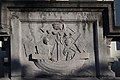 Openbare Handelsschool op het Raamplein te Amsterdam -reliëf boven de ingang.jpg 5,184 × 3,456; 4.27 MB
-
 Openbare Handelsschool op het Raamplein te Amsterdam Uil op de centrale timpaan 1.jpg 5,184 × 3,456; 4.75 MB
-
 Openbare Handelsschool op het Raamplein te Amsterdam Uil op de centrale timpaan 2.jpg 5,184 × 3,456; 2.78 MB
-
 Openbare Handelsschool op het Raamplein te Amsterdam Uil op de centrale timpaan 4.jpg 5,184 × 3,456; 2.69 MB
-
 Openbare Handelsschool op het Raamplein te Amsterdam Uil op de centrale timpaan.jpg 1,184 × 1,888; 492 KB
-

-
 Raampl1.jpg 740 × 470; 158 KB
-
 Raamplein met de Handelsschool gezien vanaf de Nieuwe Passeerdersstraat.jpg 1,748 × 1,149; 223 KB
-
 Scholen De Openbare Handelsschool te Amsterdam, Nederland 1919, SFA022819101.jpg 4,529 × 1,987; 932 KB
.jpg)
.jpg)
.jpg)
.jpg)
.jpg)
.jpg)


