Category:Oud-Beijerland
Nederlands: Afbeeldingen van Oud-Beijerland behorende tot de gemeente Hoeksche Waard in de provincie Zuid-Holland in het westen van Nederland. Nabij de gemeenten Nissewaard, Dordrecht en Rotterdam
English: Pictures of Oud-Beijerland belongs to the municipality Hoeksche Waard in the province South Holland in the West of the Netherlands. Near the municipalities Nissewaard, Dordrecht and Rotterdam
town and former municipality in the Netherlands  Casa de la vila   .svg) | |||||
| Upload media | |||||
| Instance of | |||||
|---|---|---|---|---|---|
| Named after | |||||
| Location |
| ||||
| Located in or next to body of water | |||||
| Inception |
| ||||
| Population |
| ||||
| Elevation above sea level |
| ||||
| Replaced by | |||||
| official website | |||||
 | |||||
Subcategories
This category has the following 11 subcategories, out of 11 total.
B
G
K
- KONI (8 F)
M
P
S
- Sculptures in Oud-Beijerland (7 F)
- Social sofa Oud-Beijerland (5 F)
- Symbols of Oud-Beijerland (4 F)
Media in category "Oud-Beijerland"
The following 37 files are in this category, out of 37 total.
-

-
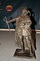 Beeld Lamoraal van Egmont Oud-Beijerland.jpg 2,592 × 3,888; 3.62 MB
-
 Bevolkingspiramide - Gemeente Oud-Beijerland (2007).png 350 × 370; 7 KB
-
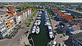 De haven van Oud-Beijerland.jpg 4,000 × 2,250; 10.85 MB
-
 DeHaven van Oud-Beijerland.jpg 4,000 × 2,250; 3.67 MB
-

-
 Egmontjaar Oud-Beijerland 05.jpg 2,304 × 3,456; 2.72 MB
-
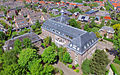
 Gemeentehuis van Oud-Beijerland.png 2,560 × 1,600; 7.17 MB
-
 Gentlemen mode Oud-Beijerland - EGM architecten.jpg 600 × 800; 436 KB
-
 H.B.S Oud-Beijerland.jpg 2,560 × 1,600; 5.86 MB
-
 Haven van OBL.JPG 2,592 × 1,936; 1.93 MB
-
 Havendam Oud-Beijerland 2.JPG 4,928 × 3,264; 7.12 MB
-
 Het oude raadhuis van Oud-Beijerland.png 2,560 × 1,600; 7.66 MB
-
 Lamoraal van Egmont Oude Raadhuis Oud Beijerland.jpg 1,184 × 1,772; 513 KB
-
 Lamoraal van Egmontspeld Oud-Beijerland.jpg 1,463 × 2,122; 539 KB
-
 Lamoraaltje Oud-Beijerland.jpg 4,592 × 3,056; 5.28 MB
-
 Logo Actief College.gif 151 × 106; 9 KB
-
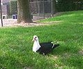 Muskuseend1.jpg 753 × 624; 124 KB
-
 Muurschildering Sabina van Beijeren, Oud-Beijerland.jpg 556 × 521; 129 KB
-

-

-
-
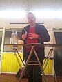 Joostniemoller 8 feb 2015.jpg 2,448 × 3,264; 556 KB
-
Nl-Oud-Beijerland.ogg 2.1 s; 26 KB
-
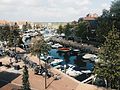
 Oud-Beijerland - 2015 - panoramio (1).jpg 4,928 × 3,264; 6.56 MB
-
 Oud-Beijerland - 2015 - panoramio (3).jpg 4,928 × 3,264; 6.09 MB
-
 Oud-Beijerland - 2015 - panoramio (5).jpg 4,928 × 3,264; 7.03 MB
-
 Oud-Beijerland - 2015 - panoramio (6).jpg 4,928 × 3,264; 7.53 MB
-
 Oud-Beijerland - 2015 - panoramio (7) pagebanner.jpg 4,928 × 705; 1.27 MB
-
 Oud-Beijerland - 2015 - panoramio (7).jpg 4,928 × 3,264; 5.64 MB
-
 Oud-Beijerland - 2015 - panoramio (8).jpg 4,928 × 3,264; 6.22 MB
-
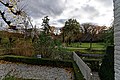
 Overzicht hoefstal - Oud-Beijerland - 20326578 - RCE.jpg 1,200 × 871; 151 KB
-
 Rhoons veer.jpg 1,200 × 1,262; 323 KB
-
 Sabina van Beijeren Oude Raadhuis Oud-Beijerland 01.jpg 1,176 × 1,792; 514 KB
-
 Wapenschild Lamoraal van Egmont Oude Raadhuis Oud Beijerland.jpg 3,456 × 5,184; 2.77 MB
-
 Wapenschild Sabina van Beijeren Oude Raadhuis Oud-Beijerland 02.jpg 3,456 × 5,184; 2.59 MB
-
 Zottegem Egmontstad.jpg 3,648 × 5,472; 12.32 MB


.png)


.jpg)
.jpg)
.jpg)
.jpg)
.jpg)
.jpg)


_pagebanner.jpg)