Category:Oude Spiegelstraat 11, Amsterdam
| Object location | | View all coordinates using: OpenStreetMap |
|---|
 | |||||
| Upload media | |||||
| Instance of |
| ||||
|---|---|---|---|---|---|
| Location | Amsterdam, North Holland, Netherlands | ||||
| Street address |
| ||||
| Located on street | |||||
| Heritage designation |
| ||||
 | |||||
|
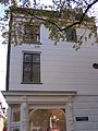
This is a category about rijksmonument number 5539
|
| Address |
|
Media in category "Oude Spiegelstraat 11, Amsterdam"
The following 6 files are in this category, out of 6 total.
-
 George Hendrik Breitner, Afb 010104000054.jpg 3,150 × 4,390; 2.33 MB
-
 Herengracht 305 door.JPG 2,304 × 1,728; 824 KB
-
 Herengracht 305 top.JPG 1,728 × 2,304; 904 KB
-
 Oude Spiegelstraat 11 corner with Herengracht 305.JPG 1,728 × 2,304; 1.13 MB
-
 Oude Spiegelstraat 11 door.JPG 1,728 × 2,304; 789 KB
-
 Oude Spiegelstraat 11 top.JPG 1,728 × 2,304; 1.08 MB


