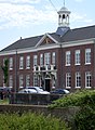
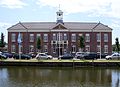
Category:Oude stadhuis (Den Helder)
| Object location | | View all coordinates using: OpenStreetMap |
|---|
building in Den Helder, Netherlands  | |||||
| Upload media | |||||
| Instance of | |||||
|---|---|---|---|---|---|
| Location | Den Helder, North Holland, Netherlands | ||||
| Street address |
| ||||
| Located on street | |||||
| Heritage designation |
| ||||
 | |||||
Nederlands: Oude stadhuis, v.m. weeshuis
|
This is a category about rijksmonument number 21387
|
| Address |
|
Media in category "Oude stadhuis (Den Helder)"
The following 43 files are in this category, out of 43 total.
-
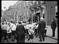
 100 jaar KIM Den Helder bezoekdag koningin Juliana, Bestanddeelnr 906-7916.jpg 4,457 × 3,304; 2.49 MB
-
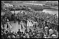
 Aankomst Uiterton 100 jaar KMI Den Helder, Bestanddeelnr 906-7931.jpg 3,247 × 2,504; 1.21 MB
-
 Aankomst Uiterton 100 jaar KMI Den Helder, Bestanddeelnr 906-7932.jpg 3,232 × 2,516; 1.22 MB
-
 Aankomst Uiterton 100 jaar KMI Den Helder, Bestanddeelnr 906-7933.jpg 3,289 × 2,516; 1.14 MB
-
 Aankomst Uiterton 100 jaar KMI Den Helder, Bestanddeelnr 906-7934.jpg 3,283 × 2,516; 1.24 MB
-
 Aankomst Uiterton 100 jaar KMI Den Helder, Bestanddeelnr 906-7935.jpg 3,304 × 2,516; 1.15 MB
-
 Begrafenis mensenredder Janus Kuiper Den Helder, Bestanddeelnr 904-8339.jpg 3,250 × 2,546; 1.43 MB
-
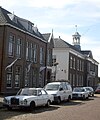
 Den Helder - Fors pand onder schilddak - compleet.JPG 3,648 × 2,736; 4.09 MB
-
 Den Helder - Fors pand onder schilddak - vooraanzicht.JPG 3,193 × 2,398; 2.51 MB
-
 Den Helder - Fors pand onder schilddak - voorkant met toren.JPG 2,736 × 3,648; 3.65 MB
-
 Den Helder - Kronen op oude stadhuis.jpg 2,077 × 659; 192 KB
-
 Den Helder Oud stadhuis 01.JPG 2,689 × 1,953; 733 KB
-
 Den Helder Oud stadhuis 02.JPG 2,094 × 2,861; 1.07 MB
-
 Den Helder Oud stadhuis 03.JPG 2,767 × 1,999; 1.01 MB
-
 DH oud stadhuis.jpg 2,304 × 2,774; 808 KB
-
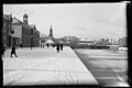
 Exterieur OVERZICHT VOORGEVEL - Den Helder - 20284786 - RCE.jpg 1,195 × 1,200; 321 KB
-
 Gemeentehuis (30370774464).jpg 5,887 × 3,938; 4.1 MB
-
 Gemeentehuis (31077638151).jpg 5,887 × 3,920; 4.03 MB
-
 Gemeentehuis (31077639121).jpg 5,887 × 3,920; 3.1 MB
-
 Gemeentehuis (31079772681).jpg 5,887 × 3,950; 3.95 MB
-
 Gemeentehuis (31193781885).jpg 5,887 × 3,920; 3.93 MB
-
 Gemeentehuis groepsfoto (31158091136).jpg 5,887 × 3,938; 3.57 MB
-
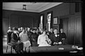
 Gemeentehuis raadzaal (31158086146).jpg 5,887 × 3,920; 3.54 MB
-
 Gemeentehuis raadzaal (31193639465).jpg 5,887 × 3,920; 3.68 MB
-

-
-

-
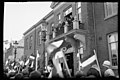
 Koninginnedag (31201850071).jpg 4,719 × 3,523; 3.08 MB
-
 Militaire parade (31201853911).jpg 4,743 × 3,523; 3.26 MB
-
 Monument voor het Reddingswezen (31175218326).jpg 5,887 × 3,920; 3.32 MB
-
 Oranje Harmoniekapel (30370780374).jpg 5,887 × 3,938; 4.44 MB
-
 Oranje Harmoniekapel (30824662670).jpg 5,887 × 3,968; 4.03 MB
-
 Oranje Harmoniekapel (30826654290).jpg 5,887 × 3,938; 4.07 MB
-
 Oranje Harmoniekapel (30983539550).jpg 6,314 × 4,175; 3.55 MB
-
 Oranje Harmoniekapel (31050291762).jpg 5,887 × 3,920; 4.08 MB
-
 Oranje Harmoniekapel (31158087606).jpg 5,887 × 3,944; 4.37 MB
-

-

-
 Voor- en zijgevel - Den Helder - 20107479 - RCE.jpg 1,200 × 961; 189 KB
-
 Voormalig Stadhuis - Wapen Den Helder.jpg 920 × 618; 348 KB
-
 WLM - Lumperjack - Algemeen Weeshuis en oud Gemeentehuis van Den Helder.jpg 1,024 × 843; 597 KB
-
 WLM - Lumperjack - Carillon, monument voor het reddingswezen.jpg 1,024 × 683; 609 KB
-
 WLM - Lumperjack - Gerechtsgebouw, rechtbank in Den Helder.jpg 1,024 × 683; 369 KB


.jpg)
.jpg)
.jpg)
.jpg)
.jpg)
.jpg)
.jpg)
.jpg)


.jpg)
.jpg)
.jpg)
.jpg)
.jpg)
.jpg)
.jpg)
.jpg)
.jpg)
_gemeentehuis_brengen_dertien_muziekverenigingen_een_aubade_bij_het_tienjar_-_RAA003012673_-_RAA_DenHelder.jpg)
_gemeentehuis_geven_dertien_muziekverenigingen_een_aubade_bij_het_tienjarig_-_RAA003012675_-_RAA_DenHelder.jpg)


