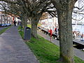
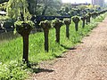
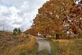
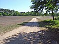
Category:Paths in the Netherlands
Countries of Europe: Austria · Belgium · Croatia · Czech Republic · Denmark · Estonia · Finland · France‡ · Germany · Greece · Hungary · Iceland · Republic of Ireland · Italy · Lithuania · Luxembourg · Malta · Netherlands‡ · Norway · Poland · Portugal‡ · Romania · Russia‡ · Slovakia · Slovenia · Spain‡ · Switzerland · Ukraine · United Kingdom
‡: partly located in Europe
‡: partly located in Europe
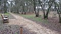
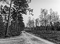
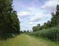
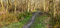
English: The Walking paths of the Netherlands.
- For more see also: Category:Trails in the Netherlands.
Subcategories
This category has the following 10 subcategories, out of 10 total.
A
- Andreas Schotel wandelroute (11 F)
B
- Bouwe Hoekstrapad (4 F)
F
- Forest paths in the Netherlands (49 F)
G
- Grass paths in the Netherlands (205 F)
H
- Hoornsepad (Groningen/Haren) (7 F)
K
- Klompenpad (25 F)
P
- Puttersvoetpad (12 F)
R
Media in category "Paths in the Netherlands"
The following 200 files are in this category, out of 238 total.
(previous page) (next page)-
 0474.Selwerderhof.Sprikkenburg.Iepenlaan.Walfridusbrug.Winsumerweg.jpg 3,024 × 4,032; 3.3 MB
-
 20110208-Slufterduinen3 DxO.jpg 6,040 × 4,026; 26.73 MB
-
 20110417 Enkhuizen 07.JPG 3,264 × 2,448; 1.91 MB
-
 20110417 Enkhuizen 09.JPG 3,264 × 2,448; 1.19 MB
-
 20110425 Amsterdam 28 Lane with Pollard willows in Nieuw Sloten.JPG 3,264 × 2,448; 1.89 MB
-
 20140516 Voetpad Esserweg-Esserhaag Groningen NL.jpg 4,200 × 2,800; 5.21 MB
-
 2016 Bissebeek bij Swier 04.jpg 2,500 × 1,708; 2.88 MB
-
 2016 Bissebeek bij Swier 05.jpg 2,500 × 1,767; 2.32 MB
-
 20190721 195 maastricht.jpg 6,000 × 4,000; 13.26 MB
-
 20211022 005 Wellerlooi De Hamert (51622661108).jpg 6,720 × 4,480; 31.71 MB
-
 2024-01-08 Overstroming op het wandelpad Henakker in Gennep (1).jpg 4,592 × 3,448; 7.67 MB
-
 2024-01-08 Overstroming op het wandelpad Henakker in Gennep (2).jpg 4,592 × 3,448; 8.05 MB
-
 2024-01-08 Overstroming op het wandelpad Henakker in Gennep (3).jpg 4,592 × 3,448; 8.35 MB
-
 2024-01-08 Overstroming van de Niers in Gennep (2).jpg 4,592 × 3,448; 7.8 MB
-

-

-
 A walking path with trees to the mallebos.JPG 480 × 320; 64 KB
-
 Ankeveense Plassen (4).jpg 3,863 × 2,704; 2.43 MB
-
 Bord-wandelroute Waalseweg Tull-en-'t Waal Nederland.JPG 2,592 × 1,944; 2.68 MB
-
 Bosch Giersbergen, Noord-Brabant 01.jpg 4,608 × 2,184; 4.49 MB
-
 Bosch Giersbergen, Noord-Brabant 03.jpg 4,608 × 2,184; 4.5 MB
-
 Bredevoort (NL), Vestingpark Sint Bernardus -- 2018 -- 1868.jpg 6,650 × 3,741; 13.96 MB
-
 Bredevoort (NL), Vestingpark Sint Bernardus -- 2018 -- 1870.jpg 4,450 × 4,450; 11.38 MB
-
 Breed pad in het mallebos.JPG 480 × 320; 65 KB
-
 Country Roads (2420748559).jpg 1,024 × 685; 363 KB
-
 De Groene streep Pieterpad.jpg 1,296 × 972; 212 KB
-
 De Slufter, Texel (1).jpg 3,214 × 2,385; 1.59 MB
-
 De Slufter, Texel.jpg 3,264 × 2,448; 1.85 MB
-
 De Wieden 4.JPG 3,008 × 2,000; 3.25 MB
-
 De Wijk, Netherlands 19 April 2021 - 15.jpeg 3,024 × 3,024; 3.06 MB
-
 De Wijk, Netherlands 19 April 2021 - 18.jpeg 3,024 × 3,024; 3.36 MB
-
 De Wijk, Netherlands 19 April 2021 - 35.jpeg 3,024 × 3,024; 2.63 MB
-
 De Wijk, Netherlands 19 April 2021 - 36.jpeg 3,024 × 3,024; 2.2 MB
-
 De Wijk, Netherlands 19 April 2021 - 37.jpeg 3,024 × 3,024; 3.17 MB
-
 E.V.A. Lanxmeer path 2009.jpg 2,301 × 1,872; 1.22 MB
-
 E.V.A. Lanxmeer vegetalEnclosure 2009.jpg 2,418 × 1,803; 1.02 MB
-
 E.V.A. Lanxmeer VegetalPath3 2009.jpg 2,560 × 1,920; 1.33 MB
-
 E.V.A. LanxmeerEcologicalPath 2009.jpg 1,920 × 2,560; 1.08 MB
-
 Een looppad op een lichtbewolkte dag.jpeg 536 × 800; 169 KB
-
 Een mooi pad naar het mallebos.JPG 480 × 320; 52 KB
-
 Fiets en wandelpad . Ezumakeeg.JPG 4,032 × 3,024; 2.48 MB
-
 Fiets en wandelpad-Alde Feanen.JPG 4,608 × 3,456; 6.15 MB
-
 Fiets of Wandelpad door het Drents-Frieswold.JPG 4,032 × 3,024; 2.6 MB
-
 Fietsbarrière - panoramio.jpg 2,592 × 1,456; 2 MB
-
 Fietspad naar halte Buitentuinen in de winter.jpg 4,000 × 2,248; 1.67 MB
-
 Groen - panoramio.jpg 2,816 × 2,112; 2.34 MB
-
 Information board Handelsweg.jpg 1,536 × 1,024; 1.07 MB
-
 Heath near Holterberg on a sunny day.jpg 4,592 × 3,064; 11.75 MB
-
 Heel erg smal pad in het mallebos.JPG 480 × 320; 59 KB
-
 Het mallebos heeft veel ruiter en wandelpaden.JPG 480 × 320; 66 KB
-
 Heumen (Gld, NL), Hiking path on the dike of the Maaswaalkanaal.JPG 3,072 × 2,304; 2.9 MB
-
 Hondsrug, De Strubben-Kniphorstbosch 013.jpg 5,136 × 1,867; 10.9 MB
-
 Jogging and walking in Spijkenisse.JPG 480 × 474; 181 KB
-
 Kampina, Mari Klijnpad.jpg 4,608 × 2,592; 6.32 MB
-
 Kavelbos-Schuinesloot-.jpg 2,048 × 1,536; 2.38 MB
-
 Keuzepuntpaal.jpg 480 × 640; 139 KB
-
 Klein bos bij Cromvoirt.jpg 4,608 × 2,184; 4.16 MB
-
 Kroondomein Het Loo. 22-02-2021 (actm.) 09.jpg 4,608 × 3,369; 10.43 MB
-
 Kroondomein Het Loo. 22-02-2021 (actm.) 10.jpg 4,760 × 3,400; 17.93 MB
-
 Langstraat - Loon op Zand - Bosrand Moleneind.jpg 3,456 × 3,456; 11.06 MB
-
 Legaat De Klencke Oosterhesselen 14 11 05 537000.jpeg 4,032 × 3,024; 4.23 MB
-
 Legaat De Klencke Oosterhesselen 14 13 05 882000.jpeg 4,032 × 3,024; 5.05 MB
-
 Legaat De Klencke Oosterhesselen 14 16 43 279000.jpeg 4,032 × 3,024; 4.64 MB
-

-

-

-
 Let de Stigterpad.JPG 2,736 × 3,648; 3.58 MB
-
 Malijksepad.jpg 4,000 × 3,000; 4.84 MB
-
 Marskramerpad near Woerdense Verlaat.jpg 3,008 × 2,000; 1.11 MB
-
 Marum, Nederland May 21, 2021 06-13-13 PM.jpeg 4,032 × 3,024; 4.22 MB
-
 Meinweg-grensweg.jpg 3,648 × 2,736; 2.89 MB
-
 Mijnsheerenland pad.jpg 4,032 × 1,816; 3.32 MB
-
 Naar het strand. Schiermonnikoog.JPG 4,032 × 3,024; 2.52 MB
-
 Naarden-vesting bedekteweg.jpg 1,712 × 400; 784 KB
-
 Nationaal Park De Alde Feanen. Locatie, It Wikelslân 004.jpg 2,999 × 2,342; 2.81 MB
-
 Nationaal Park De Alde Feanen. Locatie, It Wikelslân 019.JPG 5,138 × 2,842; 11.23 MB
-
 Nationaal Park De Alde Feanen. Locatie, It Wikelslân 020.JPG 4,444 × 3,333; 13.87 MB
-
 Nationaal Park De Alde Feanen. Locatie, It Wikelslân 028.JPG 4,019 × 2,679; 10.5 MB
-
 Nationaal Park Drents-Friese Wold 07.JPG 2,275 × 2,844; 4.51 MB
-
 Nationaal Park Weerribben-Wieden Pad tussen berken en moeras 01.jpg 5,184 × 3,456; 18.79 MB
-
 Nationaal Park Weerribben-Wieden Pad tussen berken en moeras 02.jpg 4,748 × 2,265; 10.66 MB
-
 Nationaal Park Weerribben-Wieden Pad tussen berken en moeras 03.jpg 5,184 × 2,149; 11.32 MB
-
 Nationaal Park Weerribben-Wieden. Doorkijkje vanaf pad door het laagveenmoeras 02.jpg 5,184 × 2,072; 13.73 MB
-
 Nationaal Park Weerribben-Wieden. Doorkijkje vanaf pad door het laagveenmoeras.jpg 5,184 × 3,456; 20.34 MB
-
 Nationaal Park Weerribben-Wieden. Gemarkeerd voetpad 01.JPG 2,592 × 3,456; 8.15 MB
-
 Nationaal Park Weerribben. Voetpad door laagveenmoeras 01.jpg 5,184 × 2,420; 12.28 MB
-
 Nationaal Park Weerribben. Voetpad door laagveenmoeras 02.jpg 5,184 × 2,817; 17.05 MB
-
 Natuur ´s Gravenmoer P1130090.jpg 4,000 × 2,672; 5 MB
-
 Nederasselt (Gld, NL), landschap bij de maasdijk.JPG 3,072 × 2,304; 3.1 MB
-

-
 Oosterschelde near Stavenisse.jpg 2,000 × 3,008; 581 KB
-
 Oosterschelde near Stavenissepolder.jpg 2,000 × 3,008; 670 KB
-
 Oosterschelde panorama near Sint Maartensdijk.jpg 9,561 × 1,641; 1.02 MB
-
 Oosterscheldepad near Sint Annaland.jpg 3,008 × 2,000; 828 KB
-
 Op weg naar de molen, NP-AldeFeanen.JPG 3,024 × 4,032; 2.22 MB
-
 Overzicht Holenweg, Hoorn.jpg 3,888 × 2,592; 6.45 MB
-

-
 Overzicht verhard wandelpad in het plantsoen - Amsterdam - 20535240 - RCE.jpg 1,200 × 799; 329 KB
-
 Overzicht wandelpad in plantentuin - Amsterdam - 20535221 - RCE.jpg 1,200 × 800; 158 KB
-
 Overzicht wandelpad in rechte lijn - Amsterdam - 20535210 - RCE.jpg 1,200 × 800; 336 KB
-

-
 Overzicht wandelpad met bomenrij - Amsterdam - 20535226 - RCE.jpg 1,200 × 800; 357 KB
-
 Overzicht wandelpad met gazons aan beide zijden - Amsterdam - 20535215 - RCE.jpg 1,200 × 800; 326 KB
-
 Overzicht wandelpad, in rechte lijn met gazon - Amsterdam - 20535212 - RCE.jpg 1,200 × 800; 357 KB
-
 Paadje langs het spoor (30447518493).jpg 2,592 × 1,456; 1.82 MB
-
 Paadje naar een Vogelkijkhut in de Alde Feanen.JPG 3,024 × 4,032; 2.13 MB
-
 Pad bij Reeuwijkse Plassen 2009.jpg 2,048 × 1,536; 1.49 MB
-
 Pad in het mallebos.JPG 480 × 320; 68 KB
-
 Pad op de Grebbeberg 2009.jpg 1,536 × 2,048; 1.61 MB
-
 Path mallebos.JPG 1,600 × 1,067; 1.6 MB
-
 Pionierspad.jpg 1,280 × 960; 98 KB
-

-
 ReestStream.jpg 4,608 × 2,592; 2.52 MB
-

-
 Roege Bos 13 57 36 329000.jpeg 4,032 × 3,024; 5.1 MB
-
 Routemarkering. Locatie, natuurgebied Delleboersterheide – Catspoele.jpg 5,184 × 3,173; 18.37 MB
-
 Sallandse Heuvelrug 5.JPG 3,648 × 2,736; 2.7 MB
-
 Scholtenpad Dutch-German border.jpg 3,008 × 2,000; 1.46 MB
-
 Scholtenpad Veenderhuisje.jpg 3,008 × 2,000; 1.02 MB
-
 Sign Airbornepad OLAT in Sint-Oedenrode.JPG 4,000 × 3,000; 2.56 MB
-
 SP BRUGGEN TWEEDE HEULBRUG 001 Spijkenisse Tweede Heulbrug 1935.jpg 5,583 × 3,993; 3.01 MB
-
 SP HEKELINGSEWEG 002 Voetpad langs Hekelingsweg Spijkenisse ±1980.jpg 4,091 × 2,949; 1.38 MB
-
 Sportief genieten van de natuur.jpg 4,752 × 3,168; 4.67 MB
-
 Stadspark lelystad winter.JPG 4,528 × 3,352; 5.43 MB
-
 Station Ommen 2022 5.jpg 5,472 × 3,648; 17.1 MB
-
 Texel - De Koog - Maartenhuis - Ruijslaan - View SE - March.jpg 5,952 × 3,968; 30.04 MB
-
 Texel - De Slufter - View WSW - February 2011 01.jpg 5,992 × 3,994; 24.76 MB
-
 Texel - Hoge Berg - Leemkuul - Footpath - ICE Photocompilation Viewing from SE to South.jpg 4,153 × 2,014; 10.07 MB
-
 Texel - Hoge Berg - Leemkuul - Footpath - View ESE towards de Hoge Berg.jpg 6,048 × 4,032; 27.98 MB
-
 Texel - Hoge Berg - Leemkuul - Footpath - View NNW.jpg 6,048 × 4,032; 26.92 MB
-
 Texel - Hoge Berg - Leemkuul - Footpath - View NW II.jpg 5,962 × 3,974; 20.12 MB
-
 Texel - Hoge Berg - Leemkuul - Footpath - View NW.jpg 6,024 × 4,016; 21.63 MB
-

-
 Texel - Hoge Berg - Leemkuul - Footpath - View SE I.jpg 6,048 × 4,032; 26.77 MB
-
 Texel - Hoge Berg - Leemkuul - Footpath - View SE II.jpg 6,048 × 4,032; 27.08 MB
-
 Texel - Hoge Berg - Leemkuul - Footpath - View SE III.jpg 6,048 × 4,032; 26.68 MB
-
 Texel - Hoge Berg - Leemkuul - Footpath - View SE IV.jpg 6,006 × 4,004; 23.65 MB
-
 Texel - Hoge Berg - Leemkuul - Footpath - View SE.jpg 4,032 × 6,048; 24.71 MB
-
 Texel - Hoge Berg - Leemkuul - Footpath - View South II.jpg 5,976 × 3,984; 21.14 MB
-
 Texel - Hoge Berg - Leemkuul - Footpath - View South IV.jpg 6,024 × 4,016; 22.04 MB
-
 Texel - Hoge Berg - Leemkuul - Footpath - View South.jpg 6,048 × 4,032; 27.35 MB
-
 Texel - Hoge Berg - Leemkuul - Footpath - View SSE I.jpg 6,048 × 4,032; 28.69 MB
-
 Texel - Hoge Berg - Leemkuul - Footpath - View WSW I.jpg 6,040 × 4,026; 23.39 MB
-
 Texel - Hoge Berg - Leemkuul - Footpath - View WSW III.jpg 5,962 × 3,974; 22.06 MB
-

-
 Texel - Hoge Berg - Leemkuul - Footpath - View WSW towards Den Hoorn.jpg 6,048 × 4,032; 22.49 MB
-
 Texel - Hoge Berg - Leemkuul - View South on Footpath.jpg 6,048 × 4,032; 25.67 MB
-
 Texel - Hoge Berg - Schansweg - Footpath - ICE Photocompilation Viewing from SE to South.jpg 3,681 × 2,030; 8.87 MB
-
 Texel - Hoge Berg - Schansweg - Footpath - July 2010 01.jpg 6,048 × 4,032; 28.72 MB
-
 Texel - Hoge Berg - Schansweg - Footpath - View South I.jpg 5,976 × 3,984; 23.82 MB
-
 Texel - Hoge Berg - Schansweg - Footpath - View SSE.jpg 6,040 × 4,026; 25.92 MB
-
-

-

-
 Texel - Hoge Berg - Schansweg - Zuid Haffel - Footpath - July 2010 01.jpg 5,826 × 3,884; 22.52 MB
-
 Texel - Hoge Berg - Schansweg - Zuid Haffel - Footpath - View East towards De Hoge Berg.jpg 6,048 × 4,032; 26.81 MB
-
 Texel - Hoge Berg - Schansweg - Zuid Haffel - Footpath - View East.jpg 5,916 × 3,944; 21.45 MB
-
 Texel - Hoge Berg - Schansweg - Zuid Haffel - Footpath - View ENE.jpg 6,040 × 4,026; 22.17 MB
-
 Texel - Hoge Berg - Schansweg - Zuid Haffel - Footpath - View ESE II.jpg 5,728 × 3,818; 19.05 MB
-
 Texel - Hoge Berg - Schansweg - Zuid Haffel - Footpath - View ESE.jpg 5,986 × 3,990; 24.98 MB
-
 Texel - Hoge Berg - Schansweg - Zuid Haffel - Footpath - View NE.jpg 6,040 × 4,026; 21.66 MB
-
 Texel - Hoge Berg - Schansweg - Zuid Haffel - Footpath - View NNW I.jpg 5,946 × 3,964; 23.09 MB
-
 Texel - Hoge Berg - Schansweg - Zuid Haffel - Footpath - View NNW III.jpg 6,048 × 4,032; 25.77 MB
-
-
 Texel - Hoge Berg - Schansweg - Zuid Haffel - Footpath - View NNW towards Den Burg I.jpg 5,826 × 3,884; 20.71 MB
-
 Texel - Hoge Berg - Schansweg - Zuid Haffel - Footpath - View North II.jpg 5,916 × 3,944; 22.31 MB
-
 Texel - Hoge Berg - Schansweg - Zuid Haffel - Footpath - View North.jpg 5,992 × 3,994; 22.11 MB
-
 Texel - Hoge Berg - Schansweg - Zuid Haffel - Footpath - View SE I.jpg 6,004 × 4,002; 24.28 MB
-
 Texel - Hoge Berg - Schansweg - Zuid Haffel - Footpath - View SE III.jpg 6,006 × 4,004; 26.21 MB
-
 Texel - Hoge Berg - Schansweg - Zuid Haffel - Footpath - View SE IV.jpg 6,048 × 4,032; 26.53 MB
-
 Texel - Hoge Berg - Schansweg - Zuid Haffel - Footpath - View South IV.jpg 5,962 × 3,974; 23.01 MB
-
 Texel - Hoge Berg - Schansweg - Zuid Haffel - Footpath - View South V.jpg 5,992 × 3,994; 23.65 MB
-
 Texel - Hoge Berg - Schansweg - Zuid Haffel - Footpath - View SSE I.jpg 5,962 × 3,974; 25.29 MB
-
 Texel - Hoge Berg - Schansweg - Zuid Haffel - Footpath - View SSE II.jpg 5,886 × 3,924; 24.87 MB
-
 Texel - Hoge Berg - Schansweg - Zuid Haffel - Footpath - View SSE.jpg 5,742 × 3,828; 24.38 MB
-
 Texel - Hoge Berg - Schansweg - Zuid Haffel - Footpath - View SSW I.jpg 6,048 × 4,032; 23.89 MB
-
 Texel - Hoge Berg - Schansweg - Zuid Haffel - Footpath - View SSW III.jpg 5,916 × 3,944; 22.5 MB
-
 Texel - Hoge Berg - Schansweg - Zuid Haffel - Footpath - View SW.jpg 5,716 × 3,810; 20.94 MB
-
 Texel - Hoge Berg - Zuid Haffel - End of Footpath - View SE I.jpg 5,986 × 3,990; 24.28 MB
-

-
 Texel - Hoge Berg - Zuid Haffel - Footpath - July 2010 01.jpg 4,925 × 1,985; 11.49 MB
-
 Texel - Hoge Berg - Zuid Haffel - Footpath - July 2010 02.jpg 6,048 × 4,032; 25.76 MB
-
 Texel - Hoge Berg - Zuid Haffel - Footpath - View ENE.jpg 5,970 × 3,980; 22.87 MB
-
 Texel - Hoge Berg - Zuid Haffel - Footpath - View ESE I.jpg 5,856 × 3,904; 22.33 MB
-
 Texel - Hoge Berg - Zuid Haffel - Footpath - View II.jpg 6,048 × 4,032; 26.59 MB
-
 Texel - Hoge Berg - Zuid Haffel - Footpath - View NW I.jpg 5,902 × 3,934; 21.21 MB
-
 Texel - Hoge Berg - Zuid Haffel - Footpath - View NW II.jpg 1,600 × 1,067; 489 KB
-
 Texel - Hoge Berg - Zuid Haffel - Footpath - View NW III.jpg 6,024 × 4,016; 21.6 MB
-
 Texel - Hoge Berg - Zuid Haffel - Footpath - View NW IV.jpg 5,962 × 3,974; 20.96 MB
-
 Texel - Hoge Berg - Zuid Haffel - Footpath - View SE III.jpg 5,970 × 3,980; 26.56 MB
-
 Texel - Hoge Berg - Zuid Haffel - Footpath - View SE IV.jpg 6,048 × 4,032; 26.86 MB
-
 Texel - Hoge Berg - Zuid Haffel - Footpath - View SE V.jpg 6,048 × 4,032; 25.11 MB
-
 Texel - Hoge Berg - Zuid Haffel - Footpath - View SE VI.jpg 5,872 × 3,914; 23.03 MB
-
 Texel - Hoge Berg - Zuid Haffel - Footpath - View South I.jpg 6,048 × 4,032; 22.8 MB
-
 Texel - Hoge Berg - Zuid Haffel - Footpath - View South II.jpg 5,970 × 3,980; 22.18 MB
-
 Texel - Hoge Berg - Zuid Haffel - Footpath - View South III.jpg 6,048 × 4,032; 21.37 MB
-
 Texel - Hoge Berg - Zuid Haffel - Footpath - View South IV.jpg 6,006 × 4,004; 24.85 MB
-
 Texel - Hoge Berg - Zuid Haffel - Footpath - View SSE I.jpg 5,992 × 3,994; 23.53 MB
-
 Texel - Hoge Berg - Zuid Haffel - Footpath - View SSE II.jpg 4,032 × 6,048; 24.8 MB
-
 Texel - Hoge Berg - Zuid Haffel - Footpath - View SSW.jpg 6,048 × 4,032; 23.16 MB


.jpg)
.jpg)
.jpg)
.jpg)
.jpg)


.jpg)


,_Vestingpark_Sint_Bernardus_--_2018_--_1868.jpg)
,_Vestingpark_Sint_Bernardus_--_2018_--_1870.jpg)

.jpg)

.jpg)


,_Hiking_path_on_the_dike_of_the_Maaswaalkanaal.JPG)


_09.jpg)
_10.jpg)


,_landschap_bij_de_maasdijk.JPG)
_and_modern_bike_signs_-_panoramio.jpg)


.jpg)


_-_Garden_%26_Castle_Tower_1850_by_Karel_George_Zocher_01.jpg)


_have_been_reconstructed.jpg)


