Category:Plats of the 1700s
Media in category "Plats of the 1700s"
The following 200 files are in this category, out of 316 total.
(previous page) (next page)-
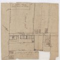
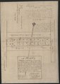
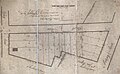
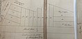
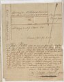
 16-20-22 King Street - 1785.pdf 1,214 × 1,941; 2.17 MB
-
 1780 Investiture of Charleston, S.C.tif 6,714 × 8,822; 169.48 MB
-
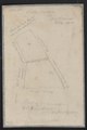
 1788 Plat of City Market.jpg 3,481 × 1,617; 1.21 MB
-
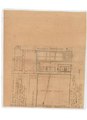
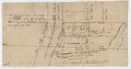
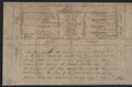
 237 Meeting and Hasell Streets - 1795.pdf 2,043 × 2,647, 2 pages; 11.85 MB
-
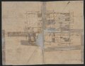
 267-273 King Street - 1799.pdf 2,462 × 1,964; 4.51 MB
-
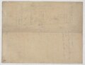
 32 Bull Street - 1786.pdf 1,964 × 1,247; 2.29 MB
-
 32 South Battery - 1798.pdf 2,512 × 1,987; 4.48 MB
-
 366 King Street - 1799.pdf 1,858 × 1,258; 2.29 MB
-
 39 Church Street - 1795.jpg 2,528 × 2,684; 2.06 MB
-
 49 Broad Street - c. 1790-1830.pdf 1,212 × 1,710; 1.03 MB
-
 55 East Bay Street - 1799.pdf 2,502 × 1,772; 3.71 MB
-
 68 Meeting Street - c. 1790.pdf 1,254 × 1,247; 1.5 MB
-
 76 Meeting Street - 1789.pdf 2,725 × 3,750; 2.97 MB
-
 76 Meeting Street plat - 1786.jpg 1,766 × 2,697; 1.24 MB
-
 Anson and Hasell Streets - 1778.jpg 2,300 × 3,818; 2.5 MB
-
 Anson Street - c. 1795.jpg 2,117 × 1,409; 586 KB
-
 Ansonborough - 1760.jpg 2,271 × 3,065; 1.1 MB
-
 Ansonborough - 1762.pdf 750 × 1,125; 752 KB
-
 Ansonborough - 1799.jpg 3,525 × 2,020; 2.12 MB
-
 Ansonborough - c. 1770.jpg 3,501 × 2,282; 1.75 MB
-
 Ansonborough - c. 1778.pdf 2,402 × 2,031; 3.88 MB
-
 Ansonborough - c. 1790.jpg 6,401 × 4,583; 5.4 MB
-
 Ansonborough - c. 1796.pdf 2,364 × 1,797; 3.63 MB
-
 Ansonborough 1786 plat.jpg 3,276 × 2,349; 2.61 MB
-
 Ansonborough and Mazyck-Wraggborough - 1795.pdf 3,318 × 2,483; 4.38 MB
-
 Ansonborough M6 408 c 1794.jpg 1,927 × 2,291; 1.03 MB
-
 Archdale and Beaufain Streets - 1799.jpg 2,153 × 3,645; 1.84 MB
-
 Archdale and King Streets - 1784.pdf 1,908 × 2,704; 4.59 MB
-
 Archdale Street - 1792.pdf 1,483 × 806; 1.2 MB
-
 Ashley Ave. and Line St. - 1791.jpg 1,383 × 1,805; 174 KB
-
 Ashley Avenue - c. 1790-1820.pdf 2,991 × 2,647; 5.4 MB
-
 Ashley Avenue and Bogard Street - 1789.pdf 2,033 × 2,560; 4.57 MB
-
 Aug 1787 K6 261.jpg 3,296 × 2,467; 1.78 MB
-
 B7 233.jpg 3,640 × 2,576; 2.09 MB
-
 Beaufain and Archdale Streets - 1799.pdf 1,785 × 1,112; 1.87 MB
-
 Beaufain and St. Philip Street - 1795.jpg 2,640 × 2,105; 1.9 MB
-
 Beaufain Street - 1797.pdf 1,287 × 1,958; 2.32 MB
-
 Beaufain Street - 1798.pdf 1,981 × 1,304; 2.71 MB
-
 Beaufain Street - 1799.pdf 1,231 × 1,981; 2.45 MB
-
 Beaufain, Princess, Market, Fulton, and King Streets - c. 1780-1800.pdf 2,014 × 3,112; 6.25 MB
-
 Beaufain, Wentworth, Coming, St. Philip. and George Sts. - 1770.pdf 2,110 × 1,493; 3.06 MB
-
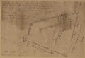
 Bedon's Alley - 1774.pdf 2,037 × 1,145, 2 pages; 2.64 MB
-
 Bedon's Alley - 1785.jpg 3,084 × 2,459; 2.37 MB
-
 Bedon's Alley - 1785.pdf 756 × 1,350; 561 KB
-
 Bedon's Alley 1789.jpg 1,899 × 1,565; 765 KB
-
 Bedon's Alley and Elliott Street - c. 1780-1820.pdf 512 × 797; 335 KB
-
 Broad and Church - 1787.jpg 3,069 × 2,667; 2.19 MB
-
 Broad and Elliott Streets - 1777.jpg 2,072 × 3,667; 2.08 MB
-
 Broad Street (south side) - c. 1780s.jpg 3,150 × 2,387; 510 KB
-
 Broad Street - 1784.jpg 2,312 × 3,557; 2.21 MB
-
 Broad Street - 1795.pdf 2,020 × 1,275; 2.11 MB
-
 Broad Street - 1797.pdf 1,952 × 1,270; 2.21 MB
-
 Broad Street - Nov. 1791.pdf 1,970 × 1,343; 2.54 MB
-
 Broad, Archdale, and Magazine - 1742.pdf 2,900 × 2,435; 4.74 MB
-
 Broad, Queen, and Legare Street - 1766.pdf 1,897 × 2,114; 4.21 MB
-
 Bull Street - 1775.jpg 1,559 × 2,011; 701 KB
-
 Bull Street - 1794.pdf 3,110 × 1,725; 2.16 MB
-
 Bull, Montagu, Barre, Gadsden, Ashley and Rutledge - 1795.pdf 3,577 × 2,720; 8.75 MB
-
 Bull, Montagu, Pitt, and Smith Streets - 1793.pdf 1,264 × 2,047; 2.85 MB
-
 Calhoun and Burns Alley - c. 1790.pdf 2,602 × 2,564; 6.72 MB
-
 Calhoun, St. Philip, Coming, King, and Vanderhorst Streets - 1799.pdf 3,137 × 2,056; 8.13 MB
-
 Cannonborough - 1789.pdf 2,033 × 2,560; 2.4 MB
-
 Cannonborough - 1796.pdf 1,360 × 1,802; 2.53 MB
-
 Cannonborough - Aug. 1786.pdf 2,943 × 2,260; 6.63 MB
-
 Cannonborough - c. 1789.pdf 2,033 × 2,560; 4.57 MB
-
 Cannonborough-Elliottborough - 1796.jpg 2,467 × 3,377; 2.27 MB
-
 Chalmers Street - 1792.jpg 2,607 × 3,174; 1.86 MB
-
 Charlotte Street - 1799.jpg 3,746 × 2,403; 1.97 MB
-
 Church and Atlantic Street - c. 1770-1800.pdf 2,479 × 3,062; 6.56 MB
-
 Church and Atlantic Streets - 1794.jpg 2,309 × 2,354; 1.64 MB
-
 Church and Cumberland Streets - 18th century.pdf 2,150 × 1,997; 3.74 MB
-
 Church and East Battery Streets - 1798.pdf 1,947 × 1,241; 2.13 MB
-
 Church and Meeting Streets - 1745.jpg 2,781 × 2,585; 1.71 MB
-
 Church and Meeting Streets - 1795.pdf 1,672 × 1,241; 2.01 MB
-
 Church Street - 1785.pdf 1,964 × 1,247; 2.03 MB
-
 Church Street - 1787.jpg 2,541 × 2,906; 2.24 MB
-
 Church Street - 1796.pdf 1,506 × 1,825; 2.78 MB
-
 Church Street - 17?5.pdf 1,964 × 1,247; 2.03 MB
-
 Church Street Aug 1793.jpg 3,006 × 1,723; 1.4 MB
-
 Church Street, South Battery and East Battery - 1799.pdf 2,475 × 1,997; 4.6 MB
-
 Clifford Street plat - 1787.jpg 1,694 × 2,500; 1.01 MB
-
 County Road Histories page 22 plat.png 6,944 × 8,528; 2.18 MB
-
 Cumberland Street - 18th century.pdf 2,097 × 1,377; 2.23 MB
-
 Daniel Elliott House plat - 1795.jpg 3,464 × 2,136; 2.38 MB
-
 Deed L6 67 Sep 20 1793.jpg 3,171 × 834; 602 KB
-
 East Battery - 1794.pdf 2,575 × 1,706; 4.64 MB
-
 East Battery - 1796.jpg 3,534 × 2,595; 2.13 MB
-
 East Battery and East Bay - 1796.pdf 2,406 × 1,881; 3.84 MB
-
 East Bay - 1787.jpg 3,740 × 1,174; 1.55 MB
-
 East Bay - 1799.jpg 2,536 × 2,935; 1.67 MB
-
 East Bay and Hasell Streets - 1787.jpg 1,898 × 2,368; 1.11 MB
-
 East Bay and Market Streets - c. 1750-1800.pdf 1,950 × 1,300; 2.3 MB
-
 East Bay Oct 13 1789.jpg 3,613 × 1,311; 1.12 MB
-
 East Bay plat 1785.jpg 1,953 × 3,573; 2.19 MB
-
 East Bay St. - May 1797.pdf 1,900 × 1,250; 6.07 MB
-
 East Bay Street - 1785.pdf 3,062 × 1,383; 1.66 MB
-
 East Bay Street - 1787.pdf 2,060 × 2,166; 3.88 MB
-
 East Bay Street - 1789.pdf 2,475 × 1,835; 3.87 MB
-
 East Bay Street - 1792.pdf 2,475 × 1,689; 4.04 MB
-
 East Bay Street - 1795.pdf 2,437 × 1,606; 1.02 MB
-
 East Bay Street - 1796.jpg 2,685 × 2,282; 1.03 MB
-
 East Bay Street - 1797.pdf 1,964 × 1,252; 2 MB
-
 East Bay Street - 1798.jpg 3,172 × 2,132; 2.02 MB
-
 East Bay Street - c. 1750-1800.pdf 4,529 × 1,175; 5.04 MB
-
 East Bay Street - c. 1770-1840.pdf 2,250 × 1,791; 4.18 MB
-
 East Bay Street - c. 1778.jpg 3,203 × 1,360; 1.15 MB
-
 East Bay Street - c. 1780-1820.pdf 829 × 2,708; 1.86 MB
-
 East Bay Street - K6 410 Apr 19 1794.jpg 2,832 × 2,578; 1.6 MB
-
 East Bay Street - March 1785.pdf 3,089 × 2,020; 6.48 MB
-
 East Bay Street - May 1797.pdf 1,831 × 1,258; 1.88 MB
-
 East Bay Street - Sept. 1785.pdf 3,012 × 2,110; 2.96 MB
-
 East Bay Street north of Queen Street.(1750).jpg 3,150 × 1,940; 525 KB
-
 East Bay Street plat - May 1796.jpg 3,506 × 2,392; 1.82 MB
-
 Ellery Street - c. 1750-1800.pdf 2,364 × 1,797; 3.63 MB
-
 Elliottborough (1786).jpg 3,150 × 1,724; 330 KB
-
 Exchange Street Nov 22 1794 M6 30.jpg 1,809 × 2,157; 892 KB
-
 Feb 18 1794 K6 327.jpg 1,372 × 2,459; 716 KB
-
 First Scots Presbyterian lot - c. 1778.jpg 2,315 × 3,269; 1.93 MB
-
 George and East Bay Streets - 1792.pdf 1,197 × 1,947; 1.95 MB
-
 George Street - 1795.jpg 2,149 × 2,801; 1.92 MB
-
 George, King, and St. Philip Streets - c. 1778.jpg 3,466 × 2,044; 1.97 MB
-
 Gibbes and South Battery - 1799.pdf 2,631 × 3,291; 5.52 MB
-
 Glebe Lands - 1797.jpg 2,164 × 3,949; 2.25 MB
-
 Grand Model of Charles Towne.jpg 5,137 × 7,176; 6.94 MB
-
 Granville Bastion on East Bay Street - 1789.jpg 2,470 × 2,735; 2.16 MB
-
 Grove Plantation - 1770.pdf 2,229 × 2,508; 2.49 MB
-
 Grove Plantation Sep 20 1793 - recorded July 14 1847 L6 67.jpg 2,749 × 3,093; 2.84 MB
-
 Hampstead - 1795.pdf 1,997 × 1,243; 2.02 MB
-
 Hampstead Plat.pdf 1,231 × 1,733; 7.44 MB
-
 Hampstead Village - 1798.pdf 1,981 × 1,254; 2.2 MB
-
 Hampton Park plat (1791).tif 3,104 × 2,400; 7.1 MB
-
 Hampton Park Terrace - July 1797.tif 3,150 × 2,039; 6.13 MB
-
 Harleston Village - 1770.pdf 3,158 × 2,481; 9.03 MB
-
 Harleston Village - 1787.pdf 1,706 × 2,575; 4.08 MB
-
 Harleston Village - 1796.pdf 1,258 × 1,812; 2.21 MB
-
 Harleston Village - 1798.pdf 2,093 × 1,420; 3.11 MB
-
 Harleston Village - c. 1790-1810.pdf 2,777 × 1,970; 5.54 MB
-
 Harleston Village Dec 8 1770 L6 539.jpg 2,329 × 3,607; 2.08 MB
-
 Hasell and East Bay - 1787.jpg 3,238 × 2,676; 2.19 MB
-
 Hasell and King - NW corner - 1787.pdf 1,925 × 1,220, 2 pages; 1.35 MB
-
 Hasell Street (1773).pdf 1,295 × 1,447; 210 KB
-
 Hasell Street - 1785.jpg 3,597 × 2,233; 1.97 MB
-
 Henry Laurens' land along Cooper River - 1797.pdf 1,808 × 1,231; 2 MB
-
 House between Church and Meeting Streets - 1799.pdf 1,958 × 1,029; 2 MB
-
 Huger and Congress Streets - 1798.tif 1,490 × 1,871; 3.16 MB
-
 Huger and Moultrie Streets - 1799.pdf 1,304 × 1,818; 2.79 MB
-
 Huger Street - 1787.jpg 2,054 × 2,582; 1.31 MB
-
 John Goddard Sep 10 1789 L6 382.jpg 2,428 × 2,467; 1.82 MB
-
 June 1787 East Bay Hasell L6 491.jpg 3,000 × 2,528; 2.08 MB
-
 June 28 1790 Hasell.jpg 3,438 × 1,629; 902 KB
-
 King and George Streets - 1763.pdf 2,554 × 1,781; 2.13 MB
-
 King and Hasell Dec 11 1794 M6 448.jpg 2,340 × 2,064; 1.13 MB
-
 King and Meeting Streets - 1787.jpg 3,706 × 2,262; 2.59 MB
-
 King and Meeting Streets - Apr 1787.jpg 3,751 × 1,986; 2.16 MB
-
 King and Queen Streets - 1799.jpg 2,433 × 3,066; 2.14 MB
-
 King Street - 1734.pdf 2,060 × 2,512; 5.36 MB
-
 King Street - 1795.jpg 3,147 × 2,166; 1.83 MB
-
 King Street - 1796.jpg 3,700 × 2,384; 2.82 MB
-
 King Street - 1799.jpg 2,116 × 3,495; 1.72 MB
-
 King Street - 1799.pdf 1,241 × 1,583; 2.02 MB
-
 King, George, and St. Philip Streets - 1794.pdf 1,885 × 1,233; 2.83 MB
-
 King, Liberty, Wentworth, and St. Philip Streets - c. 1778.jpg 2,121 × 3,039; 1.52 MB
-
 King, Wentworth, Liberty Streets - c. 1790-1800.pdf 2,545 × 1,987; 5.24 MB
-
 L6 303 King and Beaufain Aug 1794.jpg 3,151 × 2,541; 1.69 MB
-
 L6 333 Aug 27 1794 Church St.jpg 2,672 × 2,509; 1.65 MB
-
 Legare and Gibbes - 1787.jpg 2,590 × 2,468; 1.46 MB
-
 Legare and Tradd - 1753.pdf 1,872 × 2,245; 3.37 MB
-
 Legare and Tradd Streets - c. 1775.pdf 1,645 × 1,254; 1.77 MB
-
 Legare Street - 1797.jpg 2,252 × 3,814; 2.09 MB
-
 Lodge Alley plat.jpg 2,849 × 2,776; 2.77 MB
-
 Magazine and Beaufain Streets - 1793.jpg 3,248 × 5,245; 3.98 MB
-
 Magazine Street - 1799.pdf 2,554 × 1,900, 2 pages; 4.24 MB
-
 Magazine, Logan, and Beaufain Street - c. 1796.pdf 1,852 × 1,295; 2.63 MB
-
 March 1798 John Goddard N6 page 332 Huger Street.jpg 1,629 × 2,198; 1.02 MB
-
 Marion Square - May 1789.jpg 1,766 × 2,685; 1.05 MB
-
 Marion Square and St. Philip Street - 1784.pdf 3,056 × 2,060; 6.2 MB
-
 Marion Square and St. Philip Street - Aug. 1783.pdf 1,914 × 2,166; 4.13 MB
-
 Market and Ansonborough - 1742.pdf 2,439 × 1,987; 4.38 MB
-
 Market Street - 1788.jpg 3,217 × 1,509; 1.25 MB
-
 Market Street - 1796.pdf 2,456 × 1,706; 4.34 MB
-
 Mary, Reid, Meeting, and King Streets - 1794.pdf 1,735 × 1,185; 1.91 MB
-
 Mazyck-Wraggborough - 1786.pdf 2,229 × 1,641; 3.07 MB
-
 Meeting and Church Streets - 1786.pdf 1,506 × 1,825; 2.78 MB
-
 Meeting and Hasell Streets - 1795.jpg 2,634 × 3,545; 2.86 MB
-
 Meeting and Price's Alley - 1799.jpg 3,672 × 2,394; 1.82 MB
-
 Meeting and Reid Streets - 1795.jpg 2,300 × 1,892; 694 KB
-
 Meeting Street - 1787.jpg 3,034 × 2,665; 2.19 MB
-
 Meeting Street - 1791.pdf 1,768 × 2,583; 2.64 MB
-
 Meeting Street - 1799.jpg 2,678 × 2,474; 1.74 MB
-
 Meeting Street - c. 1750-1900.pdf 1,106 × 1,283; 1.43 MB
-
 Meeting Street and Burns Alley - c. 1795.pdf 1,247 × 2,031; 3.09 MB
-
 Meeting Street and South Battery - 1791.pdf 2,647 × 1,706; 5.29 MB
-
 Meeting Street Oct 28 1794 L6 463.jpg 2,446 × 2,603; 1.88 MB
-
 Montagu, Smith, Wentworth Sts., and Rutledge Ave. - 1796.pdf 1,247 × 1,427; 1.58 MB
-
 Moultrie and Huger plat 1795.jpg 2,438 × 2,429; 1.61 MB
-
 Moultrie and King Streets - 1798.pdf 2,372 × 1,566; 3.3 MB
-
 Moultrie Street - 1793.pdf 1,487 × 1,818; 1.71 MB
-
 Moultrie Street - c. 1790.pdf 1,004 × 1,412; 886 KB
-
 Moultrie, Rutledge, and King Streets - c. 1786.pdf 2,870 × 2,508; 7.38 MB
-
 Mt. Pleasant and King Street - 1798.pdf 1,968 × 2,452; 3.41 MB


_-_c._1780s.jpg)


.jpg)

.jpg)


