Category:Popley
suburb of Basingstoke, Hampshire | |||||
| Upload media | |||||
| Instance of | |||||
|---|---|---|---|---|---|
| Location | Basingstoke, Basingstoke and Deane, Hampshire, South East England, England | ||||
 | |||||
Subcategories
This category has the following 7 subcategories, out of 7 total.
A
- Abbey Road, Basingstoke (36 F)
P
- Chineham Park (9 F)
- St Gabriel's Church, Popley (2 F)
- Popley Way, Basingstoke (2 F)
- Priestley Road, Basingstoke (13 F)
S
Media in category "Popley"
The following 81 files are in this category, out of 81 total.
-
 Access to Popley Fields House - geograph.org.uk - 991795.jpg 479 × 640; 92 KB
-
 Aldermaston Road open space - geograph.org.uk - 1748141.jpg 640 × 480; 74 KB
-
 Aldermaston Road open space - geograph.org.uk - 1748225.jpg 640 × 480; 74 KB
-
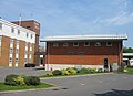
 Apollo Hotel - front view - geograph.org.uk - 799773.jpg 640 × 461; 90 KB
-
 Apollo Hotel - front wing - geograph.org.uk - 799775.jpg 640 × 464; 59 KB
-
 Apollo Hotel - geograph.org.uk - 799776.jpg 640 × 464; 58 KB
-
 Apollo Hotel - rear wing - geograph.org.uk - 799770.jpg 640 × 459; 63 KB
-
 Austen Court - geograph.org.uk - 656829.jpg 640 × 457; 62 KB
-
 Austen Court - geograph.org.uk - 991701.jpg 640 × 474; 68 KB
-
 Bermuda Close - geograph.org.uk - 781841.jpg 640 × 451; 49 KB
-
 Buckfast Close - geograph.org.uk - 1270388.jpg 640 × 470; 61 KB
-
 Clump of trees - geograph.org.uk - 1267788.jpg 640 × 466; 64 KB
-
 Colourful underpass - geograph.org.uk - 781822.jpg 640 × 430; 71 KB
-

-
 Cyclepath and autumn colours - geograph.org.uk - 991756.jpg 640 × 475; 60 KB
-
 Cyclepath between Popley and Hospital - geograph.org.uk - 990255.jpg 640 × 472; 78 KB
-
 Cycleway - Popley to Town Centre - geograph.org.uk - 816153.jpg 640 × 480; 109 KB
-
 Exit ramp for the A33 - Reading Road - geograph.org.uk - 670031.jpg 640 × 458; 64 KB
-
 Fancy entrance - geograph.org.uk - 1748283.jpg 640 × 480; 94 KB
-
 Flats on Shakespeare Road - geograph.org.uk - 1268199.jpg 640 × 470; 68 KB
-

-

-
 Fountains Close - geograph.org.uk - 1270411.jpg 640 × 474; 54 KB
-
 Going under the Ringway North - A33 - geograph.org.uk - 782183.jpg 640 × 480; 105 KB
-
 Houses on Pershore Road - geograph.org.uk - 1268150.jpg 640 × 475; 85 KB
-
 Housing on Carpenters Down - geograph.org.uk - 781843.jpg 640 × 449; 58 KB
-
 Kids Playground - Chineham Park - geograph.org.uk - 819972.jpg 640 × 480; 93 KB
-
 Magnolia Court - geograph.org.uk - 1270408.jpg 640 × 469; 91 KB
-
 Malta Close - geograph.org.uk - 781835.jpg 640 × 455; 55 KB
-
 Malta Close - geograph.org.uk - 781838.jpg 640 × 452; 76 KB
-
 Montserrat Road - geograph.org.uk - 777584.jpg 640 × 459; 58 KB
-
 Montserrat Road - geograph.org.uk - 782150.jpg 640 × 470; 45 KB
-
 Montserrat Road - geograph.org.uk - 782152.jpg 640 × 470; 62 KB
-
 New roundabout - Carpenters Down - geograph.org.uk - 781933.jpg 640 × 446; 45 KB
-
 No fire truck in sight - geograph.org.uk - 1184089.jpg 640 × 480; 54 KB
-

-
 Only for the brave - geograph.org.uk - 1771697.jpg 480 × 640; 128 KB
-
 Open ground behind the Apollo Hotel - geograph.org.uk - 991751.jpg 640 × 472; 55 KB
-
 Open ground off Popley Way - geograph.org.uk - 991759.jpg 640 × 475; 47 KB
-
 Path alongside Shakespeare Road - geograph.org.uk - 819978.jpg 640 × 480; 116 KB
-
 Path in Chineham Park - geograph.org.uk - 819925.jpg 640 × 480; 106 KB
-
 Path to Pershore Road - geograph.org.uk - 1268179.jpg 640 × 475; 110 KB
-
 Pathway through a park - geograph.org.uk - 1748139.jpg 640 × 480; 121 KB
-
 Pemberley Place - geograph.org.uk - 991699.jpg 480 × 640; 59 KB
-
 Pemberley Place - geograph.org.uk - 991704.jpg 475 × 640; 66 KB
-
 Popley - geograph.org.uk - 173881.jpg 640 × 480; 97 KB
-
 Popley Housing - geograph.org.uk - 656412.jpg 640 × 478; 87 KB
-
 Popley Way - geograph.org.uk - 1270395.jpg 640 × 481; 73 KB
-
 Popley Way - geograph.org.uk - 781823.jpg 640 × 455; 52 KB
-
 Popley Way - geograph.org.uk - 799782.jpg 640 × 472; 72 KB
-
 Priestley Road - geograph.org.uk - 1541762.jpg 640 × 471; 70 KB
-
 Ready for development - geograph.org.uk - 991726.jpg 640 × 476; 75 KB
-
 Ringway North - A33 - geograph.org.uk - 1269905.jpg 640 × 474; 58 KB
-
 Ringway North A 33 - geograph.org.uk - 655901.jpg 640 × 477; 62 KB
-
 Ringway North heading west. - geograph.org.uk - 655906.jpg 640 × 475; 65 KB
-
 Romsey Close - geograph.org.uk - 1270401.jpg 640 × 472; 59 KB
-
 Sad Paddling Pool - geograph.org.uk - 819938.jpg 640 × 480; 103 KB
-
 Scout Hut - geograph.org.uk - 1336156.jpg 640 × 468; 76 KB
-
 Scout Hut in winter - geograph.org.uk - 1164819.jpg 640 × 465; 81 KB
-
 Shakespeare Road - geograph.org.uk - 782185.jpg 640 × 480; 110 KB
-
 Shakespeare Road - geograph.org.uk - 819954.jpg 640 × 480; 66 KB
-
 Sherborne Road - Popley Way - geograph.org.uk - 991762.jpg 640 × 472; 45 KB
-
 Shetland Road - geograph.org.uk - 781839.jpg 640 × 443; 66 KB
-
 Shetland Road Flats - geograph.org.uk - 819917.jpg 640 × 480; 95 KB
-
 Shetland Road housing - geograph.org.uk - 781824.jpg 640 × 453; 64 KB
-
 Shetland Road housing - geograph.org.uk - 781826.jpg 640 × 451; 93 KB
-
 Signs come first - geograph.org.uk - 1030079.jpg 640 × 472; 45 KB
-
 Storm clouds and Popley Way - geograph.org.uk - 1748289.jpg 640 × 480; 71 KB
-
 Temporary lights on Carpenters Down - geograph.org.uk - 1035901.jpg 640 × 464; 44 KB
-
 Terraced accommodation on Popley Way - geograph.org.uk - 1270405.jpg 640 × 474; 50 KB
-
 Tesco Express and Chip Shop - geograph.org.uk - 781848.jpg 640 × 446; 60 KB
-
 Tewkesbury Close - geograph.org.uk - 1267778.jpg 640 × 468; 68 KB
-
 The sign says it all - geograph.org.uk - 781830.jpg 640 × 448; 81 KB
-
 Trinidad Close - geograph.org.uk - 990241.jpg 640 × 473; 64 KB
-
 Trinidad Close Allotments - geograph.org.uk - 990248.jpg 640 × 474; 87 KB
-
 Trinidad Close Housing - geograph.org.uk - 990245.jpg 640 × 466; 52 KB
-
 View across new estate in Popley - geograph.org.uk - 1030538.jpg 640 × 480; 87 KB
-
 View down Popley Way - geograph.org.uk - 781831.jpg 640 × 450; 96 KB
-
 What is my purpose^ - geograph.org.uk - 1335878.jpg 640 × 475; 109 KB
-
 Where John Hunt School once stood - geograph.org.uk - 781827.jpg 640 × 449; 73 KB
-
 Şeyx Sərdar Hacıhəsənli.jpg 1,280 × 830; 121 KB


