Category:Puffin Island, Anglesey
Brezhoneg: Ynys Seiriol, pe Enez Seiriol e brezhoneg, zo un enezennig, e korn kreisteiz-reter Enez Mon. Etre Ynys Seiriol hag ar beg-douar anvet Trwyn Du, war Enez Mon, ez eus bet savet un tour-tan war ur roc’h.
Cymraeg: Ynys gyferbyn â Penmon oddi ar arfordir de-ddwyreiniol Ynys Môn yw Ynys Seiriol. Mae goleudy amlwg yn sefyll ar darn o graig yn y môr rhwng Ynys Seiriol a'r Trwyn Du, Ynys Môn, yng ngofal Trinity House.
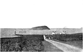
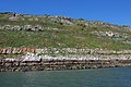
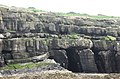
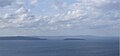
English: Puffin Island is an uninhabited island off the eastern tip of Anglesey, Wales. It was formerly known as Priestholm in English and Ynys Lannog in Welsh.
Magyar: Puffin-sziget egy lakatlan sziget Anglesey keleti csücskében, Walesben. Korábban Priestholm (angol) és Ynys Lannog (walesi) néven volt ismert. Modernkori nevét a szigeten fészkelő jelentős számú lunda (Puffin) populációról kapta.

island in Wales ,_Anglesey.JPG) | |||||
| Upload media | |||||
| Pronunciation audio | |||||
|---|---|---|---|---|---|
| Instance of | |||||
| Location | Isle of Anglesey, Wales | ||||
| Heritage designation | |||||
| Dissolved, abolished or demolished date |
| ||||
 | |||||
Media in category "Puffin Island, Anglesey"
The following 66 files are in this category, out of 66 total.
-

-
 Bird Haunts and Nature Memories - p 1.png 2,869 × 1,827; 2.76 MB
-
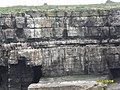 Cliffs on Puffin Island - geograph.org.uk - 1915496.jpg 3,264 × 2,448; 1.36 MB
-
 East of Gallows Point, Beaumaris - geograph.org.uk - 1407261.jpg 521 × 640; 186 KB
-

-
 Fryars Bay - geograph.org.uk - 435437.jpg 640 × 462; 78 KB
-
 Lighthouse and Puffin Island. - geograph.org.uk - 514048.jpg 640 × 512; 128 KB
-
 Lighthouse at Penmon Point - geograph.org.uk - 105712.jpg 640 × 427; 142 KB
-

-
 Llanfairfechan Beach, Wales.jpg 4,608 × 2,592; 3.63 MB
-
 Llanfairfechan with Puffin Island and Anglesey behind.jpg 3,036 × 4,048; 2.56 MB
-
 Llanfairfechan1.jpg 3,711 × 2,485; 5.29 MB
-
 Moelfre lifeboat - geograph.org.uk - 850958.jpg 640 × 481; 108 KB
-
 Northeast ridge, Foel Fras. - geograph.org.uk - 116045.jpg 640 × 421; 59 KB
-

-
 Penmon Light and Ynys Seiriol - geograph.org.uk - 222552.jpg 640 × 338; 34 KB
-

-
 Penrhyn Castle Estate - geograph.org.uk - 47398.jpg 640 × 480; 68 KB
-
 Perch Rock and Puffin Island - geograph.org.uk - 6124982.jpg 4,000 × 3,000; 4.63 MB
-
 Puffin Island (North) - geograph.org.uk - 4852447.jpg 1,600 × 900; 357 KB
-
 Puffin Island (Ynys Seiriol) seen from windfallen forest on the North side of Moel-y-Ci.jpg 4,608 × 2,128; 2.46 MB
-
 Puffin Island (Ynys Seiriol), Anglesey.JPG 2,592 × 1,944; 2.04 MB
-
 Puffin Island - geograph.org.uk - 2428286.jpg 1,280 × 960; 984 KB
-
 Puffin Island - geograph.org.uk - 3762426.jpg 1,024 × 769; 107 KB
-
 Puffin Island - geograph.org.uk - 4164657.jpg 2,309 × 1,078; 433 KB
-
 Puffin Island - geograph.org.uk - 4164662.jpg 2,056 × 1,567; 583 KB
-
 Puffin Island - Ynys Seiriol - geograph.org.uk - 2008812.jpg 640 × 425; 175 KB
-
 Puffin Island and Black Point Lighthouse (35221673382).jpg 2,304 × 1,728; 1.49 MB
-
 Puffin Island and Black Point Lighthouse (35258995071).jpg 2,304 × 1,728; 1.11 MB
-
 Puffin Island and Perch Rock - c.1982 - geograph.org.uk - 4711595.jpg 1,600 × 1,058; 215 KB
-
 Puffin Island and Perch Rock - geograph.org.uk - 3113226.jpg 640 × 480; 97 KB
-

-
 Puffin Island, Isle of Anglesey - geograph.org.uk - 312974.jpg 640 × 428; 71 KB
-
 Puffin islandmap1947.png 1,041 × 765; 1.18 MB
-
 Ruined Telegraph Station, Puffin Island - geograph.org.uk - 4172803.jpg 1,654 × 1,103; 420 KB
-
 Salt Marsh below Abergwyngregin - geograph.org.uk - 253593.jpg 640 × 348; 45 KB
-
 Sea Cliffs - Puffin Island - geograph.org.uk - 1915509.jpg 3,264 × 2,448; 1.36 MB
-
 Shore of Penmon & Puffin Island (49000023597).jpg 3,968 × 2,976; 1.99 MB
-
 The Cliffs of Puffin Island - geograph.org.uk - 2740977.jpg 3,260 × 2,142; 1.03 MB
-

-
 The Lighthouse and Puffin Island - geograph.org.uk - 3176618.jpg 1,074 × 806; 243 KB
-
 The Northern Spur of Drosgl - geograph.org.uk - 233301.jpg 640 × 480; 39 KB
-
 The shingle beach at Trwyn Du Point - geograph.org.uk - 377441.jpg 640 × 480; 56 KB
-

-
 Towards Trwyn Du lighthouse - geograph.org.uk - 1407257.jpg 440 × 640; 174 KB
-
 Trwyn Du and Puffin Island - geograph.org.uk - 3113215.jpg 640 × 480; 108 KB
-
 Trwyn Du lighthouse and Puffin Island - geograph.org.uk - 2398088.jpg 3,648 × 2,736; 5.68 MB
-

-

-

-

-
 View from Great Orme (7927).jpg 4,288 × 2,848; 3.64 MB
-
 View from Great Orme (7964).jpg 4,288 × 2,848; 3.85 MB
-
 View on Puffin Island, near Anglesea (1133547).jpg 1,000 × 759; 202 KB
-
 View on Puffin Island, near Anglesea.jpeg 900 × 669; 306 KB
-
 Ynys Seiriol - Puffin Island - geograph.org.uk - 1525853.jpg 640 × 386; 42 KB
-
 Ynys Seiriol - Puffin Island - geograph.org.uk - 1525874.jpg 640 × 427; 54 KB
-
 Ynys Seiriol - Puffin Island - geograph.org.uk - 1525892.jpg 640 × 427; 51 KB
-
 Ynys Seiriol - Puffin Island - geograph.org.uk - 575679.jpg 640 × 480; 57 KB
-
 Ynys Seiriol 01.JPG 2,490 × 1,172; 164 KB
-

-
 Ynys Seiriol-Puffin Island - geograph.org.uk - 872433.jpg 640 × 480; 81 KB
-

-
 Puffin Island - geograph.org.uk - 135527.jpg 640 × 480; 88 KB
-

-
 Ynys Seiriol (Puffin Island) - geograph.org.uk - 234360.jpg 640 × 480; 48 KB


_-_geograph.org.uk_-_4852447.jpg)
_seen_from_windfallen_forest_on_the_North_side_of_Moel-y-Ci.jpg)


.jpg)
.jpg)


.jpg)


.jpg)
.jpg)
.jpg)


_-_geograph.org.uk_-_234360.jpg)