Category:Rösrath
Rheinisch-Bergischer Kreis  Bergisch Gladbach · Burscheid · Kürten · Leichlingen · Odenthal · Overath · Rösrath · Wermelskirchen ·
municipality of Germany .jpg)    | |||||
| Upload media | |||||
| Instance of |
| ||||
|---|---|---|---|---|---|
| Location | Rhein-Berg District, Cologne Government Region, North Rhine-Westphalia, Germany | ||||
| Head of government |
| ||||
| Population |
| ||||
| Area |
| ||||
| Elevation above sea level |
| ||||
| official website | |||||
 | |||||
Subcategories
This category has the following 22 subcategories, out of 22 total.
*
- Quality images of Rösrath (129 F)
A
- Art in Rösrath (2 F)
- Athénée royal de Rösrath (17 F)
B
- Bleifeld (4 F)
C
D
H
K
L
N
P
- Pusteblume (Sculpture) (8 F)
S
T
Pages in category "Rösrath"
This category contains only the following page.
Media in category "Rösrath"
The following 82 files are in this category, out of 82 total.
-
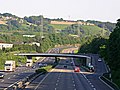
 A3 - Kreuz 30b - Lohmar-Nord (500m) - geo-en.hlipp.de - 11082.jpg 640 × 444; 57 KB
-
 A3 AS Roesrath.jpg 1,600 × 1,200; 394 KB
-
 Babrak Wassa.jpg 1,920 × 1,440; 925 KB
-
 Bergbauweg Wegmarkierung.jpg 598 × 761; 87 KB
-
 Bergsegen 1896.JPG 2,240 × 1,460; 1.99 MB
-
 Bf-roesrath-stuempen.jpg 2,592 × 1,944; 2.28 MB
-
 Brunsbach Bruecke.jpg 2,048 × 1,536; 981 KB
-
 Carsten Mell 2010 05 16.jpg 2,385 × 1,551; 397 KB
-
De-Rösrath.ogg 2.0 s; 20 KB
-
 Die Kleine Hausmeisterei - geo.hlipp.de - 14101.jpg 640 × 480; 104 KB
-
 Dieter Happ.jpg 1,920 × 2,560; 956 KB
-
 Dübelsicherung.JPG 2,953 × 2,215; 4.2 MB
-
 Einwohnerentwicklung von Rösrath.svg 800 × 400; 58 KB
-
 Esso Tankstelle - geo-en.hlipp.de - 10977.jpg 640 × 480; 61 KB
-
 Forsbach Germany Glas-fiber-installation-in-Bensberger-Strasse-01.jpg 4,779 × 3,186; 8.84 MB
-
 Fritz Zapp, Rheinisches Bildarchiv, rba 720009.jpg 3,545 × 2,739; 2.9 MB
-
 Gert Monheim.jpg 1,058 × 1,587; 296 KB
-
 Gezähe Schaufel.JPG 2,215 × 2,953; 4.51 MB
-
 Grab Leyhausen.JPG 2,112 × 2,816; 2.21 MB
-
 Grube Henricus.1.jpg 1,417 × 966; 337 KB
-
 Grube Vereinigtes Glückauf.1.jpg 1,417 × 1,141; 681 KB
-
 Grundschule - Hoffnungsthal - geo.hlipp.de - 23802.jpg 480 × 640; 82 KB
-
 Gänserich - panoramio.jpg 2,448 × 3,264; 3.16 MB
-
 Halde Lüderich.JPG 425 × 319; 167 KB
-
 Haus - geo.hlipp.de - 11272.jpg 640 × 480; 68 KB
-
 Haus in Rotdornallee - geo.hlipp.de - 39763.jpg 640 × 518; 76 KB
-
 Haus in Volberg - Hoffnungsthal - geo.hlipp.de - 13973.jpg 640 × 480; 102 KB
-
 Hofferhofer Str. Allee - geo.hlipp.de - 35627.jpg 640 × 461; 98 KB
-
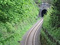 Hoffnungsthaltunnelp.jpg 1,252 × 936; 417 KB
-
 Chris Howland 2005.jpg 768 × 1,024; 114 KB
-
 Julweg - Hoffnungsthal - geo.hlipp.de - 29358.jpg 640 × 480; 108 KB
-
 Kriegsdenkmal Rösrath.jpg 6,000 × 4,000; 9.03 MB
-
 Kurtenwaldbach Blick nach Osten.jpg 4,032 × 3,024; 5.16 MB
-
 Kurtenwaldbach Blick nach Südwesten.jpg 4,032 × 3,024; 5.84 MB
-
 Landebahnbeleuchtung - panoramio.jpg 3,264 × 2,448; 1.59 MB
-
 Lehmbacher Hof.1.JPG 3,072 × 2,304; 2.4 MB
-
 Luederichtp.jpg 857 × 1,025; 176 KB
-
 Mary Bauermeister 2012.jpg 1,728 × 2,592; 1.8 MB
-
 Matthias Buth 2014.tif 1,512 × 2,268, 2 pages; 10.62 MB
-
 Metallarbeiten aller Art - geo.hlipp.de - 38051.jpg 640 × 480; 115 KB
-
 Monika Kampmann.jpg 1,500 × 2,000; 532 KB
-
 NSG Immetsiefen.JPG 1,181 × 886; 601 KB
-
 NSG Krumbach.2.JPG 945 × 709; 426 KB
-
 NSG Krumbach.JPG 3,072 × 2,304; 5.09 MB
-
 NSG Kupfersiefer Bachtal.JPG 945 × 709; 413 KB
-
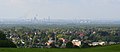 Panorama Rösrath bis Köln (cropped).jpg 3,456 × 1,500; 3.69 MB
-
 Panorama Rösrath bis Köln.jpg 3,456 × 2,304; 4.42 MB
-
 Panorama Strossenbau.jpg 909 × 339; 86 KB
-
 Parkplatz - Bahnhof Hoffnungsthal - geo-en.hlipp.de - 11525.jpg 640 × 480; 87 KB
-
 Pizza Taxi Raja - geo.hlipp.de - 23793.jpg 640 × 480; 101 KB
-
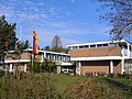 Rheinisch-Westfaelische Genossenschaftsakademie.jpg 2,560 × 1,920; 1.24 MB
-
 Roesrath Einwohnerentwicklung 2004b.png 287 × 194; 4 KB
-
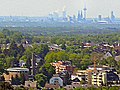 Roesrath near Cologne.jpg 2,048 × 1,536; 403 KB
-
 Roesrath Stadtteile Uebersicht.jpg 308 × 324; 16 KB
-
 Roesrath Torhaus Plakatmotiv.jpg 1,024 × 768; 168 KB
-
 Roesrath Torhaus Schloss Eulenbroich Modell.jpg 1,280 × 960; 211 KB
-
 Roesrath Willkommen.jpg 768 × 802; 125 KB
-
 Rotdornallee - geo.hlipp.de - 11301.jpg 640 × 480; 57 KB
-
 Rotdornallee - Hoffnungsthal - geo.hlipp.de - 39762.jpg 640 × 480; 101 KB
-
 Rotdornallee- Hoffnungsthal - geo.hlipp.de - 18431.jpg 480 × 640; 95 KB
-
 Rotdornallee- Hoffnungsthal - geo.hlipp.de - 18432.jpg 640 × 480; 88 KB
-
 Rösrath in GL.svg 329 × 340; 270 KB
-
 Rösrath-Adler604.JPG 3,214 × 2,405; 6.02 MB
-
 Briefkopf Saturn.JPG 1,772 × 1,229; 785 KB
-
 Siegelmarke Bürgermeister - Amt - Rösrath W0226344.jpg 270 × 268; 19 KB
-
 Suelzchan-s-np.jpg 2,635 × 1,917; 1.19 MB
-
 Suelzchan-sp.jpg 1,616 × 1,180; 563 KB
-
 Sülztalplatz261.JPG 2,304 × 1,728; 1.87 MB
-
 Sülztalplatz264.JPG 2,304 × 1,728; 2 MB
-
 Unnamed2 - panoramio (2222).jpg 5,184 × 3,456; 10.43 MB
-
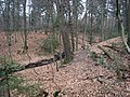
 Wald bei Hoffnungsthal - geo.hlipp.de - 24028.jpg 640 × 480; 154 KB
-
 Waldweg - Hoffnungsthal - geo.hlipp.de - 37454.jpg 480 × 640; 144 KB
-
 Weg im Wald bei Hoffnungsthal - geo.hlipp.de - 13971.jpg 460 × 640; 132 KB
-
 Weg Schwiegelshohn.JPG 2,816 × 2,112; 3.41 MB
-
 Weg südl. Förstchenteich (5).jpg 4,032 × 3,024; 6.36 MB
-
 Whisky bill parking.jpg 1,106 × 1,661; 953 KB
-
 Wilhelm Scheiner Erzaufbereitung am Luederich 1897.jpg 621 × 506; 95 KB
-
 Wintertag an der Sülzaue.jpg 2,448 × 3,264; 2.58 MB
-
 Wohnblock - geo.hlipp.de - 11280.jpg 640 × 480; 83 KB
-
 Wohnblock - geo.hlipp.de - 11281.jpg 640 × 480; 76 KB
-
 Wohnblock - geo.hlipp.de - 11296.jpg 640 × 480; 61 KB
-
 Wohnblock - geo.hlipp.de - 23790.jpg 640 × 480; 82 KB
_-_geo-en.hlipp.de_-_11082.jpg)


.jpg)


.jpg)


