Category:Raadhuis, Schoorl
| Object location | | View all coordinates using: OpenStreetMap |
|---|
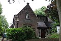
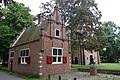
Nederlands: Afbeeldingen van het voormalige Raadhuis, Duinweg 3, 1871 AC Schoorl. Gelegen in Schoorl, behorende tot de gemeente Bergen, in de provincie Noord-Holland in het noorden van Nederland. Het is een Rijksmonument
|
This is a category about rijksmonument number 33823
|
 | |||||
| Upload media | |||||
| Instance of | |||||
|---|---|---|---|---|---|
| Location | Schoorl, North Holland, Netherlands | ||||
| Street address |
| ||||
| Architectural style | |||||
| Owned by |
| ||||
| Heritage designation |
| ||||
| Inception |
| ||||
| Date of official closure |
| ||||
 | |||||
Media in category "Raadhuis, Schoorl"
The following 9 files are in this category, out of 9 total.
-
 Duinweg 1, Schoorl.jpg 3,888 × 2,592; 4.73 MB
-
 Duinweg 3, Schoorl.jpg 3,888 × 2,592; 6.14 MB
-
 Exterieur - Schoorl - 20198914 - RCE.jpg 881 × 1,200; 339 KB
-
 Exterieur - Schoorl - 20198915 - RCE.jpg 868 × 1,200; 292 KB
-
 Exterieur aanzicht - Schoorl - 20198917 - RCE.jpg 805 × 1,200; 321 KB
-
 Exterieur na de restauratie - Schoorl - 20198916 - RCE.jpg 895 × 1,200; 343 KB
-
 Overzicht voorgevel en linker zijgevel - Schoorl - 20396731 - RCE.jpg 1,200 × 1,200; 445 KB
-

-
 Raadhuisje Schoorl.jpg 618 × 688; 120 KB


