Category:Railway bridges in the London Borough of Ealing

Subcategories
This category has the following 2 subcategories, out of 2 total.
H
- Hanwell Small Viaduct (2 F)
W
Media in category "Railway bridges in the London Borough of Ealing"
The following 56 files are in this category, out of 56 total.
-
 A tight squeeze - geograph.org.uk - 2766786.jpg 1,280 × 960; 729 KB
-
 Acton - Acton Lane railway bridge - geograph.org.uk - 2194464.jpg 640 × 480; 79 KB
-
 Acton Green, Railway bridge over Fisher Lane - geograph.org.uk - 3140344.jpg 3,456 × 2,304; 6.22 MB
-
 Acton High Street Railway Bridge With Illuminated Sign.jpg 3,264 × 2,448; 2.19 MB
-
 Alperton Lane, Perivale - geograph.org.uk - 1314843.jpg 640 × 424; 83 KB
-
 Brent Viaduct over Ruislip Road 2021.jpg 3,179 × 2,357; 5.79 MB
-
 Bridge across the Grand Union Canal - geograph.org.uk - 173850.jpg 640 × 480; 129 KB
-
 Bridge over Greenford Road - geograph.org.uk - 4672974.jpg 3,264 × 2,448; 2.3 MB
-

-
 Cast-iron pillar - The Iron Bridge - geograph.org.uk - 1164985.jpg 480 × 640; 78 KB
-
 Cast-iron pillar on the Iron Bridge - geograph.org.uk - 1165127.jpg 480 × 640; 67 KB
-
 Cast-iron pillar on the Iron Bridge - geograph.org.uk - 1165128.jpg 640 × 480; 75 KB
-
 Central Line crossing the Grand Union - geograph.org.uk - 929819.jpg 640 × 480; 48 KB
-
 Freightliner locomotive crosses Paddington Branch canal (geograph 4741211).jpg 3,648 × 2,736; 2.79 MB
-
 Greenford Avenue, Hanwell - geograph.org.uk - 2595649.jpg 4,320 × 3,240; 3.73 MB
-
 Greenford Road North - geograph.org.uk - 835118.jpg 640 × 480; 120 KB
-
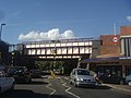
 Greenford station entrance, 1978 geograph-3580976-by-Ben-Brooksbank.jpg 2,395 × 1,583; 3.52 MB
-
 GUC - railway viaduct - geograph.org.uk - 678838.jpg 640 × 480; 146 KB
-
 Horsenden Lane by Perivale station - geograph.org.uk - 3065506.jpg 1,600 × 1,200; 669 KB
-
 Iron Bridge, Hanwell - geograph.org.uk - 17085.jpg 640 × 480; 100 KB
-
 Iron Bridge, Uxbridge Road - Southall - geograph.org.uk - 677238.jpg 640 × 480; 124 KB
-
 London MMB «I1 Kew Line.jpg 3,972 × 2,588; 4.42 MB
-

-

-
 Northolt, Pett's Hill railway bridge - geograph.org.uk - 1163309.jpg 640 × 480; 66 KB
-

-

-
 Perivale Golf Club Underbridge 2021.jpg 4,032 × 3,024; 8.33 MB
-
 Perivale station, Central Line Geograph by Peter Whatley.jpg 640 × 480; 77 KB
-
 Rail bridge over Uxbridge Road - geograph.org.uk - 3650978.jpg 800 × 600; 124 KB
-

-
 Railway bridge and street cleaners, Old Oak Common Lane - geograph.org.uk - 4479196.jpg 3,648 × 2,736; 3.14 MB
-
 Railway Bridge at Ruislp Road East - geograph.org.uk - 5769294.jpg 4,896 × 3,672; 5.86 MB
-
 Railway bridge on Acton Lane - geograph.org.uk - 4478614.jpg 2,304 × 1,728; 826 KB
-
 Railway bridge over Acton Lane - geograph.org.uk - 2643404.jpg 640 × 480; 126 KB
-
 Railway bridge over Ruislip Road East (B455) - geograph.org.uk - 6120102.jpg 5,184 × 3,888; 4.5 MB
-
-

-

-

-
 Railway Bridge, Grand Union Canal - geograph.org.uk - 4001145.jpg 640 × 430; 76 KB
-
 Railway Bridge, Greenford Rd - geograph.org.uk - 3480371.jpg 640 × 430; 69 KB
-
 Railway bridge, Oldfield Lane North - geograph.org.uk - 3461409.jpg 640 × 430; 77 KB
-
 Railway Bridge, Ruislip Road East - geograph.org.uk - 2943540.jpg 640 × 430; 76 KB
-
 Railway Bridge, Winchester St - geograph.org.uk - 4059662.jpg 640 × 430; 77 KB
-
 Railway over Ruislip Road East - geograph.org.uk - 3178281.jpg 640 × 480; 111 KB
-
 Semaphore signal at Greenford,west London, 2012. - panoramio.jpg 1,122 × 751; 1.12 MB
-
 Stockdove Way bridge, Perivale - geograph.org.uk - 1031670.jpg 640 × 480; 93 KB
-
 The Iron Bridge - geograph.org.uk - 1164986.jpg 640 × 480; 69 KB
-
 Two railway bridges Greenford Road - geograph.org.uk - 1141510.jpg 640 × 480; 45 KB
-
 Victoria Road, NW10 - geograph.org.uk - 998192.jpg 640 × 480; 48 KB
-
 Water main corridor and railway bridge - geograph.org.uk - 316136.jpg 480 × 640; 247 KB
-

-
 Windmill Lane from the Iron Bridge - geograph.org.uk - 1185084.jpg 640 × 480; 40 KB
-

-


.jpg)


_-_geograph.org.uk_-_6120102.jpg)


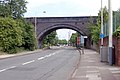
_-_Greenford_branch_railway_bridge_-_geograph.org.uk_-_2881883.jpg)


