Category:Railway bridges in the London Borough of Newham

Media in category "Railway bridges in the London Borough of Newham"
The following 20 files are in this category, out of 20 total.
-
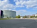 Aloft Hotel, ExCeL London, 2021.jpg 4,032 × 3,024; 6.66 MB
-
 Carpenters Road on an RLH Bus, Stratford E15 Low Bridge Last day open.jpg 1,152 × 864; 179 KB
-
 Disused GER rail bridge, Canning Town E16 Dec 2010.jpg 2,133 × 1,600; 827 KB
-
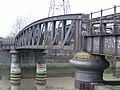 DIsused goods bridge Canning Town E16 Dec 2010.jpg 2,133 × 1,600; 552 KB
-
 DLR Viaduct, Gallions Reach - geograph.org.uk - 222773.jpg 640 × 447; 30 KB
-
 EWS Loco 60 073and the Lee Navigation E3. Nov 2009 (4111006607).jpg 1,600 × 2,133; 718 KB
-
 Former River Lea Railway Bridge, Bow Creek - 2022-03-28.jpg 4,032 × 3,024; 3.96 MB
-
 Old Bridge Across the River Lea - geograph.org.uk - 441627.jpg 640 × 480; 100 KB
-
 Railway bridge over River Lea - 2022-04-03.jpg 3,653 × 2,063; 2.21 MB
-
 Railway Bridge, Marshgate Lane - geograph.org.uk - 1128117.jpg 640 × 430; 87 KB
-
 River Lee (Bow Creek) - geograph.org.uk - 410602.jpg 640 × 480; 64 KB
-

-
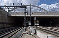 Stratford International station MMB 05.jpg 3,644 × 2,348; 2.86 MB
-
 Stratford International station MMB 06.jpg 3,936 × 2,476; 2.75 MB
-
 Stratford International station MMB 17.jpg 3,460 × 2,458; 2.81 MB
-
 Stratford International station MMB 21.jpg 3,873 × 2,556; 4.53 MB
-
 Stratford International station MMB 22.jpg 3,750 × 2,457; 2.78 MB
-
 Wanstead Park railway station in 2007.jpg 640 × 480; 103 KB
-
 Wanstead Park station - geograph.org.uk - 108657.jpg 640 × 480; 126 KB
-
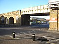
 West Ham Station geograph-4065181-by-Ben-Brooksbank.jpg 2,329 × 1,395; 3.43 MB


.jpg)


_-_geograph.org.uk_-_410602.jpg)
,_Disused_railway_bridge_-_geograph.org.uk_-_721451.jpg)


