Category:Rathmell
village in United Kingdom | |||||
| Upload media | |||||
| Instance of | |||||
|---|---|---|---|---|---|
| Location | Craven, North Yorkshire, Yorkshire and the Humber, England | ||||
 | |||||
English: Rathmell is a village and civil parish in the Craven district of North Yorkshire, England. It is close to the River Ribble and about three miles south of Settle. Other towns and villages nearby include Wigglesworth, Tosside, Giggleswick and Long Preston.
Subcategories
This category has the following 2 subcategories, out of 2 total.
H
R
- Rathmell War Memorial (2 F)
Media in category "Rathmell"
The following 200 files are in this category, out of 242 total.
(previous page) (next page)-
 A hawthorn near a footpath, Rathmell - geograph.org.uk - 5081458.jpg 2,000 × 1,500; 939 KB
-
 A sign for the Ribble Way - geograph.org.uk - 3574552.jpg 4,592 × 3,056; 6.56 MB
-
 Ackworth, Rathmell - geograph.org.uk - 2556301.jpg 2,000 × 1,500; 921 KB
-
 Approaching Black Hill - geograph.org.uk - 4358982.jpg 800 × 600; 195 KB
-
 Approaching Bull Hurst - geograph.org.uk - 4358618.jpg 800 × 600; 129 KB
-
 Approaching Moor Close Crag - geograph.org.uk - 3494823.jpg 4,320 × 3,240; 6.07 MB
-
 Back Lane at Hesley Lane, Rathmell - geograph.org.uk - 5081576.jpg 2,000 × 1,500; 1.18 MB
-
 Barn and farmhouse at Lumb - geograph.org.uk - 4650942.jpg 1,024 × 631; 253 KB
-
 Benchmark on footpath steps at Littlebank - geograph.org.uk - 4651040.jpg 683 × 1,024; 269 KB
-
 Benchmark on Lumb Barn - geograph.org.uk - 4650871.jpg 1,024 × 683; 187 KB
-
 Bikers passing through Rathmell - geograph.org.uk - 3121928.jpg 1,879 × 1,408; 1.51 MB
-
 Bond Beck - geograph.org.uk - 144398.jpg 640 × 480; 142 KB
-
 Boulders on Cocket Moss - geograph.org.uk - 3999519.jpg 640 × 480; 68 KB
-
 Buried pipeline - geograph.org.uk - 522892.jpg 640 × 480; 126 KB
-
 Cocket Lane - geograph.org.uk - 3494832.jpg 4,320 × 3,240; 5.31 MB
-
 Cocket Lane - geograph.org.uk - 3996336.jpg 640 × 480; 81 KB
-
 Cocket Lane, Rathmell - geograph.org.uk - 2556458.jpg 2,000 × 1,500; 1.12 MB
-
 Cocket Moss - geograph.org.uk - 1393974.jpg 640 × 480; 106 KB
-
 Cocket Moss - geograph.org.uk - 3494816.jpg 4,320 × 3,240; 5.79 MB
-
 Cocket Moss, Rathmell - geograph.org.uk - 3080538.jpg 2,000 × 1,500; 966 KB
-
 Country Road Rathmell - geograph.org.uk - 176779.jpg 640 × 480; 94 KB
-

-
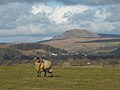 Dalesbred ram and Pen-y-Ghent - geograph.org.uk - 4358973.jpg 640 × 480; 96 KB
-
 Derelict farmhouse, Black Hill - geograph.org.uk - 4358602.jpg 640 × 480; 134 KB
-
 Descending towards Upper Sheep Wash - geograph.org.uk - 4358632.jpg 640 × 480; 97 KB
-

-
 Elizabeth II postbox on Main Street, Rathmell - geograph.org.uk - 5141880.jpg 1,470 × 2,405; 682 KB
-
 Entrance and road to Street House Farm - geograph.org.uk - 158221.jpg 640 × 426; 134 KB
-
 Far Cappleside - geograph.org.uk - 5091436.jpg 5,156 × 2,784; 1.8 MB
-
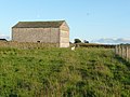
 Far Cappleside Barn - geograph.org.uk - 5140149.jpg 640 × 480; 60 KB
-
 Farm building near Rathmell - geograph.org.uk - 4904556.jpg 640 × 480; 85 KB
-
 Farm Buildings near New Hall - geograph.org.uk - 4911454.jpg 640 × 428; 64 KB
-
 Farm driveway at Whelpstone Lodge, Rathmell - geograph.org.uk - 5496882.jpg 2,000 × 1,500; 879 KB
-
 Farm track towards Lumb passing Littlebank - geograph.org.uk - 4651089.jpg 1,024 × 683; 320 KB
-
 Farmhouse, Millgate House Farm - geograph.org.uk - 5140159.jpg 640 × 504; 62 KB
-
 Farmland at New Hall - geograph.org.uk - 4910364.jpg 640 × 428; 71 KB
-
 Field Well, Far Cappleside - geograph.org.uk - 4904536.jpg 640 × 480; 75 KB
-
 Flooded field - geograph.org.uk - 5610244.jpg 640 × 427; 120 KB
-
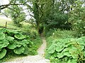
 Footbridge on the path to Cocket Moss - geograph.org.uk - 3080569.jpg 2,000 × 1,500; 1.26 MB
-
 Footbridge,Rathmell Beck - geograph.org.uk - 4904545.jpg 640 × 480; 114 KB
-
 Footpath above Higher Brayshaw - geograph.org.uk - 4357685.jpg 640 × 480; 97 KB
-
 Footpath above Rathmell Beck - geograph.org.uk - 4356238.jpg 640 × 480; 101 KB
-
 Footpath at the corner of a wall, Rathmell - geograph.org.uk - 5081468.jpg 2,000 × 1,500; 968 KB
-
 Footpath down to Rathmell Beck - geograph.org.uk - 4356224.jpg 640 × 480; 136 KB
-
 Footpath on Badger Hill - geograph.org.uk - 3493261.jpg 4,320 × 3,240; 5.73 MB
-
 Footpath to Green Farm - geograph.org.uk - 5610238.jpg 640 × 427; 111 KB
-
 Footpath to Heath Farm - geograph.org.uk - 158204.jpg 640 × 426; 151 KB
-
 Ford at Rathmell Beck - geograph.org.uk - 1394504.jpg 640 × 480; 134 KB
-
 Former post office, Rathmell - geograph.org.uk - 2353576.jpg 480 × 640; 70 KB
-
 Foxholes Crag - geograph.org.uk - 3080727.jpg 2,000 × 1,500; 820 KB
-
 Foxholes Crag - geograph.org.uk - 3537345.jpg 1,600 × 1,200; 499 KB
-

-

-
 Grassland near Long Gill - geograph.org.uk - 4507016.jpg 1,024 × 768; 605 KB
-
 Grazing north east of Rathmell - geograph.org.uk - 5140172.jpg 640 × 480; 54 KB
-
 Green Lane above Hanover Gill - geograph.org.uk - 3493559.jpg 4,320 × 3,240; 5.66 MB
-
 Green Lane leading down to Upper and Lower Sheep Wash - geograph.org.uk - 3493596.jpg 4,320 × 3,240; 5.22 MB
-
 Hanover Gill and Scoutber Crag - geograph.org.uk - 4358609.jpg 640 × 480; 111 KB
-
 Heading for Rathmell - geograph.org.uk - 4358775.jpg 800 × 600; 112 KB
-
 Heading north east from Rathmell - geograph.org.uk - 5140177.jpg 640 × 480; 64 KB
-
 Heading north towards Rathmell - geograph.org.uk - 5140148.jpg 640 × 480; 66 KB
-
 Hedge and tree-lined lane near to High Green Wood - geograph.org.uk - 6053856.jpg 4,000 × 3,000; 4.95 MB
-
 Hesley Hall - geograph.org.uk - 5610217.jpg 640 × 427; 81 KB
-
 Hill up into the village, Rathmell - geograph.org.uk - 1450604.jpg 640 × 466; 101 KB
-
 Hollin Hall Barn - geograph.org.uk - 3121940.jpg 2,718 × 1,976; 1.81 MB
-
 Hollin Hall Barn - geograph.org.uk - 5140178.jpg 640 × 480; 53 KB
-
 Hollin Hall Barn, Rathmell - geograph.org.uk - 1450618.jpg 640 × 480; 126 KB
-
 Hollow Gill - geograph.org.uk - 5091439.jpg 5,183 × 2,435; 1.73 MB
-
 Hollow Gill Bridge, looking north, Wigglesworth - geograph.org.uk - 5081618.jpg 2,000 × 1,500; 1.05 MB
-
 Hollow Gill Brow approaching Hollow Gill Bridge, Rathmell - geograph.org.uk - 5081627.jpg 2,000 × 1,500; 1.11 MB
-
 Holly Dene - geograph.org.uk - 4904567.jpg 640 × 480; 48 KB
-

-
 Houses on Main Street, Rathmell - geograph.org.uk - 5141881.jpg 2,848 × 2,136; 1.28 MB
-
 Huggon House - geograph.org.uk - 2248554.jpg 4,320 × 3,240; 4.96 MB
-
 Ingleborough - geograph.org.uk - 5610219.jpg 640 × 427; 66 KB
-
 Junction of Hesley Lane and Back Lane, Rathmell - geograph.org.uk - 5081583.jpg 2,000 × 1,431; 1.2 MB
-
 Lane at Lower Sheep Wash Farm - geograph.org.uk - 6053861.jpg 4,000 × 3,000; 3.51 MB
-
 Lane bend north of Rathmell - geograph.org.uk - 3338222.jpg 640 × 481; 41 KB
-
-
 Lane near Huggon, Rathmell - geograph.org.uk - 1438854.jpg 640 × 480; 98 KB
-
 Lane near Huggon, Rathmell - geograph.org.uk - 1438860.jpg 640 × 471; 124 KB
-
 Last few metres to Resting Stone - geograph.org.uk - 3537361.jpg 1,600 × 1,200; 330 KB
-
 Littlebank - geograph.org.uk - 4908788.jpg 640 × 428; 92 KB
-
 Long Gill Brook below Middle Brayshaw - geograph.org.uk - 4357667.jpg 800 × 600; 119 KB
-
 Looking down the lane to Whelpstone Lodge, Rathmell - geograph.org.uk - 5496897.jpg 2,000 × 1,307; 796 KB
-
 Looking South East along Scoutber Crag - geograph.org.uk - 550989.jpg 640 × 480; 112 KB
-
 Looking south from Resting Stone - geograph.org.uk - 3537367.jpg 1,600 × 1,200; 405 KB
-
 Lumb Barn - geograph.org.uk - 4650925.jpg 683 × 1,024; 219 KB
-
 Lumb Bridge - geograph.org.uk - 4358752.jpg 640 × 480; 173 KB
-
 Main Street in Rathmell - geograph.org.uk - 6053852.jpg 3,812 × 2,859; 1.93 MB
-
 Main Street, Rathmell - geograph.org.uk - 2353567.jpg 640 × 480; 133 KB
-
 Main Street, Rathmell - geograph.org.uk - 3338211.jpg 640 × 480; 75 KB
-
 Main Street, Rathmell - geograph.org.uk - 5140164.jpg 640 × 480; 64 KB
-
 Mill Lane near Rathmell - geograph.org.uk - 6053854.jpg 4,000 × 3,000; 3.65 MB
-
 Millgate House Farm - geograph.org.uk - 5140157.jpg 640 × 480; 77 KB
-
 Minor road towards Giggleswick - geograph.org.uk - 5140181.jpg 640 × 480; 54 KB
-
 Minor road towards Giggleswick - geograph.org.uk - 5140186.jpg 640 × 480; 61 KB
-
 Muddy patch on Cocket Moss - geograph.org.uk - 3996303.jpg 640 × 480; 99 KB
-
 New Hall - geograph.org.uk - 4910353.jpg 640 × 428; 85 KB
-
 New Hall - geograph.org.uk - 5610242.jpg 640 × 427; 109 KB
-
 New houses being built, Rathmell - geograph.org.uk - 5140163.jpg 640 × 480; 80 KB
-
 Odd Stone Bridge between Upper and Lower Sheep Wash - geograph.org.uk - 3493696.jpg 4,320 × 3,240; 4.72 MB
-
 On the footpath below Big Hill - geograph.org.uk - 3537340.jpg 1,600 × 1,200; 371 KB
-
-
 Ordnance Survey Pivot Cut Mark - geograph.org.uk - 6054138.jpg 3,812 × 2,859; 3.4 MB
-
 Outside Rathmell - geograph.org.uk - 3121909.jpg 2,816 × 2,112; 3.92 MB
-

-
 Perched boulder - geograph.org.uk - 3080560.jpg 2,000 × 1,500; 1.03 MB
-
 Pond in pasture - geograph.org.uk - 3080600.jpg 2,000 × 1,500; 1.02 MB
-
 Ragged Hall - geograph.org.uk - 1394498.jpg 640 × 480; 109 KB
-
 Rathmell - geograph.org.uk - 5091396.jpg 4,576 × 2,768; 2.01 MB
-
 Rathmell - geograph.org.uk - 5091434.jpg 5,183 × 3,011; 2.02 MB
-
 Rathmell Beck - geograph.org.uk - 5610230.jpg 640 × 427; 156 KB
-
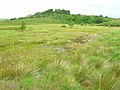
 Rathmell Common - geograph.org.uk - 3080617.jpg 2,000 × 1,500; 931 KB
-
 Rathmell from Watery Lane - geograph.org.uk - 5610263.jpg 640 × 427; 103 KB
-
 Rathmell Reading Room - geograph.org.uk - 2353448.jpg 640 × 480; 111 KB
-
 Rathmell Reading Room - geograph.org.uk - 5140167.jpg 640 × 480; 73 KB
-
 Rathmell Reading Room, Rathmell village - geograph.org.uk - 45204.jpg 640 × 480; 124 KB
-
 Rathmell telephone box - geograph.org.uk - 5610267.jpg 640 × 427; 103 KB
-
 Rathmell Yorks WR Signpost 2016.06.03.jpg 1,500 × 1,057; 718 KB
-
 Reedy tarn near Resting Stone - geograph.org.uk - 2067210.jpg 640 × 426; 427 KB
-
 Resting Stone - geograph.org.uk - 2067206.jpg 640 × 426; 350 KB
-
 Resting Stone - geograph.org.uk - 770105.jpg 640 × 480; 74 KB
-
 Resting Stone - Northeast - Bowland - geograph.org.uk - 1869340.jpg 3,264 × 2,448; 1.96 MB
-
 Retired farm machine at Whelpstone Lodge - geograph.org.uk - 1704524.jpg 1,909 × 1,273; 1.02 MB
-
 Ribble Valley - geograph.org.uk - 5091393.jpg 5,184 × 3,456; 1.61 MB
-
 Ribble Way - geograph.org.uk - 4904574.jpg 640 × 480; 50 KB
-
 Ribble Way at Holly Dene - geograph.org.uk - 2248549.jpg 4,320 × 3,240; 3.72 MB
-
 Ribble Way near Hollin Hall - geograph.org.uk - 2248546.jpg 4,320 × 3,240; 3.42 MB
-
 Ribble Way passing through Green Farm - geograph.org.uk - 2248551.jpg 4,320 × 3,240; 4.05 MB
-
 River Ribble - geograph.org.uk - 176213.jpg 640 × 480; 235 KB
-
 River Ribble - geograph.org.uk - 176220.jpg 640 × 480; 238 KB
-
 River Ribble - geograph.org.uk - 696179.jpg 640 × 427; 59 KB
-
 River Ribble - geograph.org.uk - 696202.jpg 640 × 427; 54 KB
-
 River Ribble - geograph.org.uk - 706140.jpg 640 × 427; 67 KB
-
 River Ribble - geograph.org.uk - 706177.jpg 640 × 427; 81 KB
-
 River Ribble Meander looking North - geograph.org.uk - 2980952.jpg 4,320 × 3,240; 3.02 MB
-
 River Ribble Meander looking South - geograph.org.uk - 2980964.jpg 4,320 × 3,240; 3.05 MB
-
 Road (footpath) to Far Cappleside - geograph.org.uk - 5140153.jpg 640 × 480; 71 KB
-
 Road junction, Rathmell - geograph.org.uk - 5081513.jpg 2,000 × 1,388; 906 KB
-
 Rome Crag - geograph.org.uk - 1393965.jpg 640 × 480; 57 KB
-
 Rough ground southwest of Sandford Farm - geograph.org.uk - 3537328.jpg 1,600 × 1,200; 436 KB
-
 Rough pastureland by Black Leach - geograph.org.uk - 4358641.jpg 640 × 480; 104 KB
-
 Ruins below Big Hill from the East - geograph.org.uk - 3491345.jpg 4,320 × 3,240; 4.59 MB
-
 Ruins below Big Hill from the West - geograph.org.uk - 3491337.jpg 4,320 × 3,240; 5.77 MB
-
 Seat^ Main Street, Rathmell - geograph.org.uk - 2353462.jpg 640 × 480; 185 KB
-
 Sheep grazing near Hollin Hall Barn - geograph.org.uk - 5140179.jpg 640 × 480; 81 KB
-
 Sheep grazing near New Hall - geograph.org.uk - 5140191.jpg 640 × 480; 69 KB
-
 Sheep near New Hall - geograph.org.uk - 6273885.jpg 1,024 × 683; 206 KB
-
 Sheep near old ruin - Foxholes Crag - NE Bowland - geograph.org.uk - 1869432.jpg 3,264 × 2,448; 1.82 MB
-
-
 Stile on path across Rathmell Common - geograph.org.uk - 3080624.jpg 2,000 × 1,459; 1.06 MB
-
 Stile on path to Cocket Moss - geograph.org.uk - 3080563.jpg 2,000 × 1,500; 1.19 MB
-
 Stile on path to Cocket Moss and Cocket Lane, Rathmell - geograph.org.uk - 3080556.jpg 2,000 × 1,500; 1,001 KB
-
 Stile on the footpath from Boostagill to Old Oliver Lane - geograph.org.uk - 5081118.jpg 2,000 × 1,472; 924 KB
-

-
 Stile onto Cocket Moss - geograph.org.uk - 3080582.jpg 2,000 × 1,500; 905 KB
-
 Stone Barn between Hesley Lane and Boostagill - geograph.org.uk - 2248557.jpg 4,320 × 3,240; 4.9 MB
-
 Stone barn, Millgate House Farm - geograph.org.uk - 5140160.jpg 640 × 480; 83 KB
-
 Storm over the River Ribble - geograph.org.uk - 4727442.jpg 640 × 428; 33 KB
-
 Swainstead - geograph.org.uk - 5098866.jpg 5,184 × 2,405; 1.39 MB
-
 Swainstead from Coney Garth, Rathmell - geograph.org.uk - 2556310.jpg 2,000 × 1,471; 879 KB
-
 Swainstead Raike - geograph.org.uk - 1394505.jpg 480 × 640; 79 KB
-
 Swainstead Raikes - geograph.org.uk - 3494810.jpg 4,320 × 3,240; 5.66 MB
-
 The Crook - geograph.org.uk - 4667847.jpg 640 × 426; 74 KB
-
 The Crook - geograph.org.uk - 4667849.jpg 640 × 426; 67 KB
-

-
 The Olde Post House, Main Street - geograph.org.uk - 6141262.jpg 1,024 × 683; 168 KB
-
 The Rathmell road - geograph.org.uk - 3573871.jpg 4,213 × 1,778; 5.13 MB
-
 The Ribble valley at Cleatop - geograph.org.uk - 5149552.jpg 4,000 × 3,000; 6.1 MB
-
 The Ribble Way - geograph.org.uk - 3574701.jpg 4,314 × 2,871; 7.27 MB
-
 The Ribble Way leaving Hollow Gill Brow, Rathmell - geograph.org.uk - 5081593.jpg 2,000 × 1,438; 682 KB
-
 The road south from Rathmell - geograph.org.uk - 3574090.jpg 4,427 × 2,773; 6.3 MB
-
 The summit of Cross Hills, 312m - geograph.org.uk - 3080643.jpg 2,000 × 1,500; 967 KB
-
 The valley of Rathmell Beck - geograph.org.uk - 4358763.jpg 640 × 480; 106 KB
-
 The village street, Rathmell - geograph.org.uk - 1445280.jpg 640 × 469; 119 KB
-
 Track from Holly Dene - geograph.org.uk - 5610270.jpg 640 × 427; 97 KB
-
 Track from Littlebank to New Hall - geograph.org.uk - 6273890.jpg 1,024 × 683; 215 KB
-
 Track into Hollin Hall farm buildings - geograph.org.uk - 5575594.jpg 1,024 × 683; 201 KB
-
 Track leading to Hesley Lane - geograph.org.uk - 3494793.jpg 4,320 × 3,240; 4.2 MB
-
 Track leading to Higher Winterscale Bank - geograph.org.uk - 6053865.jpg 4,000 × 3,000; 2.91 MB
-
 Track near Lower Sheepwash - geograph.org.uk - 1438839.jpg 640 × 480; 149 KB
-
 Track to Hollin Hall - geograph.org.uk - 5140184.jpg 640 × 480; 62 KB
-
 Track to Littlebank - geograph.org.uk - 4910344.jpg 640 × 428; 78 KB
-
 Track to Low Bank Farm - geograph.org.uk - 1393982.jpg 480 × 640; 72 KB
-
 View east from Littlebank - geograph.org.uk - 6273887.jpg 1,024 × 683; 219 KB
-

-

-

-
 View from the lane to Whelpstone Lodge, Rathmell - geograph.org.uk - 5496903.jpg 2,000 × 1,500; 996 KB
-
 View over fields from track passing Holly Dene - geograph.org.uk - 5575596.jpg 1,024 × 683; 185 KB
-
 Wall-lined lane between Lower Sheep Wash and Low Folds - geograph.org.uk - 6053863.jpg 3,925 × 3,000; 2.67 MB
-

-
 Whelpstone Lodge - geograph.org.uk - 1703274.jpg 1,909 × 1,273; 1.17 MB
-
 Whelpstone Lodge - geograph.org.uk - 595128.jpg 640 × 480; 108 KB
-
 Whelpstone Lodge, Rathmell - geograph.org.uk - 5496873.jpg 2,000 × 1,467; 860 KB
-
 A pair of Gates - geograph.org.uk - 217303.jpg 640 × 480; 234 KB
-
 A stile on Lodge Road near Hoyman Laithe - geograph.org.uk - 629056.jpg 640 × 480; 104 KB
-
 Barn - geograph.org.uk - 217715.jpg 640 × 480; 70 KB
-
 Birchshow Rocks, Giggleswick - geograph.org.uk - 1438740.jpg 640 × 480; 88 KB


_to_Far_Cappleside_-_geograph.org.uk_-_5140153.jpg)


