Category:Rechener Park
| Object location | | View all coordinates using: OpenStreetMap |
|---|
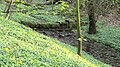
Deutsch: Rechener Park, auch Südpark genannt, in Bochum-Wiemelhausen (Ehrenfeld)
park in Bochum, Germany  | |||||
| Upload media | |||||
| Instance of | |||||
|---|---|---|---|---|---|
| Location | Bochum, Arnsberg Government Region, North Rhine-Westphalia, Germany | ||||
 | |||||
Media in category "Rechener Park"
The following 6 files are in this category, out of 6 total.
-
 Bochum RechenerPark 080408 070 00.jpg 2,816 × 1,584; 4.96 MB
-
 Bochum RechenerPark 080408 072 00.jpg 2,816 × 1,584; 5.13 MB
-
 Bochum RechenerPark 080408 075 00.jpg 2,816 × 1,584; 5.39 MB
-
 Bochum RechenerPark 080408 077 00.jpg 2,816 × 2,112; 4.25 MB
-
 Bochum RechenerPark 080408 080 00.jpg 2,816 × 2,112; 5.99 MB
-
 Bochum RechenerPark080408 091 00.jpg 2,816 × 1,584; 4.72 MB


