Category:Republic of Ireland photographs taken on 2007-07-17
Countries of Europe: Armenia‡ · Austria · Belgium · Cyprus‡ · Estonia · Finland · France‡ · Germany · Greece · Iceland · Republic of Ireland · Italy · Latvia · Lithuania · Netherlands‡ · Norway · Poland · Portugal‡ · Romania · Russia‡ · Serbia · Slovakia · Slovenia · Spain‡ · Sweden · Switzerland · Turkey‡ · Ukraine · United Kingdom
‡: partly located in Europe
‡: partly located in Europe
| ← | 17 July 2007 | → | ||
| ← | July 2007 | → | ||

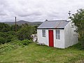
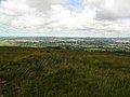
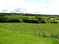
Republic of Ireland photographs taken on 17 July 2007.
Image files should be categorized here automatically using {{taken on}} template. Direct categorisation is also possible, if automatic is impossible.
Media in category "Republic of Ireland photographs taken on 2007-07-17"
The following 52 files are in this category, out of 52 total.
-
 Ballybofey.jpg 640 × 479; 55 KB
-

-
 Caravan Brae, Dungloe - geograph.org.uk - 500542.jpg 640 × 479; 55 KB
-
 Cloghan - geograph.org.uk - 500376.jpg 640 × 479; 74 KB
-
 Cloghan, Co. Donegal - geograph.org.uk - 500372.jpg 640 × 479; 62 KB
-
 Cloghan, Co. Donegal - geograph.org.uk - 500380.jpg 640 × 479; 65 KB
-
 Countryside at School near Maghery - geograph.org.uk - 500634.jpg 640 × 479; 47 KB
-
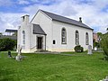
 Donoughmore Presbyterian Church - geograph.org.uk - 500352.jpg 640 × 479; 50 KB
-
 Doochary, Co. Donegal - geograph.org.uk - 500514.jpg 640 × 479; 66 KB
-
 Dungloe - geograph.org.uk - 500599.jpg 640 × 479; 62 KB
-
 Dungloe library - geograph.org.uk - 500539.jpg 640 × 479; 59 KB
-
 Dunlow Lough - geograph.org.uk - 500638.jpg 640 × 479; 45 KB
-
 Farmhouse at Dungloe - geograph.org.uk - 500552.jpg 640 × 479; 81 KB
-
 Fintown Railway - geograph.org.uk - 500492.jpg 640 × 479; 47 KB
-
 Fintown Railway.jpg 640 × 479; 59 KB
-
 Fintown.jpg 640 × 479; 49 KB
-
 Killygordon - geograph.org.uk - 500354.jpg 640 × 479; 52 KB
-
 Lough Finn.jpg 640 × 479; 54 KB
-
 Lough near Doochary - geograph.org.uk - 500509.jpg 640 × 479; 64 KB
-
 Lough near Dungloe - geograph.org.uk - 500548.jpg 640 × 479; 46 KB
-
 Lough Shivnagh - geograph.org.uk - 500470.jpg 640 × 479; 55 KB
-
 National School near Maghery - geograph.org.uk - 500633.jpg 640 × 479; 58 KB
-
 Near Maghery, Dungloe - geograph.org.uk - 500630.jpg 640 × 479; 57 KB
-
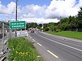
 Oifig an Phoist (Post Office) - geograph.org.uk - 500516.jpg 640 × 479; 61 KB
-

-

-

-

-
 Recreational Facilities near Dungloe - geograph.org.uk - 500556.jpg 640 × 479; 71 KB
-
 Road at Fintown - geograph.org.uk - 500507.jpg 640 × 479; 59 KB
-
 Siopa Pobail - geograph.org.uk - 500628.jpg 640 × 479; 52 KB
-
 St Crone's Church of Ireland, Dungloe - geograph.org.uk - 500587.jpg 640 × 479; 54 KB
-

-
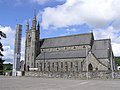 Church- Stranorlar.jpg 640 × 479; 53 KB
-
 Stranorlar (Srath an Urlâir) - geograph.org.uk - 500358.jpg 640 × 479; 66 KB
-
 Stranorlar - geograph.org.uk - 500360.jpg 640 × 479; 52 KB
-
 Teach leanna beedi, An Cloghan Liath - geograph.org.uk - 500531.jpg 640 × 479; 69 KB
-
 Toberkeen - geograph.org.uk - 500583.jpg 640 × 479; 63 KB
-
 Toberkeen, Dungloe - geograph.org.uk - 500581.jpg 640 × 479; 62 KB
-
 Wee house at Dungloe - geograph.org.uk - 500545.jpg 640 × 479; 55 KB
-
 Ballinamore - geograph.org.uk - 500395.jpg 640 × 479; 66 KB
-
 Ballinamore Townland - geograph.org.uk - 500394.jpg 640 × 479; 85 KB
-
 Bog Vegetation - geograph.org.uk - 497321.jpg 640 × 480; 67 KB
-
 Castlefin - geograph.org.uk - 500350.jpg 640 × 479; 53 KB
-
 Castlefin, Co. Donegal - geograph.org.uk - 500346.jpg 640 × 479; 55 KB
-
 Cloghan - geograph.org.uk - 500374.jpg 640 × 479; 54 KB
-
 Cottages near Maghery - geograph.org.uk - 500631.jpg 640 × 479; 55 KB
-
 Crohy Head - geograph.org.uk - 500622.jpg 640 × 479; 56 KB
-
 Loch na Snathaide - geograph.org.uk - 500519.jpg 640 × 479; 67 KB
-
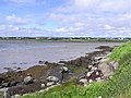
 River Owennamarve - geograph.org.uk - 500526.jpg 640 × 479; 65 KB
-
 Road near Maghery - geograph.org.uk - 500625.jpg 640 × 479; 46 KB
-
 St Taodhbhoch's National School - geograph.org.uk - 500391.jpg 640 × 479; 63 KB


_-_geograph.org.uk_-_500516.jpg)


_-_geograph.org.uk_-_500358.jpg)


