Category:Republic of Ireland photographs taken on 2008-05-04
Countries of Europe: Albania · Austria · Belarus · Belgium · Bosnia and Herzegovina · Croatia · Czech Republic · Denmark · Estonia · Finland · France‡ · Germany · Greece · Hungary · Republic of Ireland · Italy · Latvia · Lithuania · Malta · Montenegro · Netherlands‡ · Norway · Poland · Portugal‡ · Romania · Russia‡ · Serbia · Slovakia · Spain‡ · Sweden · Switzerland · Turkey‡ · Ukraine · United Kingdom
‡: partly located in Europe
‡: partly located in Europe
| ← | 4 May 2008 | → | ||
| ← | May 2008 | → | ||

Republic of Ireland photographs taken on 4 May 2008.
Image files should be categorized here automatically using {{taken on}} template. Direct categorisation is also possible, if automatic is impossible.
Media in category "Republic of Ireland photographs taken on 2008-05-04"
The following 46 files are in this category, out of 46 total.
-

-
 Aghacashel Church - geograph.org.uk - 796797.jpg 640 × 480; 58 KB
-
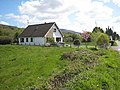
 Aghacashel Organic Farm - geograph.org.uk - 1586654.jpg 640 × 480; 111 KB
-
 An Abhainn Bhui - geograph.org.uk - 1586635.jpg 640 × 480; 113 KB
-
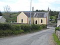 Ballinagleragh Church - geograph.org.uk - 796651.jpg 640 × 480; 59 KB
-
 Bridge over the Stony River - geograph.org.uk - 1111723.jpg 640 × 480; 126 KB
-

-
 Bungalow near Aghaginny - geograph.org.uk - 1112808.jpg 640 × 480; 84 KB
-
 Cottage at Cornashamsoge - geograph.org.uk - 1111717.jpg 640 × 480; 81 KB
-
 Cottages at Sheskinacurry - geograph.org.uk - 1111711.jpg 640 × 480; 79 KB
-
-
 Crolly - Leo's Tavern - geograph.org.uk - 1174544.jpg 640 × 427; 70 KB
-
 Crolly - Leo's Tavern Sign - geograph.org.uk - 1174573.jpg 639 × 426; 370 KB
-
 Derryhalagh Lough - geograph.org.uk - 1111697.jpg 640 × 480; 66 KB
-
 Fahy - geograph.org.uk - 1111727.jpg 640 × 480; 101 KB
-
 Farm at Largan - geograph.org.uk - 796549.jpg 640 × 480; 75 KB
-
 Field day - geograph.org.uk - 788209.jpg 640 × 480; 227 KB
-
 Headwater of the Aghacashlaun River - geograph.org.uk - 1586684.jpg 640 × 480; 136 KB
-

-
 Hillside with stone walls near Brinlack - geograph.org.uk - 1159743.jpg 572 × 381; 316 KB
-

-
 Ireland,Airija - panoramio - Raimundas Budzeika (1).jpg 1,600 × 1,200; 954 KB
-
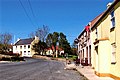
 John Rynn's Bar, Ballinagleragh - geograph.org.uk - 796646.jpg 640 × 480; 74 KB
-
 Looking up Lough Allen - geograph.org.uk - 796579.jpg 640 × 480; 59 KB
-
 Modern house near Ballinagleragh - geograph.org.uk - 1112215.jpg 640 × 480; 94 KB
-
 Moorland at Stralongford - geograph.org.uk - 796903.jpg 640 × 480; 81 KB
-
 Moorland below Bencroy - geograph.org.uk - 796877.jpg 640 × 480; 101 KB
-
 Moorland stream - geograph.org.uk - 1586846.jpg 640 × 480; 129 KB
-
 Mulvey's Bar, Ballinagleragh - geograph.org.uk - 1112803.jpg 640 × 480; 63 KB
-
 Old castle - geograph.org.uk - 788195.jpg 640 × 480; 284 KB
-
 Old cemetery - geograph.org.uk - 788185.jpg 640 × 480; 189 KB
-

-
 Preparing to land at Donegal - geograph.org.uk - 1159594.jpg 639 × 426; 308 KB
-

-
 Rocky outcrop in small inlet - geograph.org.uk - 1025841.jpg 640 × 480; 82 KB
-
 Saint Marys church, Inistioge - geograph.org.uk - 788155.jpg 480 × 640; 208 KB
-

-
 St Hugh's Well - geograph.org.uk - 796639.jpg 640 × 480; 93 KB
-
 The Mountain Tavern, Aghacashel - geograph.org.uk - 796787.jpg 640 × 480; 61 KB
-
 Washing line and kennels - geograph.org.uk - 796801.jpg 640 × 480; 70 KB
-
 Wayside tractor near Glen Bridge - geograph.org.uk - 796562.jpg 640 × 480; 91 KB
-

-
 A steady climb up to Bencroy Hill - geograph.org.uk - 796843.jpg 640 × 480; 68 KB
-
 Aghagrania River - geograph.org.uk - 796601.jpg 640 × 480; 85 KB
-
 Barns at Derreen - geograph.org.uk - 796835.jpg 640 × 480; 70 KB
-
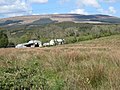
 Bencroy Hill Radio Site - geograph.org.uk - 796868.jpg 640 × 480; 56 KB


.jpg)


