Category:Republic of Ireland photographs taken on 2009-06-03
Countries of Europe: Austria · Belgium · Croatia · Czech Republic · Denmark · Finland · France‡ · Germany · Greece · Hungary · Republic of Ireland · Italy · Kazakhstan‡ · Latvia · Malta · Netherlands‡ · Norway · Poland · Portugal‡ · Romania · Russia‡ · Serbia · Slovakia · Slovenia · Spain‡ · Sweden · Switzerland · Turkey‡ · Ukraine · United Kingdom
‡: partly located in Europe
‡: partly located in Europe
| ← | 3 June 2009 | → | ||
| ← | June 2009 | → | ||

Republic of Ireland photographs taken on 3 June 2009.
Image files should be categorized here automatically using {{taken on}} template. Direct categorisation is also possible, if automatic is impossible.
Media in category "Republic of Ireland photographs taken on 2009-06-03"
The following 158 files are in this category, out of 158 total.
-
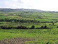
 Ballyargus Townland - geograph.org.uk - 1341225.jpg 640 × 479; 87 KB
-
 Ballyargus Townland - geograph.org.uk - 1341233.jpg 640 × 479; 81 KB
-
 Ballyargus Townland - geograph.org.uk - 1341321.jpg 640 × 479; 62 KB
-
 Ballyargus Townland - geograph.org.uk - 1341326.jpg 640 × 479; 59 KB
-
 Ballyargus Townland - geograph.org.uk - 1341348.jpg 640 × 479; 73 KB
-
 Ballyargus Townland - geograph.org.uk - 1341384.jpg 640 × 479; 71 KB
-
 Ballyargus Townland - geograph.org.uk - 1341388.jpg 640 × 479; 66 KB
-
 Ballyargus Townland - geograph.org.uk - 1341394.jpg 640 × 479; 72 KB
-
 Ballyargus Townland - geograph.org.uk - 1341397.jpg 640 × 479; 61 KB
-
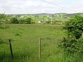
 Ballylawn Townland - geograph.org.uk - 1341110.jpg 640 × 479; 66 KB
-
 Ballylawn Townland - geograph.org.uk - 1341118.jpg 640 × 479; 52 KB
-
 Ballynally Townland - geograph.org.uk - 1341002.jpg 640 × 479; 80 KB
-
 Ballynally Townland - geograph.org.uk - 1341010.jpg 640 × 479; 59 KB
-
 Ballyrattan Townland - geograph.org.uk - 1341136.jpg 640 × 479; 68 KB
-
 Brandon Bay - geograph.org.uk - 1576914.jpg 640 × 427; 46 KB
-
 Carrickmaquigley National School - geograph.org.uk - 1341333.jpg 640 × 479; 59 KB
-
 Cawan Hill - geograph.org.uk - 1341059.jpg 640 × 479; 65 KB
-
 Cawan Hill - geograph.org.uk - 1341064.jpg 640 × 479; 67 KB
-
 Cawan Hill - geograph.org.uk - 1341068.jpg 640 × 479; 71 KB
-
 Cawan Hill - geograph.org.uk - 1341072.jpg 640 × 479; 57 KB
-
 Claggan Townland - geograph.org.uk - 1341031.jpg 640 × 479; 68 KB
-
 Claggan Townland - geograph.org.uk - 1341034.jpg 640 × 479; 74 KB
-
 Claggan Townland - geograph.org.uk - 1341040.jpg 640 × 479; 76 KB
-
 Claggan Townland - geograph.org.uk - 1341045.jpg 640 × 479; 81 KB
-
 Clare Townland - geograph.org.uk - 1341201.jpg 640 × 479; 56 KB
-
 Clare Townland - geograph.org.uk - 1341202.jpg 640 × 479; 70 KB
-
 Cololnasillagh Townland - geograph.org.uk - 1340991.jpg 640 × 479; 64 KB
-
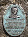 Commemorative Plaque - geograph.org.uk - 1337711.jpg 450 × 600; 328 KB
-
 Condrum Hill - geograph.org.uk - 1341210.jpg 640 × 479; 55 KB
-
 Condrum Hill - geograph.org.uk - 1341214.jpg 640 × 479; 65 KB
-
 Condrum Rocks - geograph.org.uk - 1341408.jpg 640 × 479; 69 KB
-
 Condrum Rocks - geograph.org.uk - 1341409.jpg 640 × 479; 77 KB
-
 Coolnasillagh Townland - geograph.org.uk - 1340995.jpg 640 × 479; 71 KB
-
 Coolnasillagh Townland - geograph.org.uk - 1340999.jpg 640 × 479; 44 KB
-
 Cooly Townland - geograph.org.uk - 1341086.jpg 640 × 479; 77 KB
-
 Cooly Townland - geograph.org.uk - 1341090.jpg 640 × 479; 73 KB
-
 Cooly Townland - geograph.org.uk - 1341093.jpg 640 × 479; 73 KB
-
 Cooly Townland - geograph.org.uk - 1341096.jpg 640 × 479; 79 KB
-
 Cooly Townland - geograph.org.uk - 1341101.jpg 640 × 479; 69 KB
-
 Cooly Townland - geograph.org.uk - 1341107.jpg 640 × 479; 64 KB
-
 Cottage at Cawan Hill - geograph.org.uk - 1341049.jpg 640 × 479; 63 KB
-
 Cottage at Cawan Hill - geograph.org.uk - 1341054.jpg 640 × 479; 48 KB
-
 Cottage near Claggan - geograph.org.uk - 1341029.jpg 640 × 479; 99 KB
-
 Country Lane - geograph.org.uk - 1337220.jpg 600 × 475; 296 KB
-
 Creehennan Townland - geograph.org.uk - 1342278.jpg 640 × 479; 57 KB
-
 Creehennan Townland - geograph.org.uk - 1342282.jpg 640 × 479; 60 KB
-
 Croagh Townland - geograph.org.uk - 1341430.jpg 640 × 479; 88 KB
-
 Cross Townland - geograph.org.uk - 1342286.jpg 640 × 479; 72 KB
-
 Cross Townland - geograph.org.uk - 1342293.jpg 640 × 479; 72 KB
-
 Cross Townland - geograph.org.uk - 1342332.jpg 640 × 479; 57 KB
-
 Cross Townland - geograph.org.uk - 1342334.jpg 640 × 479; 62 KB
-
 Cullineen Townland - geograph.org.uk - 1341236.jpg 640 × 479; 71 KB
-
 Cullineen Townland - geograph.org.uk - 1341244.jpg 640 × 479; 62 KB
-
 Drung Townland - geograph.org.uk - 1341401.jpg 640 × 422; 76 KB
-
 Drung Townland - geograph.org.uk - 1341415.jpg 640 × 479; 48 KB
-
 Drung Townland - geograph.org.uk - 1341418.jpg 640 × 479; 70 KB
-
 Drung Townland - geograph.org.uk - 1341422.jpg 640 × 479; 83 KB
-
 Forest Entrance - geograph.org.uk - 1337867.jpg 600 × 450; 285 KB
-
 Forest Track - geograph.org.uk - 1339524.jpg 600 × 450; 229 KB
-
 Glentogher Townland - geograph.org.uk - 1342327.jpg 640 × 479; 85 KB
-
 Gortnamona Townland - geograph.org.uk - 1342378.jpg 640 × 479; 66 KB
-
 Gortnamona Townland - geograph.org.uk - 1342381.jpg 640 × 479; 56 KB
-
 Gowlane Strand - geograph.org.uk - 1506151.jpg 640 × 427; 51 KB
-
 Hot Hiking - geograph.org.uk - 1339534.jpg 600 × 450; 264 KB
-
 Keeranbane Townland - geograph.org.uk - 1341446.jpg 640 × 479; 77 KB
-
 Keeranbane Townland - geograph.org.uk - 1341450.jpg 640 × 479; 68 KB
-
 Knockalt Townland - geograph.org.uk - 1341012.jpg 640 × 479; 59 KB
-
 Knockalt Townland - geograph.org.uk - 1341022.jpg 640 × 479; 88 KB
-
 Knockalt Townland - geograph.org.uk - 1341027.jpg 640 × 479; 102 KB
-
 L7151 at Meenavanaghan - geograph.org.uk - 1342345.jpg 640 × 479; 79 KB
-
 Lemacrossan Townland - geograph.org.uk - 1342337.jpg 640 × 479; 72 KB
-
 Lemacrossan Townland - geograph.org.uk - 1342339.jpg 640 × 479; 83 KB
-
 Lough Inn - geograph.org.uk - 1341470.jpg 640 × 479; 74 KB
-
 Magheralaghan Townland - geograph.org.uk - 1342352.jpg 640 × 479; 74 KB
-
 Magheralaghan Townland - geograph.org.uk - 1342355.jpg 640 × 479; 97 KB
-
 Meenabaltin Townland - geograph.org.uk - 1342301.jpg 640 × 479; 77 KB
-
 Meenalevin Townland - geograph.org.uk - 1341456.jpg 640 × 479; 68 KB
-
 Meenalevin Townland - geograph.org.uk - 1341461.jpg 640 × 479; 65 KB
-
 Meenalevin Townland - geograph.org.uk - 1341465.jpg 640 × 479; 71 KB
-
 Minehill Bridge - geograph.org.uk - 1342319.jpg 640 × 479; 74 KB
-
 Moneyvola Townland - geograph.org.uk - 1341286.jpg 640 × 479; 87 KB
-
 Moneyvola Townland - geograph.org.uk - 1341290.jpg 640 × 479; 82 KB
-
 Moneyvola Townland - geograph.org.uk - 1341293.jpg 640 × 479; 83 KB
-
 Moneyvola Townland - geograph.org.uk - 1341306.jpg 640 × 479; 67 KB
-
 Moneyvola Townland - geograph.org.uk - 1341312.jpg 640 × 479; 98 KB
-
 Near Brown Shoulder - geograph.org.uk - 1341174.jpg 640 × 479; 66 KB
-
 Near Brown Shoulder - geograph.org.uk - 1341177.jpg 640 × 479; 56 KB
-
 Plaque, Carrickmaquigley School - geograph.org.uk - 1341338.jpg 640 × 369; 65 KB
-
 R242 at Magheralaghan - geograph.org.uk - 1342350.jpg 640 × 479; 68 KB
-
 R242 at Trusk Beg - geograph.org.uk - 1342322.jpg 640 × 479; 57 KB
-
 R242 Road at Meenavanaghan - geograph.org.uk - 1342348.jpg 640 × 479; 53 KB
-
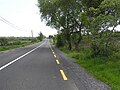
 Road at Ballyargus - geograph.org.uk - 1341228.jpg 640 × 479; 50 KB
-
 Road at Ballyargus - geograph.org.uk - 1341316.jpg 640 × 479; 65 KB
-
 Road at Ballyargus - geograph.org.uk - 1341351.jpg 640 × 479; 54 KB
-
 Road at Ballyargus - geograph.org.uk - 1341391.jpg 640 × 479; 56 KB
-
 Road at Ballylawn - geograph.org.uk - 1341115.jpg 640 × 479; 47 KB
-
 Road at Ballynally - geograph.org.uk - 1341007.jpg 640 × 479; 68 KB
-
 Road at Ballyrattan - geograph.org.uk - 1341131.jpg 640 × 479; 47 KB
-
 Road at Ballyrattan - geograph.org.uk - 1341141.jpg 640 × 479; 58 KB
-
 Road at Claggan - geograph.org.uk - 1341036.jpg 640 × 479; 58 KB
-
 Road at Claggan - geograph.org.uk - 1341041.jpg 640 × 479; 63 KB
-
 Road at Clare - geograph.org.uk - 1341196.jpg 640 × 479; 46 KB
-
 Road at Clare - geograph.org.uk - 1341206.jpg 640 × 479; 42 KB
-
 Road at Condrum Rocks - geograph.org.uk - 1341411.jpg 640 × 479; 57 KB
-
 Road at Coolbrack - geograph.org.uk - 1341082.jpg 640 × 479; 68 KB
-
 Road at Cooly - geograph.org.uk - 1341103.jpg 640 × 479; 63 KB
-
 Road at Creehennan - geograph.org.uk - 1342281.jpg 640 × 479; 74 KB
-
 Road at Croagh - geograph.org.uk - 1341427.jpg 640 × 479; 58 KB
-
 Road at Croagh - geograph.org.uk - 1341435.jpg 640 × 479; 60 KB
-
 Road at Croagh - geograph.org.uk - 1341437.jpg 640 × 479; 42 KB
-
 Road at Crockglass - geograph.org.uk - 1342356.jpg 640 × 479; 42 KB
-
 Road at Crockglass - geograph.org.uk - 1342358.jpg 640 × 479; 56 KB
-
 Road at Cross - geograph.org.uk - 1342291.jpg 640 × 479; 62 KB
-
 Road at Cross - geograph.org.uk - 1342330.jpg 640 × 479; 58 KB
-
 Road at Cullineen - geograph.org.uk - 1341242.jpg 640 × 479; 37 KB
-
 Road at Cullineen - geograph.org.uk - 1341249.jpg 640 × 479; 42 KB
-
 Road at Drung - geograph.org.uk - 1341399.jpg 640 × 479; 63 KB
-
 Road at Drung - geograph.org.uk - 1341406.jpg 640 × 479; 76 KB
-
 Road at Gortnamona - geograph.org.uk - 1342387.jpg 640 × 479; 100 KB
-
 Road at Gortnashade - geograph.org.uk - 1342262.jpg 640 × 479; 60 KB
-
 Road at Keeranbane - geograph.org.uk - 1341444.jpg 640 × 479; 51 KB
-
 Road at Knockalt - geograph.org.uk - 1341016.jpg 640 × 479; 68 KB
-
 Road at Knockalt - geograph.org.uk - 1341024.jpg 640 × 479; 51 KB
-
 Road at Lemacrossan - geograph.org.uk - 1342341.jpg 640 × 479; 83 KB
-
 Road at Meenabaltin - geograph.org.uk - 1342296.jpg 640 × 479; 55 KB
-
 Road at Meenalevin - geograph.org.uk - 1341459.jpg 640 × 479; 55 KB
-
 Road at Meenalevin - geograph.org.uk - 1341468.jpg 640 × 479; 46 KB
-
 Road at Meenavanaghan - geograph.org.uk - 1342344.jpg 640 × 479; 80 KB
-
 Road at Meenscregga - geograph.org.uk - 1341258.jpg 640 × 479; 54 KB
-
 Road at Meenscregga - geograph.org.uk - 1341266.jpg 640 × 479; 69 KB
-
 Road at Moneyvola - geograph.org.uk - 1341299.jpg 640 × 479; 63 KB
-
 Road at Moneyvola - geograph.org.uk - 1341303.jpg 640 × 479; 57 KB
-
 Road at Rock Hill - geograph.org.uk - 1341146.jpg 640 × 479; 54 KB
-
 Road at Rock Hill - geograph.org.uk - 1341161.jpg 640 × 479; 62 KB
-
 Road at Stranagappoge - geograph.org.uk - 1342306.jpg 640 × 479; 69 KB
-
 Road at Stranagappoge - geograph.org.uk - 1342311.jpg 640 × 479; 63 KB
-
 Road at Tullyard - geograph.org.uk - 1341485.jpg 640 × 479; 58 KB
-
 Road at Tullynavinn - geograph.org.uk - 1341219.jpg 640 × 479; 53 KB
-
 Road near Brown Shoulder - geograph.org.uk - 1341168.jpg 640 × 479; 54 KB
-
 Road near Johnston's Bridge - geograph.org.uk - 1342324.jpg 640 × 479; 61 KB
-
 Rock Hill - geograph.org.uk - 1341150.jpg 640 × 479; 49 KB
-
 Rock Hill - geograph.org.uk - 1341156.jpg 640 × 479; 68 KB
-
 Ruin, Meenscregga - geograph.org.uk - 1341261.jpg 640 × 479; 83 KB
-
 Sheepfield in Cloghane - geograph.org.uk - 1478913.jpg 640 × 427; 82 KB
-
 Stranagappoge Townland - geograph.org.uk - 1342309.jpg 640 × 479; 64 KB
-
 Trebracken Townland - geograph.org.uk - 1342362.jpg 640 × 479; 57 KB
-
 Trebracken Townland - geograph.org.uk - 1342363.jpg 640 × 479; 57 KB
-
 Trebracken Townland - geograph.org.uk - 1342375.jpg 640 × 479; 51 KB
-
 Trusk Beg - geograph.org.uk - 1342313.jpg 640 × 461; 65 KB
-
 Trusk Beg - geograph.org.uk - 1342323.jpg 640 × 479; 97 KB
-
 Tullyard Townland - geograph.org.uk - 1341477.jpg 640 × 479; 79 KB
-
 Tullyard Townland - geograph.org.uk - 1341516.jpg 640 × 479; 71 KB
-
 Tullyard Townland - geograph.org.uk - 1342266.jpg 640 × 479; 63 KB
-
 Tullyard Townland - geograph.org.uk - 1342273.jpg 640 × 479; 79 KB
-
 Tullynavinn Townland - geograph.org.uk - 1341220.jpg 640 × 479; 49 KB
-
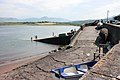
 Brandon Harbour - geograph.org.uk - 1506070.jpg 640 × 427; 77 KB
-
 Brandon Harbour - geograph.org.uk - 1506083.jpg 640 × 427; 74 KB
-
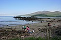 Cappagh Strand - geograph.org.uk - 1506111.jpg 640 × 427; 61 KB


