Category:Republic of Ireland photographs taken on 2009-06-23
Countries of Europe: Belarus · Belgium · Bulgaria · Croatia · Denmark · Estonia · Finland · France‡ · Germany · Greece · Hungary · Iceland · Republic of Ireland · Italy · Latvia · Lithuania · Montenegro · Netherlands‡ · Norway · Poland · Romania · Russia‡ · Spain‡ · Sweden · Switzerland · Turkey‡ · Ukraine · United Kingdom · Vatican City
‡: partly located in Europe
‡: partly located in Europe
| ← | 23 June 2009 | → | ||
| ← | June 2009 | → | ||

Republic of Ireland photographs taken on 23 June 2009.
Image files should be categorized here automatically using {{taken on}} template. Direct categorisation is also possible, if automatic is impossible.
Media in category "Republic of Ireland photographs taken on 2009-06-23"
The following 200 files are in this category, out of 206 total.
(previous page) (next page)-
 'Culdaff Arms', Culdaff, Co. Donegal - geograph.org.uk - 1383860.jpg 640 × 480; 65 KB
-
 Aghilly Townland - geograph.org.uk - 1368339.jpg 640 × 479; 65 KB
-
 Aghilly Townland - geograph.org.uk - 1368342.jpg 640 × 479; 82 KB
-
 Ancient stones, Meenkeragh - geograph.org.uk - 1368280.jpg 640 × 479; 76 KB
-
 Ardbane Townland - geograph.org.uk - 1368369.jpg 640 × 479; 80 KB
-
 Ardbane Townland - geograph.org.uk - 1368371.jpg 640 × 479; 77 KB
-
 Ballymagan Townland - geograph.org.uk - 1368356.jpg 640 × 479; 78 KB
-
 Ballynarry Townland - geograph.org.uk - 1368445.jpg 640 × 479; 68 KB
-
 Bauville Keeloges and Clonglash - geograph.org.uk - 1368283.jpg 640 × 479; 77 KB
-
 Bauville Keeloges and Clonglash - geograph.org.uk - 1368285.jpg 640 × 479; 79 KB
-
 Bauville Keeloges and Clonglash - geograph.org.uk - 1368291.jpg 640 × 479; 59 KB
-
 Bauville Keeloges and Clonglash - geograph.org.uk - 1368294.jpg 640 × 479; 61 KB
-
 Castles of Munster, Ardfinnan, Tipperary - geograph.org.uk - 1393364.jpg 1,024 × 683; 975 KB
-
 Church at Meenalooban - geograph.org.uk - 1368488.jpg 640 × 479; 80 KB
-
 Clamperland Townland - geograph.org.uk - 1368318.jpg 640 × 479; 73 KB
-
 Clamperland Townland - geograph.org.uk - 1368324.jpg 640 × 479; 68 KB
-
 Clamperland Townland - geograph.org.uk - 1368327.jpg 640 × 479; 55 KB
-
 Clonbeg Townland - geograph.org.uk - 1368437.jpg 640 × 479; 93 KB
-
 Clonblosk Townland - geograph.org.uk - 1368330.jpg 640 × 479; 68 KB
-
 Clonblosk Townland - geograph.org.uk - 1368332.jpg 640 × 479; 68 KB
-
 Clonblosk Townland - geograph.org.uk - 1368335.jpg 640 × 479; 88 KB
-
 Cockhill Townland - geograph.org.uk - 1368428.jpg 640 × 479; 82 KB
-
 Cottage at Dunree - geograph.org.uk - 1368545.jpg 640 × 479; 102 KB
-
 Cottage at Dunree - geograph.org.uk - 1368550.jpg 640 × 479; 90 KB
-
 Courtyard, Loreto Building - geograph.org.uk - 1368483.jpg 640 × 251; 36 KB
-
 Crossroads at Garrynabullogy - geograph.org.uk - 1368447.jpg 640 × 479; 77 KB
-
 Crummie's Bay, Dunree - geograph.org.uk - 1368627.jpg 640 × 479; 57 KB
-
 Crummie's Bay, Dunree - geograph.org.uk - 1368661.jpg 640 × 479; 72 KB
-
 Culdaff Village Hall, Co. Donegal - geograph.org.uk - 1383903.jpg 640 × 480; 62 KB
-
 Desertegny Townland - geograph.org.uk - 1368509.jpg 640 × 479; 71 KB
-
 Desertegny Townland - geograph.org.uk - 1368512.jpg 640 × 479; 102 KB
-
 Druminderry Townland - geograph.org.uk - 1368302.jpg 640 × 479; 75 KB
-
 Druminderry Townland - geograph.org.uk - 1368303.jpg 640 × 479; 82 KB
-
 Druminderry Townland - geograph.org.uk - 1368377.jpg 640 × 479; 89 KB
-
 Druminderry Townland - geograph.org.uk - 1368379.jpg 640 × 479; 71 KB
-
 Druminderry Townland - geograph.org.uk - 1368409.jpg 640 × 479; 77 KB
-
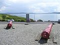
 Dunree Fort - geograph.org.uk - 1368577.jpg 640 × 479; 58 KB
-
 Dunree Fort buildings Geograph 1368617 727ad847.jpg 640 × 281; 35 KB
-
 Dunree Fort Geograph 1368563 13461447.jpg 640 × 479; 76 KB
-
 Dunree Fort old muzzle-loading cannons Geograph 1368605 e86b6ff6.jpg 640 × 479; 72 KB
-
 Dunree Fort outbuildings Geograph 1368609 f62f2928.jpg 640 × 479; 70 KB
-
 Dunree Head - geograph.org.uk - 1368571.jpg 640 × 479; 66 KB
-
 Dunree Head - geograph.org.uk - 1368591.jpg 640 × 478; 56 KB
-
 Foffenagh Townland - geograph.org.uk - 1368387.jpg 640 × 479; 82 KB
-
 Foffenagh Townland - geograph.org.uk - 1368395.jpg 640 × 479; 87 KB
-
 Footpath beside the River Suir - geograph.org.uk - 1398723.jpg 640 × 480; 272 KB
-
 Fort Dunree - 2 6-inch Mk VII guns Geograph 1368587 b01a5670.jpg 640 × 479; 84 KB
-
 Fort Dunree - old muzzle-loader Geograph 1368580 71b12c96.jpg 640 × 479; 80 KB
-
 Glebe Townland - geograph.org.uk - 1368514.jpg 640 × 479; 70 KB
-
 Gortleck Townland - geograph.org.uk - 1368724.jpg 640 × 479; 74 KB
-
 Gortleck Townland - geograph.org.uk - 1368725.jpg 640 × 479; 63 KB
-
 Gortyarrigan Townland - geograph.org.uk - 1368779.jpg 640 × 479; 60 KB
-
 Gortyarrigan Townland - geograph.org.uk - 1368783.jpg 640 × 479; 50 KB
-
 Granshaw Townland - geograph.org.uk - 1368133.jpg 640 × 479; 60 KB
-
 House at Tullydush - geograph.org.uk - 1368184.jpg 640 × 479; 71 KB
-

-
 Junction of the tracks - geograph.org.uk - 1384512.jpg 640 × 480; 124 KB
-
 Kilsheelan Bridge on the River Suir - geograph.org.uk - 1398661.jpg 640 × 480; 256 KB
-
 Land near Lislin Hill - geograph.org.uk - 1368460.jpg 640 × 479; 112 KB
-
 Lane near Lislin Hill - geograph.org.uk - 1368457.jpg 640 × 479; 80 KB
-
 Lenynarnan Townland - geograph.org.uk - 1368155.jpg 640 × 479; 61 KB
-
 Lenynarnan Townland - geograph.org.uk - 1368166.jpg 640 × 479; 66 KB
-
 Lenynarnan Townland - geograph.org.uk - 1368169.jpg 640 × 479; 65 KB
-
 Liafin Townland - geograph.org.uk - 1368766.jpg 640 × 479; 41 KB
-
 Lighthouse, Dunree Head - geograph.org.uk - 1368599.jpg 640 × 479; 81 KB
-
 Logan Close - geograph.org.uk - 1368126.jpg 640 × 479; 56 KB
-
 Logan Close - geograph.org.uk - 1368127.jpg 640 × 479; 70 KB
-
 Loreto Building, Buncrana - geograph.org.uk - 1368463.jpg 640 × 342; 38 KB
-
 Loreto House, Linsfort, Buncrana - geograph.org.uk - 1368485.jpg 640 × 479; 60 KB
-
 Lough Swilly, near Buncrana - geograph.org.uk - 1368471.jpg 640 × 479; 63 KB
-
 McDaid's Superstore - geograph.org.uk - 1368347.jpg 640 × 479; 62 KB
-

-
 Meenalooban Townland - geograph.org.uk - 1368491.jpg 640 × 479; 72 KB
-
 Meenalooban Townland - geograph.org.uk - 1368495.jpg 640 × 479; 75 KB
-
 Meenamullaghan Townland - geograph.org.uk - 1368416.jpg 640 × 479; 71 KB
-
 Meenamullaghan Townland - geograph.org.uk - 1368419.jpg 640 × 479; 105 KB
-
 Meenamullaghan Townland - geograph.org.uk - 1368424.jpg 640 × 479; 103 KB
-
 Meenkeeragh Townland - geograph.org.uk - 1368262.jpg 640 × 479; 51 KB
-
 Meenkeeragh Townland - geograph.org.uk - 1368264.jpg 640 × 479; 66 KB
-
 Meenkeeragh Townland - geograph.org.uk - 1368266.jpg 640 × 479; 77 KB
-
 Meenkeeragh Townland - geograph.org.uk - 1368271.jpg 640 × 479; 39 KB
-
 Meenkeeragh Townland - geograph.org.uk - 1368276.jpg 640 × 479; 51 KB
-
 Milltown Townland - geograph.org.uk - 1368672.jpg 640 × 479; 79 KB
-
 Milltown Townland - geograph.org.uk - 1368680.jpg 640 × 479; 69 KB
-
 Milltown Townland - geograph.org.uk - 1368687.jpg 640 × 479; 94 KB
-
 Muineagh Townland - geograph.org.uk - 1368533.jpg 640 × 479; 95 KB
-
 Muineagh Townland - geograph.org.uk - 1368537.jpg 640 × 479; 77 KB
-
 Muineagh Townland - geograph.org.uk - 1368540.jpg 640 × 479; 61 KB
-
 Near Dunree Head - geograph.org.uk - 1368557.jpg 640 × 479; 90 KB
-
 New Bridge - geograph.org.uk - 1388098.jpg 600 × 450; 193 KB
-
 Old Mountain - geograph.org.uk - 1368748.jpg 640 × 479; 54 KB
-
 Old Mountain Townland - geograph.org.uk - 1368754.jpg 640 × 479; 79 KB
-
 Owenkillew Townland - geograph.org.uk - 1368208.jpg 640 × 479; 55 KB
-

-
 Pump, Culdaff, Co.Donegal - geograph.org.uk - 1383937.jpg 640 × 480; 95 KB
-
 Rail and Road Bridges - geograph.org.uk - 1389448.jpg 576 × 414; 138 KB
-
 RC Church at Glebe - geograph.org.uk - 1368518.jpg 640 × 479; 54 KB
-
 Red Iron Bridge - geograph.org.uk - 1388086.jpg 600 × 450; 221 KB
-
 Rhododendrons by the stream - geograph.org.uk - 1395027.jpg 480 × 640; 281 KB
-
 Road at Aghilly - geograph.org.uk - 1368340.jpg 640 × 479; 53 KB
-
 Road at Ardbane - geograph.org.uk - 1368368.jpg 640 × 479; 62 KB
-
 Road at Ardbane - geograph.org.uk - 1368375.jpg 640 × 479; 85 KB
-
 Road at Ballymagan - geograph.org.uk - 1368357.jpg 640 × 479; 75 KB
-
 Road at Ballynarry - geograph.org.uk - 1368443.jpg 640 × 479; 98 KB
-

-

-
 Road at Clamperland - geograph.org.uk - 1368316.jpg 640 × 479; 58 KB
-
 Road at Clamperland - geograph.org.uk - 1368322.jpg 640 × 479; 62 KB
-
 Road at Clonbeg - geograph.org.uk - 1368435.jpg 640 × 479; 56 KB
-
 Road at Clonblosk - geograph.org.uk - 1368337.jpg 640 × 479; 62 KB
-
 Road at Cockhill - geograph.org.uk - 1368344.jpg 640 × 479; 54 KB
-
 Road at Cockhill - geograph.org.uk - 1368426.jpg 640 × 479; 63 KB
-
 Road at Druminderry - geograph.org.uk - 1368300.jpg 640 × 479; 80 KB
-
 Road at Druminderry - geograph.org.uk - 1368383.jpg 640 × 479; 57 KB
-
 Road at Druminderry - geograph.org.uk - 1368403.jpg 640 × 479; 77 KB
-
 Road at Druminderry - geograph.org.uk - 1368406.jpg 640 × 479; 63 KB
-
 Road at Druminore - geograph.org.uk - 1368441.jpg 640 × 479; 67 KB
-
 Road at Drumnacross - geograph.org.uk - 1368758.jpg 640 × 479; 58 KB
-
 Road at Drumnacross - geograph.org.uk - 1368761.jpg 640 × 479; 51 KB
-
 Road at Dunree - geograph.org.uk - 1368554.jpg 640 × 479; 70 KB
-
 Road at Foffenagh - geograph.org.uk - 1368389.jpg 640 × 479; 63 KB
-
 Road at Foffenagh - geograph.org.uk - 1368392.jpg 640 × 479; 67 KB
-
 Road at Garrynabullogy - geograph.org.uk - 1368450.jpg 640 × 479; 91 KB
-
 Road at Gortleck - geograph.org.uk - 1368727.jpg 640 × 479; 58 KB
-
 Road at Granshaw - geograph.org.uk - 1368137.jpg 640 × 479; 63 KB
-
 Road at Granshaw - geograph.org.uk - 1368139.jpg 640 × 479; 49 KB
-
 Road at Lenynarnan - geograph.org.uk - 1368162.jpg 640 × 479; 45 KB
-
 Road at Liafin - geograph.org.uk - 1368771.jpg 640 × 479; 75 KB
-
 Road at Logan Close - geograph.org.uk - 1368125.jpg 640 × 479; 55 KB
-
 Road at Meenalooban - geograph.org.uk - 1368499.jpg 640 × 479; 63 KB
-
 Road at Meenalooban - geograph.org.uk - 1368503.jpg 640 × 479; 64 KB
-
 Road at Meenamullaghan - geograph.org.uk - 1368414.jpg 640 × 479; 74 KB
-
 Road at Meenamullaghan - geograph.org.uk - 1368420.jpg 640 × 479; 63 KB
-
 Road at Meenamullaghan - geograph.org.uk - 1368423.jpg 640 × 281; 28 KB
-
 Road at Meenkeeragh - geograph.org.uk - 1368273.jpg 640 × 479; 72 KB
-
 Road at Milltown - geograph.org.uk - 1368676.jpg 640 × 479; 87 KB
-
 Road at Milltown - geograph.org.uk - 1368682.jpg 640 × 479; 80 KB
-
 Road at Old Mountain - geograph.org.uk - 1368749.jpg 640 × 479; 57 KB
-
 Road at Old Mountain - geograph.org.uk - 1368756.jpg 640 × 479; 51 KB
-
 Road at Owenkillew - geograph.org.uk - 1368205.jpg 640 × 479; 52 KB
-
 Road at Owenkillew - geograph.org.uk - 1368210.jpg 640 × 479; 51 KB
-
 Road at Sharagore - geograph.org.uk - 1368690.jpg 640 × 479; 62 KB
-
 Road at Sharagore - geograph.org.uk - 1368699.jpg 640 × 479; 56 KB
-
 Road at Sharagore Upper - geograph.org.uk - 1368714.jpg 640 × 479; 62 KB
-
 Road at Sharagore Upper - geograph.org.uk - 1368720.jpg 640 × 479; 72 KB
-
 Road at Sorne - geograph.org.uk - 1368217.jpg 640 × 479; 59 KB
-
 Road at Sorne - geograph.org.uk - 1368220.jpg 640 × 479; 57 KB
-
 Road at Trillick - geograph.org.uk - 1368147.jpg 640 × 479; 45 KB
-
 Road at Tullydish Upper - geograph.org.uk - 1368193.jpg 640 × 479; 52 KB
-
 Road at Tullydush - geograph.org.uk - 1368188.jpg 640 × 479; 71 KB
-
 Road outside the Loreto Building - geograph.org.uk - 1368468.jpg 640 × 479; 69 KB
-
 Rooad at Desertegny - geograph.org.uk - 1368506.jpg 640 × 479; 48 KB
-
 Scotch Quay - geograph.org.uk - 1392739.jpg 640 × 512; 78 KB
-
 Scrap Iron - geograph.org.uk - 1384861.jpg 640 × 480; 109 KB
-
 Sharagore Upper - geograph.org.uk - 1368692.jpg 640 × 479; 88 KB
-
 Sharagore Upper - geograph.org.uk - 1368694.jpg 640 × 479; 72 KB
-
 Sharagore Upper - geograph.org.uk - 1368717.jpg 640 × 479; 74 KB
-
 Sharagore Upper - geograph.org.uk - 1368719.jpg 640 × 479; 77 KB
-
 Sorne Townland - geograph.org.uk - 1368212.jpg 640 × 479; 61 KB
-
 Sorne Townland - geograph.org.uk - 1368215.jpg 640 × 479; 57 KB
-
 Sorne Townland - geograph.org.uk - 1368222.jpg 640 × 479; 75 KB
-
 St Mary's RC Church, Cockhill - geograph.org.uk - 1368352.jpg 640 × 562; 89 KB
-
 St Patrick's School, Glebe - geograph.org.uk - 1368521.jpg 640 × 479; 66 KB
-
 St Patrick's School, Glebe - geograph.org.uk - 1368529.jpg 640 × 479; 51 KB
-

-
 St.Anne`s Park-Rose Garden,Dublin,Ireland - panoramio (1).jpg 3,888 × 2,592; 4.73 MB
-
 St.Anne`s Park-Rose Garden,Dublin,Ireland - panoramio (10).jpg 3,888 × 2,592; 6.21 MB
-
 St.Anne`s Park-Rose Garden,Dublin,Ireland - panoramio (11).jpg 3,888 × 2,592; 5.77 MB
-
 St.Anne`s Park-Rose Garden,Dublin,Ireland - panoramio (12).jpg 3,888 × 2,592; 5.37 MB
-
 St.Anne`s Park-Rose Garden,Dublin,Ireland - panoramio (13).jpg 3,888 × 2,592; 6.09 MB
-
 St.Anne`s Park-Rose Garden,Dublin,Ireland - panoramio (14).jpg 3,888 × 2,592; 4.44 MB
-
 St.Anne`s Park-Rose Garden,Dublin,Ireland - panoramio (15).jpg 3,888 × 2,592; 4.39 MB
-
 St.Anne`s Park-Rose Garden,Dublin,Ireland - panoramio (16).jpg 3,888 × 2,592; 4.94 MB
-
 St.Anne`s Park-Rose Garden,Dublin,Ireland - panoramio (17).jpg 3,888 × 2,592; 4.86 MB
-
 St.Anne`s Park-Rose Garden,Dublin,Ireland - panoramio (18).jpg 3,888 × 2,592; 5.34 MB
-
 St.Anne`s Park-Rose Garden,Dublin,Ireland - panoramio (19).jpg 3,888 × 2,592; 5.67 MB
-
 St.Anne`s Park-Rose Garden,Dublin,Ireland - panoramio (2).jpg 3,888 × 2,592; 4.48 MB
-
 St.Anne`s Park-Rose Garden,Dublin,Ireland - panoramio (20).jpg 3,888 × 2,592; 3.14 MB
-
 St.Anne`s Park-Rose Garden,Dublin,Ireland - panoramio (21).jpg 3,888 × 2,592; 5.27 MB
-
 St.Anne`s Park-Rose Garden,Dublin,Ireland - panoramio (22).jpg 3,888 × 2,592; 4.49 MB
-
 St.Anne`s Park-Rose Garden,Dublin,Ireland - panoramio (23).jpg 3,888 × 2,592; 3.89 MB
-
 St.Anne`s Park-Rose Garden,Dublin,Ireland - panoramio (24).jpg 3,888 × 2,592; 4.71 MB
-
 St.Anne`s Park-Rose Garden,Dublin,Ireland - panoramio (25).jpg 3,888 × 2,592; 4.38 MB
-
 St.Anne`s Park-Rose Garden,Dublin,Ireland - panoramio (26).jpg 3,888 × 2,592; 4.04 MB
-
 St.Anne`s Park-Rose Garden,Dublin,Ireland - panoramio (27).jpg 3,888 × 2,592; 3.83 MB
-
 St.Anne`s Park-Rose Garden,Dublin,Ireland - panoramio (28).jpg 3,888 × 2,592; 3.46 MB
-
 St.Anne`s Park-Rose Garden,Dublin,Ireland - panoramio (29).jpg 3,888 × 2,592; 3.97 MB
-
 St.Anne`s Park-Rose Garden,Dublin,Ireland - panoramio (3).jpg 3,888 × 2,592; 4.29 MB
-
 St.Anne`s Park-Rose Garden,Dublin,Ireland - panoramio (4).jpg 3,888 × 2,592; 6.06 MB
-
 St.Anne`s Park-Rose Garden,Dublin,Ireland - panoramio (5).jpg 3,888 × 2,592; 4.17 MB
-
 St.Anne`s Park-Rose Garden,Dublin,Ireland - panoramio (6).jpg 3,888 × 2,592; 4.24 MB
-
 St.Anne`s Park-Rose Garden,Dublin,Ireland - panoramio (7).jpg 3,888 × 2,592; 5.55 MB
-
 St.Anne`s Park-Rose Garden,Dublin,Ireland - panoramio (8).jpg 3,888 × 2,592; 5.23 MB
-
 St.Anne`s Park-Rose Garden,Dublin,Ireland - panoramio (9).jpg 3,888 × 2,592; 5.97 MB
-
 St.Anne`s Park-Rose Garden,Dublin,Ireland - panoramio.jpg 3,888 × 2,592; 6.87 MB
-

-
 Stragill Strand - geograph.org.uk - 1368452.jpg 640 × 479; 67 KB
-
 Stragill Strand - geograph.org.uk - 1368455.jpg 640 × 479; 61 KB
-
 The V of 'The Vee' - geograph.org.uk - 1395057.jpg 640 × 480; 261 KB
-
 Tranquil garden, Loreto Building - geograph.org.uk - 1368480.jpg 640 × 479; 70 KB


,_Culdaff,_Co.Donegal_-_geograph.org.uk_-_1383868.jpg)
.jpg)
.jpg)
.jpg)
.jpg)
.jpg)
.jpg)
.jpg)
.jpg)
.jpg)
.jpg)
.jpg)
.jpg)
.jpg)
.jpg)
.jpg)
.jpg)
.jpg)
.jpg)
.jpg)
.jpg)
.jpg)
.jpg)
.jpg)
.jpg)
.jpg)
.jpg)
.jpg)
.jpg)
.jpg)


