Category:Rishworth branch line
disused railway line in West Yorkshire, England   | |||||
| Upload media | |||||
| Instance of | |||||
|---|---|---|---|---|---|
| Location | West Yorkshire, Yorkshire and the Humber, England | ||||
| Owned by | |||||
| Date of official opening |
| ||||
| Date of official closure |
| ||||
| |||||
Media in category "Rishworth branch line"
The following 30 files are in this category, out of 30 total.
-
 Rishworth Branch Line.png 1,547 × 1,557; 1.16 MB
-

-
 Bridge over the disused Rishworth branch line - geograph.org.uk - 3966635.jpg 2,000 × 1,442; 1.32 MB
-
 Bridge over the old railway near Dodge Royd Wood - geograph.org.uk - 3104590.jpg 2,048 × 1,536; 534 KB
-
 Cutting on the Rishworth branch line - geograph.org.uk - 3966615.jpg 2,000 × 1,477; 1.49 MB
-
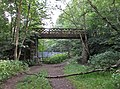
 Footbridge for Sowerby Bridge FP134 - geograph.org.uk - 3966627.jpg 2,000 × 1,499; 1.63 MB
-
 Footbridge over disused railway - geograph.org.uk - 224676.jpg 640 × 436; 85 KB
-
 Footbridge over the disused railway, Norland - geograph.org.uk - 4763543.jpg 1,536 × 2,048; 951 KB
-
 Footbridge over the disused Rishworth branch line - geograph.org.uk - 3966647.jpg 2,000 × 1,500; 1.69 MB
-
 Gas installation on the disused railway - geograph.org.uk - 3967957.jpg 2,000 × 1,499; 1.77 MB
-

-
 Milepost 31 - geograph.org.uk - 519960.jpg 640 × 480; 229 KB
-
 On the footbridge over the disused railway, Norland - geograph.org.uk - 4884452.jpg 1,536 × 2,048; 750 KB
-
 Railway bridge on Stansfield Mill Lane, Norland - geograph.org.uk - 2942313.jpg 2,000 × 1,500; 1.31 MB
-
 Railway bridge, Norland - geograph.org.uk - 1503548.jpg 640 × 480; 191 KB
-
 Railway bridge, Norland - geograph.org.uk - 1503560.jpg 640 × 480; 182 KB
-
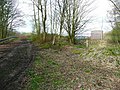
 Railway cutting northeast of Stansfield Lane - geograph.org.uk - 3104583.jpg 2,048 × 1,536; 511 KB
-
 Railway cutting on the Rishworth branch line - geograph.org.uk - 3966612.jpg 2,000 × 1,500; 1.73 MB
-
 Railway path, Triangle - geograph.org.uk - 224681.jpg 640 × 437; 87 KB
-
 Rishworth Branch 1 (2826163920).jpg 1,852 × 1,850; 4.42 MB
-
 Rishworth Branch 2 (2826157480).jpg 2,560 × 1,920; 5.18 MB
-
 Ryburn Valley footpath. - geograph.org.uk - 518939.jpg 640 × 359; 127 KB
-
-
 Station House, Norland (geograph 2942218).jpg 2,000 × 1,500; 1.16 MB
-
 Steps up to footbridge over the disused railway, Norland - geograph.org.uk - 4884448.jpg 1,536 × 2,048; 915 KB
-

-
 The end of the disused railway track - geograph.org.uk - 3967968.jpg 2,000 × 1,500; 1.64 MB
-

-
 The old railway at the Stansfield Lane bridge - geograph.org.uk - 3104576.jpg 2,048 × 1,536; 515 KB
-
 Water chute in railway embankment - geograph.org.uk - 3966631.jpg 2,000 × 1,500; 1.88 MB


.jpg)
.jpg)


.jpg)


