Category:Road maps of Arizona
States of the United States: Alabama · Alaska · Arizona · Arkansas · California · Colorado · Connecticut · Delaware · Florida · Georgia · Hawaii · Idaho · Illinois · Indiana · Iowa · Kansas · Kentucky · Louisiana · Maine · Maryland · Massachusetts · Michigan · Minnesota · Mississippi · Missouri · Montana · Nebraska · Nevada · New Hampshire · New Jersey · New Mexico · New York · North Carolina · North Dakota · Ohio · Oklahoma · Oregon · Pennsylvania · Rhode Island · South Carolina · South Dakota · Tennessee · Texas · Utah · Vermont · Virginia · Washington · West Virginia · Wisconsin · Wyoming – Washington, D.C.
Puerto Rico
Puerto Rico
Subcategories
This category has the following 4 subcategories, out of 4 total.
Media in category "Road maps of Arizona"
The following 12 files are in this category, out of 12 total.
-
 Arizona State Route 143 map.png 2,205 × 1,286; 73 KB
-
 Arizona-Roads-GIS.png 10,000 × 10,000; 29.31 MB
-
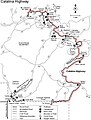 Catalina Highway Map.jpg 552 × 727; 73 KB
-
 Map of the stack.svg 806 × 538; 568 KB
-
 Map of the Sunshine Highway WDL11546.png 1,024 × 3,485; 5.98 MB
-
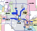 Maricopa County METRO Light Rail Map.svg 650 × 550; 403 KB
-
 Mini Stack map.svg 806 × 538; 92 KB
-
 Phoenix Area Freeways map.svg 817 × 663; 678 KB
-
 Phoenix Metro Area Future Freeway System.svg 3,600 × 2,300; 361 KB
-
 Road Map of Central Phoenix.png 1,616 × 905; 1,006 KB
-
 SR 143 2016.jpg 2,480 × 3,507; 446 KB
-
 SuperRedTan map.svg 806 × 538; 46 KB


