Category:Road maps of Maryland
States of the United States: Alabama · Alaska · Arizona · Arkansas · California · Colorado · Connecticut · Delaware · Florida · Georgia · Hawaii · Idaho · Illinois · Indiana · Iowa · Kansas · Kentucky · Louisiana · Maine · Maryland · Massachusetts · Michigan · Minnesota · Mississippi · Missouri · Montana · Nebraska · Nevada · New Hampshire · New Jersey · New Mexico · New York · North Carolina · North Dakota · Ohio · Oklahoma · Oregon · Pennsylvania · Rhode Island · South Carolina · South Dakota · Tennessee · Texas · Utah · Vermont · Virginia · Washington · West Virginia · Wisconsin · Wyoming – Washington, D.C.
Puerto Rico
Puerto Rico
Subcategories
This category has the following 4 subcategories, out of 4 total.
Media in category "Road maps of Maryland"
The following 42 files are in this category, out of 42 total.
-
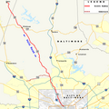
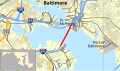 Baltimore Harbor Tunnel map.svg 1,004 × 591; 1.65 MB
-
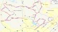
 Capital Beltway Map Color.svg 564 × 489; 279 KB
-
 Fort McHenry Tunnel map.svg 1,004 × 591; 1.65 MB
-
 I-68 map.svg 1,027 × 609; 876 KB
-
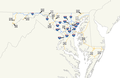 Maryland Interstates and U.S. highways map with shields.png 933 × 610; 57 KB
-
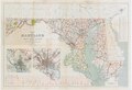
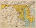
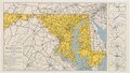
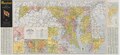
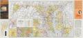
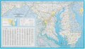
 Maryland State Highway Map - 1930.jpg 10,420 × 7,076; 11.95 MB
-
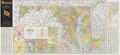
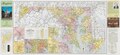
 Maryland State Highway Map - 1933.pdf 7,745 × 5,291; 13.45 MB
-
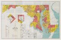
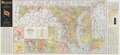
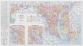
 Maryland State Highway Map - 1935.pdf 7,862 × 5,347; 12.61 MB
-
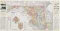
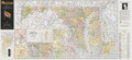
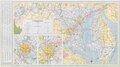
 Maryland State Highway Map - 1936.pdf 3,658 × 2,841, 2 pages; 6.3 MB
-
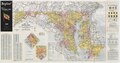
 Maryland State Highway Map - 1938.pdf 4,414 × 2,502; 4.09 MB
-
 Maryland State Highway Map - 1939.pdf 6,025 × 3,360; 7.49 MB
-
 Maryland State Highway Map - 1940.pdf 7,164 × 4,729, 2 pages; 18.38 MB
-
 Maryland State Highway Map - 1946.pdf 5,887 × 3,097; 30.27 MB
-
 Maryland State Highway Map - 1948.pdf 5,887 × 3,081, 2 pages; 12.82 MB
-
 Maryland State Highway Map - 1949.pdf 5,895 × 3,095, 2 pages; 13.22 MB
-
 Maryland State Highway Map - 1950.pdf 6,085 × 2,814, 2 pages; 13.09 MB
-
 Maryland State Highway Map - 1951.pdf 6,085 × 2,814, 2 pages; 13.37 MB
-
 Maryland State Highway Map - 1953.pdf 6,085 × 2,814, 2 pages; 13.55 MB
-
 Maryland State Highway Map - 1954.pdf 6,085 × 2,814, 2 pages; 11.63 MB
-
 Maryland State Highway Map - 1955.pdf 6,085 × 2,822, 2 pages; 11.88 MB
-
 Maryland State Highway Map - 1956.pdf 6,064 × 2,787, 2 pages; 11.7 MB
-
 Maryland State Highway Map - 1957.pdf 6,100 × 2,856, 2 pages; 10.93 MB
-
 Maryland State Highway Map - 1959.pdf 6,058 × 2,793, 2 pages; 11.38 MB
-
 Maryland State Highway Map - 1960.pdf 6,472 × 3,604, 2 pages; 16.03 MB
-
 Maryland State Highway Map - 1970.pdf 6,477 × 3,595, 2 pages; 15.83 MB
-
 Maryland State Highway Map - 1980.pdf 6,154 × 3,604, 2 pages; 16.35 MB
-
 MD Interstates and US Highways map with shields darkerborders.png 3,149 × 2,299; 242 KB
-
 MD Interstates and US Highways map with shields.png 3,149 × 2,299; 242 KB
-
 MD Scenic Byway 10, Lower Susquehanna Map.png 1,300 × 1,050; 218 KB
-
 MD Scenic Byway 11, Charles Street Map.png 1,845 × 1,543; 1.27 MB
-
 MD Scenic Byway 12, National Historic Seaport Map.png 1,916 × 1,050; 935 KB
-
 MD Scenic Byway 13, Star-Spangled Banner Map.png 1,196 × 1,770; 841 KB
-
 MD Scenic Byway 16, Religious Freedom Tour Map.png 1,681 × 1,011; 476 KB
-
 MD Scenic byway 7, Mason and Dixon Map.png 1,840 × 450; 292 KB
-
 MD Scenic byway 8, Falls Road Map.png 1,050 × 1,050; 353 KB
-
 MD Scenic Byway 9, Horses and Hounds Map.png 1,840 × 1,010; 421 KB
-
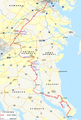
 Route 286 (DE-MD) map.svg 1,028 × 610; 1.34 MB
-
 SilverSpringCDP2010.PNG 888 × 520; 108 KB
-
 Sligo Creek Parkway map.svg 1,004 × 591; 3.01 MB
-
 Suitland Parkway map.svg 1,004 × 591; 3.09 MB
-
 US 113 (DE-MD) map.svg 1,180 × 688; 1.62 MB
-
 WBR-1795.png 1,642 × 1,389; 1.97 MB


_map.svg)


_map.svg)
