Category:Road signs in Citrus County, Florida
Counties of Florida: Alachua · Baker · Bay · Bradford · Brevard · Broward · Calhoun · Charlotte · Citrus · Clay · Collier · Columbia · Dixie · Duval · Escambia · Flagler · Franklin · Gadsden · Gilchrist · Glades · Hamilton · Hardee · Hendry · Hernando · Highlands · Hillsborough · Holmes · Indian River · Jackson · Jefferson · Lafayette · Lake · Lee · Leon · Levy · Liberty · Madison · Manatee · Marion · Martin · Miami-Dade · Monroe · Nassau · Okaloosa · Okeechobee · Orange · Osceola · Palm Beach · Pasco · Pinellas · Polk · Putnam · Santa Rosa · Sarasota · Seminole · St. Johns · St. Lucie · Sumter · Suwannee · Taylor · Union · Volusia · Wakulla · Walton · Washington
Subcategories
This category has only the following subcategory.
Media in category "Road signs in Citrus County, Florida"
The following 68 files are in this category, out of 68 total.
-
 19-98 in 1997 (6243487306).jpg 2,400 × 1,600; 1.12 MB
-
 Boat Ramp 500 feet Warning Sign.jpg 4,000 × 3,000; 2.64 MB
-
 Citrus CR 486 @ US 41 Arrows.JPG 4,000 × 3,000; 2.41 MB
-
 Citrus CR 486 @ US 41 to FL 200.JPG 4,000 × 3,000; 2.42 MB
-
 Citrus CR 486 Bikeway; Six Percent Downgrade.JPG 4,000 × 3,000; 2.54 MB
-
 Citrus-Sumter CR 48 Bridge; Looking East(Embankment).JPG 4,000 × 3,000; 2.39 MB
-
 Citrus-Sumter CR 48 Bridge; Looking East(Wynn Haven).JPG 4,000 × 3,000; 1.99 MB
-
 Citrus-Sumter CR 48 Bridge; Looking West.JPG 4,000 × 3,000; 2.08 MB
-
 Crystal River FL-US 19-98 & NW 2nd Avenue.JPG 4,000 × 3,000; 2.39 MB
-
 East End of CCR 490A.jpg 1,818 × 1,228; 604 KB
-
 East End of Citrus CR 470 from EB FL 44.jpg 5,152 × 3,864; 7.79 MB
-
 EB FL 44 East of Citrus CR 470 East End.jpg 5,152 × 3,864; 7.61 MB
-
 EB FL 44 near SB Citrus CR 581.jpg 3,648 × 2,736; 2.01 MB
-
 EB FL 44 near SB Citrus CR 581; Great Florida Birding Trail.jpg 3,648 × 2,736; 2.03 MB
-
 EB FL 44 near SB Citrus CR 581; To Brooksville.jpg 3,648 × 2,736; 2.05 MB
-
 EB FL 44; JCT Citrus CR 470.jpg 5,152 × 3,864; 7.84 MB
-
 EB FL 44; West Citrus CR 470 Arrow.jpg 5,152 × 3,864; 8.23 MB
-
 EB FL 44; West Citrus CR 470; Close-Up.jpg 5,152 × 3,864; 7.83 MB
-
 First North Florida 200 sign; May 18, 2003.jpg 729 × 470; 51 KB
-
 FL 44 Westbound WST Ramp.JPG 4,000 × 3,000; 2.45 MB
-
 FL 44; Henderson Lake Boat Dock; Inverness-3.jpg 5,152 × 3,864; 7.71 MB
-
 Junction FL 200 on US 41; May 18, 2003.jpg 727 × 443; 50 KB
-
 NB Citrus CR 39 Pineola.JPG 4,000 × 3,000; 2.19 MB
-
 NB Citrus CR 491 in Oak Grove, FL.JPG 4,000 × 3,000; 2.59 MB
-
 NB FL 200; Hernando, Florida(First Sign).JPG 4,000 × 3,000; 2.35 MB
-
 NB Florida SR 200 Bridge; Withlacoochee River.JPG 4,000 × 3,000; 2.54 MB
-
 NB Sugarmill Woods Sign on US 19-98.JPG 4,000 × 3,000; 2.36 MB
-
 NB US 19-98 at Withlacoochee River-FDOT Bridge Number.jpg 4,000 × 3,000; 2.58 MB
-
 NB US 19-98 at Withlacoochee River-Outstanding Waterway.jpg 4,000 × 3,000; 2.47 MB
-
 NB US 19-98 Homosassa Springs FL Sign.JPG 4,000 × 3,000; 2.62 MB
-
 NB US 19-98 in Red Level FL-1.JPG 4,000 × 3,000; 2.73 MB
-
 NB US 19-98 in Red Level FL-2.JPG 4,000 × 3,000; 2.59 MB
-
 NB US 41 Bridge over Withlacoochee River.JPG 4,000 × 3,000; 2.54 MB
-
 NB US 41 Bridge; Boating and Canoeing signs.JPG 4,000 × 3,000; 2.45 MB
-
 NB US 41-JCT FL 200; February 1, 2011.JPG 4,000 × 3,000; 2.23 MB
-
 Road signs along WST in Inverness, FLA.jpg 5,152 × 3,864; 6.9 MB
-
 SB Florida SR 200 Bridge; Withlacoochee River.JPG 4,000 × 3,000; 2.85 MB
-
 SB US 19-98 at Withlacoochee River-Enter Citrus Co.jpg 4,000 × 3,000; 2.4 MB
-
 SB US 41 @ FL 44 to Crystal River, Florida.jpg 3,648 × 2,736; 2.1 MB
-
 SB US 41 @ FL 44; Inverness, Florida.jpg 3,648 × 2,736; 2.08 MB
-
 SB US 41 Bridge over Withlacoochee River.JPG 4,000 × 3,000; 2.56 MB
-
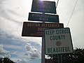 SB US 41 Bridge; Keep Citrus County Beautiful.JPG 4,000 × 3,000; 2.19 MB
-
 South End FL 200; May 18, 2003.jpg 736 × 439; 65 KB
-
 South FL 200; Apache Shores.JPG 4,000 × 3,000; 2.24 MB
-
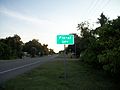 Southbound Floral City Sign-US 41.JPG 4,000 × 3,000; 2.21 MB
-
 Southbound US 41 @ FL 200; May 18, 2003.jpg 728 × 422; 48 KB
-
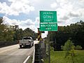
 Trooper Ronald Gordon Smith Memorial Bridge; NB.jpg 4,000 × 3,000; 2.15 MB
-
 US 19-98 @ CCR 490A(1).jpg 1,818 × 1,228; 547 KB
-
 US 19-98 @ CCR 490A(2).jpg 1,818 × 1,228; 518 KB
-
 US 19-98 Blk-Homosassa.jpg 942 × 594; 80 KB
-
 US 41 & FL 200 Arrows; May 18, 2003.jpg 734 × 440; 58 KB
-
 US 41 & FL 44 from Highland Blvd-Inverness.JPG 4,000 × 3,000; 2.6 MB
-
 US 41 Independence Hwy Signal-1.jpg 5,152 × 3,864; 7.97 MB
-
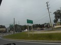
 US 41-FL SR 200 Fork; February 1, 2011.JPG 4,000 × 3,000; 2.53 MB
-
 WB Begin Citrus CR 482 @ Cardinal St (Close-Up).jpg 3,648 × 2,736; 1.9 MB
-
 WB Begin Citrus CR 482 @ Cardinal St.jpg 3,648 × 2,736; 1.95 MB
-
 WB FL 44 Destination Sign at US 41; Inverness.jpg 5,152 × 3,864; 7.8 MB
-
 WB FL 44 East of Citrus CR 470 East End.jpg 5,152 × 3,864; 7.83 MB
-
 WB FL 44 to North US 41; Inverness.jpg 5,152 × 3,864; 8.22 MB
-
 WB FL 44 to South US 41; Inverness.jpg 5,152 × 3,864; 7.84 MB
-
 WB FL 44-Inverness; Lighted Pedestrian Crossing 400 Feet.jpg 5,152 × 3,864; 7.93 MB
-
 WB FL 44; Fort Cooper State Park Sign.jpg 5,152 × 3,864; 8.29 MB
-
 WB FL 44; Inverness City Limit Sign-1.jpg 5,152 × 3,864; 7.79 MB
-
 WB FL 44; Inverness City Limit Sign-2.jpg 5,152 × 3,864; 7.3 MB
-
 WB FL 44; Inverness; Vet Friendly City.jpg 5,152 × 3,864; 8.17 MB
-
 WST Citrus CR 486 Crosswalk; North Side.jpg 4,000 × 3,000; 2.25 MB
-
 WST Citrus CR 486 Crosswalk; South Side.jpg 4,000 × 3,000; 2.81 MB
-
 WST South Detour @ CCR 486.JPG 4,000 × 3,000; 2.78 MB
.jpg)


.JPG)
.JPG)


.JPG)


.jpg)
.jpg)


.jpg)


