Category:Road signs in Taylor County, Florida
Counties of Florida: Alachua · Baker · Bay · Bradford · Brevard · Broward · Calhoun · Charlotte · Citrus · Clay · Collier · Columbia · Dixie · Duval · Escambia · Flagler · Franklin · Gadsden · Gilchrist · Glades · Hamilton · Hardee · Hendry · Hernando · Highlands · Hillsborough · Holmes · Indian River · Jackson · Jefferson · Lafayette · Lake · Lee · Leon · Levy · Liberty · Madison · Manatee · Marion · Martin · Miami-Dade · Monroe · Nassau · Okaloosa · Okeechobee · Orange · Osceola · Palm Beach · Pasco · Pinellas · Polk · Putnam · Santa Rosa · Sarasota · Seminole · St. Johns · St. Lucie · Sumter · Suwannee · Taylor · Union · Volusia · Wakulla · Walton · Washington
Media in category "Road signs in Taylor County, Florida"
The following 57 files are in this category, out of 57 total.
-
 Aucilla River US 98 bridge05.jpg 3,264 × 2,448; 1.97 MB
-
 Big Bend Wildlife Management Area Road No.1 sign.jpg 3,264 × 2,448; 3.23 MB
-
 Big Bend WMA Spring Creek Unit Strickland Bridge Road sign.jpg 3,264 × 2,448; 2.72 MB
-
 Boyd limits, US221NB.JPG 4,608 × 3,456; 5.28 MB
-
 Boyd limits, US221SB.JPG 4,608 × 3,456; 5.11 MB
-
 C-14A Sign (15828638272).jpg 800 × 533; 239 KB
-
 CR14, US221SB intersection.JPG 4,608 × 3,456; 5.32 MB
-
 Dixie County, FL51nb.jpg 5,184 × 3,456; 4.84 MB
-
 Do Not Park Past This Point sign at Adams Beach.jpg 3,264 × 2,448; 1.55 MB
-
 Hodges Park beach.jpg 3,264 × 2,448; 2.12 MB
-
 Keaton Beach Coastal Park parking lot entrance.jpg 3,006 × 2,448; 2.32 MB
-
 Keaton Beach Coastal Park parking lot.jpg 2,316 × 2,448; 1.84 MB
-
 Keaton Beach Coastal Park sign.jpg 3,264 × 2,448; 1.88 MB
-
 Lake Bird limits, US221NB.JPG 4,608 × 3,456; 5.68 MB
-
 Lake Bird limits, US221SB.JPG 4,608 × 3,456; 5.65 MB
-
 Madison County, CR14EB.JPG 4,608 × 3,456; 5.42 MB
-
 Mayo 22 distance sign, FL51nb.jpg 5,184 × 3,456; 5.03 MB
-
 Mowing CR-361 roadside.jpg 3,264 × 2,448; 2.97 MB
-
 NB US 19 @ US 98, US 27, N End US ALT 27; Perry, FL.jpg 3,648 × 2,736; 2.08 MB
-
 NB US 19-27 Taylor County Rest Area; 7AM-PM; One Mile.jpg 3,648 × 2,736; 2.04 MB
-
 NB US 19-27 Taylor County Rest Area; Left Arrow.jpg 3,648 × 2,736; 2.01 MB
-
 NB US 19-27 Taylor County Rest Area; Left Lane.jpg 3,648 × 2,736; 1.99 MB
-
 NB US 19-27 Taylor County Rest Area; No Security.jpg 3,648 × 2,736; 2.02 MB
-
 NB US 19-27; 3-Destination Sign north of Main Street, Perry, FL.jpg 3,648 × 2,736; 2.01 MB
-
 NB US 19-27; First Signs north of Main Street; Perry, FL.jpg 3,648 × 2,736; 2.09 MB
-
 NB US 19-27; First Signs north of US 98.jpg 3,648 × 2,736; 2.07 MB
-
 NB US 19-27; Hurricane E-Vac Sign north of Main Street, Perry, FL.jpg 3,648 × 2,736; 2.06 MB
-
 NB US 19-27; Jct Taylor CR 356.jpg 3,648 × 2,736; 2.08 MB
-
 NB US 19-27; Next Gas and Services; 15 Miles.jpg 3,648 × 2,736; 2.06 MB
-
 NB US 19-27; No Trucks on West Ash Street.jpg 3,648 × 2,736; 2.09 MB
-
 NB US 19-98-ALT 27; Begin NB US 221 & Truck US 221; Perry, FL.jpg 3,648 × 2,736; 2.07 MB
-
 NB US 19-98-ALT 27; Jct US 27; Perry, FL.jpg 3,648 × 2,736; 2.1 MB
-
 NB US 19-98-ALT 27; Railroad Xing in Perry, FL-01.jpg 3,648 × 2,736; 2.12 MB
-
 NB US 19-98-ALT 27; To N or S US 221; Perry, FL.jpg 3,648 × 2,736; 1.98 MB
-
 NB US 19-98-Alt US 27; EB Taylor CR 30.jpg 4,608 × 3,456; 3.79 MB
-
 NB US 19-98-Alt US 27; JCT Taylor CR 30.jpg 4,608 × 3,456; 3.93 MB
-
 NB US 19-Alt 27-98 Enters Taylor Co @ Steinhatchee River.jpg 3,648 × 2,736; 2.07 MB
-
 NB US 19-Alt 27-98; 3-Destination Sign north of FL 51, Tennille.jpg 3,648 × 2,736; 2.09 MB
-
 NB US 19-Alt 27-98; Next Gas and Services; 9 and 23 Miles.jpg 3,648 × 2,736; 2.09 MB
-
 Perry city limit, Green St WB.jpg 5,184 × 3,456; 8.47 MB
-
 Perry city limit, N Johnson Stripling Rd SB.jpg 5,184 × 3,456; 5.91 MB
-
 Perry city limit, US19NB.JPG 4,608 × 3,456; 5.5 MB
-
 Perry city limit, US221SB.JPG 4,608 × 3,456; 5.46 MB
-
 Perry city limit, US98EB.JPG 4,608 × 3,456; 4.61 MB
-
 Perry FL FDOT rest stop02.jpg 3,264 × 2,448; 2.6 MB
-
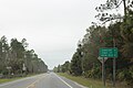
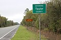
 SB US 19-27 Enters Taylor County, FL.jpg 3,648 × 2,736; 2.06 MB
-
 SB US 27-EB FL 20; Mayo 23; High Springs 64.jpg 3,499 × 2,087; 789 KB
-
 Shady Grove limits, CR14WB.JPG 4,608 × 3,456; 4.29 MB
-
 Shady Grove limits, US221NB.JPG 4,608 × 3,456; 5.77 MB
-
 Spring Warrior Fish Camp Hotel.jpg 3,248 × 2,448; 1.81 MB
-
 Steinhatchee distance sign, FL51sb.jpg 5,184 × 3,456; 4.5 MB
-
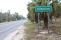 Steinhatchee road sign, FL51sb.jpg 5,184 × 3,456; 7.44 MB
-
 Taylor County, CR14WB.JPG 4,608 × 3,456; 5 MB
-
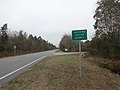
 Taylor County, FL51sb.jpg 5,184 × 3,456; 5.41 MB
-
 Tennille, FL51nb.jpg 5,184 × 3,456; 9.74 MB
-
 US 19-27 Taylor County Rest Area; Don't Drink Sprinklers.jpg 3,648 × 2,736; 2.05 MB
-
 US 19-27 Taylor County Rest Area; Main Building.jpg 3,648 × 2,736; 2.61 MB


.jpg)


