Category:Rob Roy Glacier Walk
walking trail in Mount Aspiring National Park, New Zealand .jpg) | |||||
| Upload media | |||||
| Instance of | |||||
|---|---|---|---|---|---|
| Located in protected area | |||||
| Location | Queenstown-Lakes District, Otago Region, New Zealand | ||||
| Length |
| ||||
 | |||||
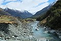
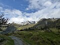
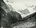
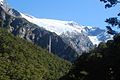
Rob Roy Glacier Walk is a popular walking track that leads to Rob Roy Glacier in the Southern Alps of New Zealand.
Subcategories
This category has the following 2 subcategories, out of 2 total.
R
- Rob Roy Falls (9 F)
- Rob Roy Glacier (15 F)
Media in category "Rob Roy Glacier Walk"
The following 29 files are in this category, out of 29 total.
-
 Matukituki River West Branch downstream from swingbridge towards Sharks Tooth Peak.jpg 4,896 × 3,264; 7.27 MB
-
 Matukituki River West Branch upstream from swingbridge.jpg 4,896 × 3,264; 6.29 MB
-
 Matukituki River West Branch.jpg 4,896 × 3,264; 6.71 MB
-
 On the Rob Roy Glacier Track, Mt Aspiring NP, New Zealand - panoramio.jpg 3,872 × 2,592; 4.56 MB
-
 Rob Roy Glacier Track (5890637952).jpg 1,071 × 1,600; 743 KB
-
 Rob Roy Glacier Track (5890638132).jpg 1,071 × 1,600; 636 KB
-
 Rob Roy Glacier Track (5890638410).jpg 1,600 × 1,071; 880 KB
-
 Rob Roy Glacier View at end of Track.jpg 4,160 × 3,120; 5.56 MB
-
 Rob Roy Glacier Walk (5862918719).jpg 3,866 × 2,559; 1.6 MB
-
 Rob Roy Glacier Walk (5862923853).jpg 3,872 × 2,592; 2.72 MB
-
 Rob Roy Glacier Walk (5862925955).jpg 3,872 × 2,592; 3.48 MB
-
 Rob Roy Glacier Walk (5862933103).jpg 3,872 × 2,592; 4.82 MB
-
 Rob Roy Glacier Walk (5862934527).jpg 3,872 × 2,592; 2.34 MB
-
 Rob Roy Glacier Walk (5862961473).jpg 3,872 × 2,592; 4.65 MB
-
 Rob Roy Glacier Walk (5863472274).jpg 3,872 × 2,592; 3.16 MB
-
 Rob Roy Glacier Walk (5863473754).jpg 3,872 × 2,592; 2.49 MB
-
 Rob Roy Glacier Walk (5863479578).jpg 3,872 × 2,592; 3.94 MB
-
 Rob Roy Glacier Walk (5863492542).jpg 2,550 × 3,234; 2.29 MB
-
 Rob Roy Glacier Walk (5863509644).jpg 2,592 × 3,513; 3.03 MB
-
 Rob Roy Glacier, Mt Aspiring, New Zealand - panoramio.jpg 3,872 × 2,592; 4.41 MB
-
 Rob Roy Stream in front of beech forest and snow-covered peaks.jpg 4,896 × 3,264; 6.12 MB
-
 Rob Roy Stream through beech forest in Rob Roy Valley.jpg 3,264 × 4,896; 6.75 MB
-
 Rob Roy Stream through beech forest towards Matukituki Valley.jpg 4,896 × 3,264; 6.82 MB
-
 Rob Roy Stream towards Matukituki Valley.jpg 3,264 × 4,896; 6.77 MB
-
 Rob Roy Valley towards Matukituki Valley.jpg 4,896 × 3,264; 6.09 MB
-
 Sharks Tooth Peak & Craigroyston Peak, NZ.jpg 4,000 × 3,000; 4.78 MB
-
 Snowfields at the head of Rob Roy Valley in spring 2014.jpg 4,896 × 3,264; 5.9 MB
-
-
 ^st Lookout, Rob Roy Glacier Track, Mt Aspiring NP, New Zealand - panoramio.jpg 3,872 × 2,592; 4.55 MB


.jpg)
.jpg)
.jpg)

.jpg)
.jpg)
.jpg)
.jpg)
.jpg)
.jpg)
.jpg)
.jpg)
.jpg)
.jpg)


_(14783149435).jpg)
