Category:SVG linguistic maps of South America
Temperate regions: North America · South America · Africa · Europe · Asia · Oceania – Polar regions: – Other regions:
| NO WIKIDATA ID FOUND! Search for SVG linguistic maps of South America on Wikidata | |
| Upload media |

Countries of South America: Argentina · Bolivia · Brazil · Chile · Colombia · Ecuador · Guyana · Paraguay · Peru · Suriname · Trinidad and Tobago‡ · Uruguay · Venezuela
Other territories: Aruba · Bonaire · Curaçao · the Falkland Islands ≈ Falkland Islands · French Guiana · South Georgia and the South Sandwich Islands
‡: partly located in South America
Other territories: Aruba · Bonaire · Curaçao · the Falkland Islands ≈ Falkland Islands · French Guiana · South Georgia and the South Sandwich Islands
‡: partly located in South America
Subcategories
This category has only the following subcategory.
C
Media in category "SVG linguistic maps of South America"
The following 18 files are in this category, out of 18 total.
-
 Languages of South America (de).svg 350 × 402; 18 KB
-
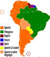 Languages of South America (en).svg 350 × 402; 27 KB
-
 Languages of South America (es).svg 350 × 402; 25 KB
-
 Languages of South America (fr).svg 350 × 402; 18 KB
-
 Languages of South America (nl).svg 350 × 402; 18 KB
-
 Languages of South America (pl).svg 350 × 402; 18 KB
-
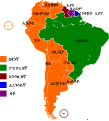
 Languages of South America (pt).svg 350 × 402; 18 KB
-
 Languages of South America (ti).svg 364 × 402; 439 KB
-
 Languages of South America mk.svg 364 × 402; 356 KB
-
 Languages of South America.svg 350 × 402; 26 KB
-
 Lusophone America (orthographic projection).svg 550 × 551; 329 KB
-
 Macro-Ge groups.svg 650 × 606; 1.25 MB
-
 Quechua (grupos).svg 540 × 720; 2.09 MB
-
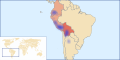
 Quechua (Southern) lang map.svg 1,000 × 500; 2.87 MB
-
 Quechua (subgrupos).svg 600 × 800; 2.09 MB
-
 Quechua (with country names) mk.svg 1,000 × 1,000; 1.05 MB
-
 Quechua (with country names).svg 1,000 × 1,000; 1.05 MB
-
 Quechuan langs map.svg 1,000 × 500; 2.89 MB
.svg)
.svg)
.svg)
.svg)
.svg)
.svg)
.svg)
.svg)


.svg)

.svg)
_lang_map.svg)
.svg)
_mk.svg)
.svg)
