Category:SVG locator maps of former countries of Africa
Subcategories
This category has the following 2 subcategories, out of 2 total.
Media in category "SVG locator maps of former countries of Africa"
The following 24 files are in this category, out of 24 total.
-
 Ethiopia 1400.svg 1,052 × 744; 3.55 MB
-
 Ethiopia 1500.svg 1,052 × 744; 3.53 MB
-
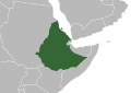 Ethiopian Empire in 1952.svg 1,052 × 744; 275 KB
-
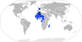 French Community 1959.svg 940 × 477; 630 KB
-
 French Community 1961.svg 940 × 477; 821 KB
-
 French Union.svg 940 × 477; 675 KB
-
 LocationBophuthatswana.svg 1,000 × 500; 2.77 MB
-
 LocationCape Colonyca1890.svg 1,000 × 500; 2.72 MB
-
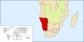 LocationGermanSWAca1890.svg 1,000 × 500; 2.72 MB
-
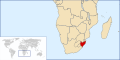
 LocationGriqualandEast.svg 1,000 × 500; 2.72 MB
-
 LocationNatalColony.svg 1,000 × 500; 2.77 MB
-
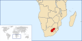
 LocationNatalia.svg 1,000 × 500; 2.71 MB
-
 LocationNewRepublic.svg 1,000 × 500; 2.72 MB
-
 LocationOrangeRiverColony.svg 1,000 × 500; 2.77 MB
-
 LocationOrangeRiverSovereignty.svg 1,000 × 500; 2.71 MB
-
 LocationRhodesiaandNyasaland (1953–1963).svg 1,000 × 500; 2.76 MB
-
 LocationStellaland.svg 1,000 × 500; 2.72 MB
-
 LocationTranskei.svg 1,000 × 500; 2.76 MB
-
 LocationUnitedArabRepublic.svg 512 × 260; 226 KB
-
 LocationZARca1890.svg 1,000 × 500; 2.72 MB
-
 LocationZululandca1890.svg 1,000 × 500; 2.72 MB
-
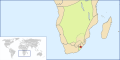
 Locator map of the Union of South Africa.svg 1,000 × 500; 2.76 MB
-
 Menelik II conquests map on world sphere.svg 550 × 550; 134 KB
-
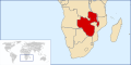
 SouthernAfrica1880s.svg 1,000 × 500; 2.72 MB


.svg)


