Category:Sambourne
hamlet in Warwickshire, England  | |||||
| Upload media | |||||
| Instance of | |||||
|---|---|---|---|---|---|
| Location | Stratford-on-Avon, Warwickshire, West Midlands, England | ||||
| Population |
| ||||
| Area |
| ||||
 | |||||
Subcategories
This category has the following 5 subcategories, out of 5 total.
G
- Green Dragon, Sambourne (9 F)
J
M
- Middletown, Warwickshire (8 F)
S
- Sambourne Mission Church (4 F)
- Sambourne War Memorial (6 F)
Media in category "Sambourne"
The following 90 files are in this category, out of 90 total.
-

-
 A435 Haydon Way - geograph.org.uk - 4277451.jpg 640 × 440; 39 KB
-
-
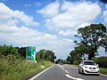
 A435 Heading North Junction For A448 - geograph.org.uk - 3548406.jpg 640 × 480; 63 KB
-
 A435 Near Haydon Way Farm - geograph.org.uk - 4277453.jpg 640 × 480; 46 KB
-
 A435 north of Coughton - geograph.org.uk - 2054477.jpg 640 × 480; 47 KB
-
 A448 Approaching B4092 Station Road - geograph.org.uk - 3550179.jpg 640 × 480; 78 KB
-
 A448 at Jill Lane Turning - geograph.org.uk - 3551359.jpg 640 × 472; 59 KB
-

-
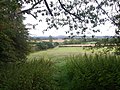
 Arable land at Sambourne - geograph.org.uk - 3059422.jpg 1,024 × 680; 255 KB
-
 At the county boundary - geograph.org.uk - 2550843.jpg 640 × 480; 117 KB
-

-
-
 Bridge over the railway that was - geograph.org.uk - 2550850.jpg 640 × 480; 119 KB
-
 Bridging the gap - geograph.org.uk - 1811744.jpg 6,048 × 4,032; 1.23 MB
-
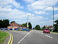
 Bromsgrove Road (A448) - geograph.org.uk - 6191317.jpg 800 × 600; 128 KB
-
 Bromsgrove Road, Studley - geograph.org.uk - 6508218.jpg 1,866 × 1,192; 1.03 MB
-
 Cain Brook west of Middletown - geograph.org.uk - 3987313.jpg 640 × 480; 117 KB
-
 Cereal crop, Sambourne - geograph.org.uk - 6191231.jpg 800 × 600; 128 KB
-
-
 Elizabeth II postbox on Sambourne Lane, Sambourne - geograph.org.uk - 6192040.jpg 2,931 × 4,874; 3.41 MB
-
 Elmdale Farm Caravan Park - geograph.org.uk - 6331169.jpg 4,000 × 3,000; 2.69 MB
-
 Entering Sambourne - geograph.org.uk - 6191230.jpg 800 × 600; 171 KB
-

-
-
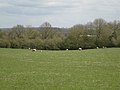 Ewes and lambs near Sambourne - geograph.org.uk - 3987366.jpg 640 × 480; 61 KB
-
 Field corner with footbridge - geograph.org.uk - 3418738.jpg 640 × 480; 381 KB
-

-

-
 Footpath view near Sambourne - geograph.org.uk - 4657739.jpg 480 × 640; 79 KB
-

-
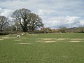
 Grazing, Middletown - geograph.org.uk - 6191314.jpg 800 × 563; 116 KB
-
 Green oak tortrix moth on Spernal Ash - geograph.org.uk - 5814441.jpg 2,048 × 1,536; 1.35 MB
-
 House on Sambourne Lane - geograph.org.uk - 6191228.jpg 800 × 525; 126 KB
-

-
 Layby on Spernal Ash - geograph.org.uk - 5796471.jpg 2,048 × 1,536; 1.52 MB
-
 Littlewood Green Farm - geograph.org.uk - 3062040.jpg 1,024 × 680; 160 KB
-
 Node Hill, Studley - geograph.org.uk - 6492106.jpg 1,920 × 1,280; 1.71 MB
-
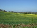 Oilseed rape crop near New End - geograph.org.uk - 5348073.jpg 640 × 480; 74 KB
-

-
-

-
 Path near Sambourne - geograph.org.uk - 4657785.jpg 640 × 480; 49 KB
-
 Path near Sambourne - geograph.org.uk - 4657787.jpg 640 × 480; 94 KB
-
 Path near Sambourne - geograph.org.uk - 4657791.jpg 640 × 480; 69 KB
-
 Path towards Whitemoor Lane - geograph.org.uk - 3410934.jpg 640 × 480; 96 KB
-
 Perrymill Lane, Sambourne - geograph.org.uk - 3987315.jpg 640 × 480; 73 KB
-
 Perrymill Lane, Sambourne - geograph.org.uk - 4893193.jpg 640 × 437; 74 KB
-
 R W Rutter on Bromsgrove Road - geograph.org.uk - 5813467.jpg 1,960 × 1,412; 1.21 MB
-
 Random water pump - geograph.org.uk - 4657736.jpg 480 × 640; 122 KB
-
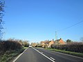
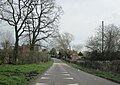
 Road into Sambourne - geograph.org.uk - 3058671.jpg 1,024 × 680; 258 KB
-
 Road junction in Sambourne - geograph.org.uk - 3058682.jpg 1,024 × 680; 202 KB
-
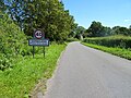
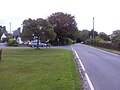
 Road sign at Sambourne - geograph.org.uk - 3062636.jpg 1,024 × 680; 299 KB
-
 Rough Hill Wood in passing sun - geograph.org.uk - 3419228.jpg 640 × 480; 336 KB
-
 Ryknild Street Spernal Ash - geograph.org.uk - 4277457.jpg 640 × 480; 82 KB
-
 Samborne Village Green.jpg 3,296 × 2,472; 1.73 MB
-
 Sambourne - geograph.org.uk - 4657730.jpg 640 × 480; 65 KB
-
 Sambourne - geograph.org.uk - 6192042.jpg 640 × 428; 103 KB
-
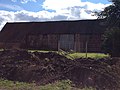
 Sambourne barn - geograph.org.uk - 4657737.jpg 640 × 480; 98 KB
-
 Sambourne cottage.jpg 3,296 × 2,472; 1.74 MB
-
 Sambourne Hall - geograph.org.uk - 4657731.jpg 640 × 480; 69 KB
-
 Sambourne Lane Sambourne - geograph.org.uk - 4893192.jpg 640 × 455; 82 KB
-
 Sambourne Lane Sambourne - geograph.org.uk - 4904033.jpg 640 × 462; 67 KB
-
 Sambourne Lane, Sambourne - geograph.org.uk - 6191232.jpg 800 × 600; 237 KB
-
 Sambourne Village Green - geograph.org.uk - 4904040.jpg 640 × 480; 112 KB
-

-
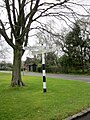 Signpost Sambourne Village Green - geograph.org.uk - 4904038.jpg 480 × 640; 104 KB
-

-
 Thatch repair - geograph.org.uk - 1811756.jpg 6,048 × 4,032; 2.31 MB
-
 Thatched cottage in Sambourne - geograph.org.uk - 3062632.jpg 680 × 1,024; 223 KB
-
 The Green, Sambourne - geograph.org.uk - 1890106.jpg 640 × 480; 84 KB
-
 Thundering Ditch ^ - geograph.org.uk - 3410954.jpg 640 × 480; 69 KB
-
 Towards Middletown - geograph.org.uk - 4657777.jpg 480 × 640; 100 KB
-
 Towards Middletown - geograph.org.uk - 4657778.jpg 480 × 640; 76 KB
-
 Towards Middletown - geograph.org.uk - 4657779.jpg 480 × 640; 136 KB
-
 Towards Middletown - geograph.org.uk - 4657781.jpg 480 × 640; 76 KB
-
 Towards Middletown - geograph.org.uk - 4657783.jpg 480 × 640; 69 KB
-
 Towards Sadlers Hill Coppice - geograph.org.uk - 4657776.jpg 480 × 640; 62 KB
-

-
 Underground services, Middletown - geograph.org.uk - 3987255.jpg 640 × 480; 85 KB
-
 View from the Ridgeway - geograph.org.uk - 438040.jpg 640 × 480; 96 KB
-

-
 View near Sambourne - geograph.org.uk - 4657735.jpg 480 × 640; 73 KB
-

-
 Waymark post - geograph.org.uk - 2550854.jpg 640 × 480; 84 KB
-
 West on bridleway to Middletown - geograph.org.uk - 3979920.jpg 640 × 480; 154 KB
-
 Wike Lane meets Middletown Lane, Sandbourne - geograph.org.uk - 3498612.jpg 3,264 × 2,448; 1.51 MB
-

-
 Oak Tree Lane crossroads, Sambourne - geograph.org.uk - 160689.jpg 640 × 480; 304 KB
-
 Perrymill Lane, Sambourne - geograph.org.uk - 163130.jpg 640 × 480; 318 KB


_-_geograph.org.uk_-_6191317.jpg)


